
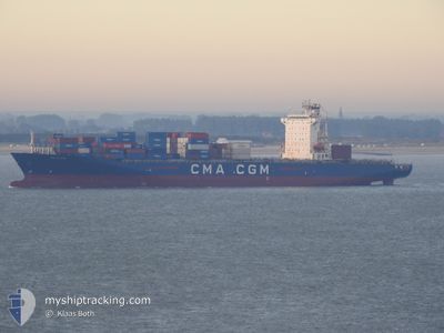
ANL WYONG
Container Ship
Current Trip
| Time Travelled | 2 days |
|---|---|
| Remaining Time | 1 day |
| Distance Travelled | 677.55 nm |
| Remaining Distance | 561.76 nm |
| AVG Speed | 11.8 Noeuds |
| MAX Speed | 16.9 Noeuds |
| AVG Wind | 15 knots |
| MAX Wind | 28 knots |
| MIN Temp | 9.9°C / 49.82°F |
| MAX Temp | 13.6°C / 56.48°F |
| Tirant d eau | 9.9 m |
| Position reçue | 1 d depuis |
Current Position
| Longitude | -5.29670° |
|---|---|
| Latitude | 49.08893° |
| Etat | Under way using engine |
| Vitesse | 11.4 Noeuds |
| Parcours | 243.1° |
| Zone | Celtic Sea |
| Station | T-AIS |
| Position reçue | 1 d depuis |
Info
Information
The current position of ANL WYONG is in Celtic Sea with coordinates 49.08893° / -5.29670° as reported on 2024-04-30 10:43 by AIS to our vessel tracker app. The vessel's current speed is 11.4 Noeuds and is heading at the port of TANGER MED. The estimated time of arrival as calculated by MyShipTracking vessel tracking app is 2024-05-03 19:08 LT
The vessel ANL WYONG (IMO: 9334155, MMSI: 215206000) is a Container Ship that was built in 2008 ( 16 Age ). It's sailing under the flag of [MT] Malta.
In this page you can find informations about the vessels current position, last detected port calls, and current voyage information. If the vessels is not in coverage by AIS you will find the latest position.
The current position of ANL WYONG is detected by our AIS receivers and we are not responsible for the reliability of the data. The last position was recorded while the vessel was in Coverage by the Ais receivers of our vessel tracking app.
The current draught of ANL WYONG as reported by AIS is 9.9 meters
Weather
| Temperature | 12.6°C / 54.68°F |
|---|---|
| Wind Speed | 14 knots |
| Direction | 281° W |
| Pressure | 1016.9 hPa |
| Humidity | 72.4 % |
| Cloud Coverage | 10 % |
Featured Company
Last Port Calls
| Port | Arrival | Departure | Time In Port |
|---|---|---|---|
| 2024-04-28 12:09 | 2024-04-29 13:37 | 1 d | |
| 2024-04-25 22:21 | 2024-04-26 18:43 | 20 h | |
| 2024-04-24 11:13 | 2024-04-25 08:22 | 21 h | |
| 2024-04-23 11:02 | 2024-04-24 04:43 | 17 h | |
| 2024-04-21 23:05 | 2024-04-22 14:26 | 15 h | |
| 2024-04-12 19:20 | 2024-04-13 19:36 | 1 d | |
| 2024-04-06 05:11 | 2024-04-08 08:59 | 2 d | |
| 2024-03-31 14:11 | 2024-04-01 13:07 | 22 h | |
| 2024-03-26 10:20 | 2024-03-27 22:25 | 1 d | |
| 2024-03-24 16:21 | 2024-03-25 04:09 | 11 h |
Last Trips
| Origin | Departure | Destination | Arrival | Distance | |
|---|---|---|---|---|---|
| 2024-04-26 20:43 | 2024-04-28 14:09 | 285.14 nm | |||
| 2024-04-25 10:22 | 2024-04-26 00:21 | 101.35 nm | |||
| 2024-04-24 06:43 | 2024-04-24 13:13 | 79.01 nm | |||
| 2024-04-22 15:26 | 2024-04-23 13:02 | 135.06 nm | |||
| 2024-04-13 19:36 | 2024-04-22 00:05 | 2602.84 nm | |||
| 2024-04-08 08:59 | 2024-04-12 19:20 | 1254.92 nm | |||
| 2024-04-01 13:07 | 2024-04-06 05:11 | 1333.28 nm | |||
| 2024-03-27 22:25 | 2024-03-31 14:11 | 1545.35 nm | |||
| 2024-03-25 05:09 | 2024-03-26 10:20 | 140.12 nm | |||
| 2024-03-19 12:54 | 2024-03-24 17:21 | 1331.59 nm |
Events
| Heure | Evenement | Détails | Position/ Destination | Info |
|---|---|---|---|---|
| 2024-04-30 10:50 | Etat Changé | Default Under way using engine |
49.07834 / -5.32667
FRLEH - MAPTM
|
Vitesse: 11.4 kn Parcours: 243.1° |
| 2024-04-30 10:43 | Hors de la zone couverte |
49.08893 / -5.29670
Celtic Sea
FRLEH - MAPTM
|
Vitesse: 11.4 kn Parcours: 243.1° |
|
| 2024-04-30 10:16 | Changement de zone | French part of the Celtic Sea United Kingdom part of the English Channel |
49.12486 / -5.18746
Celtic Sea
FRLEH - MAPTM
|
Vitesse: 10.6 kn Parcours: 243.8° |
| 2024-04-30 10:14 | Etat Changé | Under way using engine Default |
49.12830 / -5.17859
FRLEH - MAPTM
|
Vitesse: 10 kn Parcours: 235° |
| 2024-04-30 10:14 | Dans la zone couverte |
49.12486 / -5.18746
Celtic Sea
FRLEH - MAPTM
|
Vitesse: 10.6 kn Parcours: 243.8° |
|
| 2024-04-30 04:54 | Etat Changé | Default Under way using engine |
49.56982 / -4.00428
FRLEH - MAPTM
|
Vitesse: 10.7 kn Parcours: 239.9° |
| 2024-04-30 04:45 | Etat Changé | Under way using engine Default |
49.58400 / -3.96678
FRLEH - MAPTM
|
Vitesse: 10.7 kn Parcours: 239° |
| 2024-04-30 04:45 | Hors de la zone couverte |
49.58400 / -3.96678
English Channel
FRLEH - MAPTM
|
Vitesse: 10.7 kn Parcours: 239.9° |
|
| 2024-04-30 04:37 | Dans la zone couverte |
49.58400 / -3.96678
English Channel
FRLEH - MAPTM
|
Vitesse: 10.7 kn Parcours: 239.9° |
|
| 2024-04-30 02:43 | Hors de la zone couverte |
49.77638 / -3.45903
English Channel
FRLEH - MAPTM
|
Vitesse: 11.3 kn Parcours: 236.8° |