
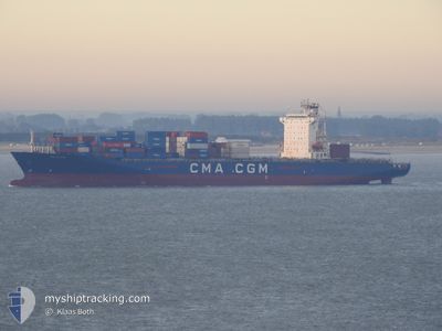
ANL WYONG
Container Ship
Current Trip
| Time Travelled | 6 days |
|---|---|
| Remaining Time | 1 day |
| Distance Travelled | 2222.22 nm |
| Remaining Distance | 345.43 nm |
| AVG Speed | 13.6 Knopen |
| MAX Speed | 21 Knopen |
| AVG Wind | 10.9 knots |
| MAX Wind | 27 knots |
| MIN Temp | 9.5°C / 49.1°F |
| MAX Temp | 24.4°C / 75.92°F |
| Diepgang | 8.9 M |
| Positie ontvangen | 1 h, 7 m geleden |
Current Position
| Lengtegraad | -4.85767° |
|---|---|
| Breedtegraat | 49.08186° |
| Status | Under way using engine |
| Snelheid | 13.8 Knopen |
| Koers | 73.8° |
| Gebied | English Channel |
| Station | T-AIS |
| Positie ontvangen | 1 h, 7 m geleden |
Info
Information
The current position of ANL WYONG is in English Channel with coordinates 49.08186° / -4.85767° as reported on 2024-04-20 15:29 by AIS to our vessel tracker app. The vessel's current speed is 13.8 Knopen and is heading at the port of TILBURY. The estimated time of arrival as calculated by MyShipTracking vessel tracking app is 2024-04-21 16:50 LT
The vessel ANL WYONG (IMO: 9334155, MMSI: 215206000) is a Container Ship that was built in 2008 ( 16 Jaar oud ). It's sailing under the flag of [MT] Malta.
In this page you can find informations about the vessels current position, last detected port calls, and current voyage information. If the vessels is not in coverage by AIS you will find the latest position.
The current position of ANL WYONG is detected by our AIS receivers and we are not responsible for the reliability of the data. The last position was recorded while the vessel was in Coverage by the Ais receivers of our vessel tracking app.
The current draught of ANL WYONG as reported by AIS is 8.9 meters
Weather
| Temperature | 9.3°C / 48.74°F |
|---|---|
| Wind Speed | 16 knots |
| Direction | 76° ENE |
| Pressure | 1029.5 hPa |
| Humidity | 63.3 % |
| Cloud Coverage | 11 % |
Featured Company
Last Port Calls
| Port | Arrival | Departure | Time In Port |
|---|---|---|---|
| 2024-04-12 19:20 | 2024-04-13 19:36 | 1 d | |
| 2024-04-06 05:11 | 2024-04-08 08:59 | 2 d | |
| 2024-03-31 14:11 | 2024-04-01 13:07 | 22 h | |
| 2024-03-26 10:20 | 2024-03-27 22:25 | 1 d | |
| 2024-03-24 16:21 | 2024-03-25 04:09 | 11 h | |
| 2024-03-18 19:38 | 2024-03-19 11:54 | 16 h | |
| 2024-03-16 10:00 | 2024-03-17 21:35 | 1 d | |
| 2024-03-15 03:54 | 2024-03-15 22:59 | 19 h | |
| 2024-03-14 07:21 | 2024-03-14 17:24 | 10 h | |
| 2024-03-07 14:55 | 2024-03-07 21:45 | 6 h |
Last Trips
| Origin | Departure | Destination | Arrival | Distance | |
|---|---|---|---|---|---|
| 2024-04-08 08:59 | 2024-04-12 19:20 | 1254.92 nm | |||
| 2024-04-01 13:07 | 2024-04-06 05:11 | 1333.28 nm | |||
| 2024-03-27 22:25 | 2024-03-31 14:11 | 1545.35 nm | |||
| 2024-03-25 05:09 | 2024-03-26 10:20 | 140.12 nm | |||
| 2024-03-19 12:54 | 2024-03-24 17:21 | 1331.59 nm | |||
| 2024-03-17 22:35 | 2024-03-18 20:38 | 268.66 nm | |||
| 2024-03-15 23:59 | 2024-03-16 11:00 | 128.25 nm | |||
| 2024-03-14 17:24 | 2024-03-15 04:54 | 130.60 nm | |||
| 2024-03-07 22:45 | 2024-03-14 07:21 | 1631.51 nm | |||
| 2024-03-02 19:32 | 2024-03-07 15:55 | 1559.17 nm |
Events
| Tijd | Evenement | Details | Positie / Bestemming | Info |
|---|---|---|---|---|
| 2024-04-20 15:32 | Status Changed | Default Under way using engine |
49.08606 / -4.84151
SNDKR-GBTIL
|
Snelheid: 13.8 kn Koers: 73.8° |
| 2024-04-20 15:29 | Buitenbereik |
49.08186 / -4.85767
English Channel
SNDKR-GBTIL
|
Snelheid: 13.8 kn Koers: 73.8° |
|
| 2024-04-20 15:23 | Wijzig zee gebeid | French part of the English Channel French part of the Celtic Sea |
49.07648 / -4.89237
English Channel
SNDKR-GBTIL
|
Snelheid: 13.9 kn Koers: 76.6° |
| 2024-04-20 15:23 | Status Changed | Under way using engine Default |
49.07648 / -4.89237
SNDKR-GBTIL
|
Snelheid: 13.9 kn Koers: 78° |
| 2024-04-20 15:18 | Status Changed | Default Under way using engine |
49.07204 / -4.92116
SNDKR-GBTIL
|
Snelheid: 14.1 kn Koers: 66° |
| 2024-04-20 15:00 | Status Changed | Under way using engine Default |
49.04694 / -5.02037
SNDKR-GBTIL
|
Snelheid: 14 kn Koers: 60° |
| 2024-04-20 14:54 | Status Changed | Default Under way using engine |
49.03405 / -5.04765
SNDKR-GBTIL
|
Snelheid: 13.9 kn Koers: 62.2° |
| 2024-04-20 14:14 | Status Changed | Under way using engine Default |
48.95739 / -5.24759
SNDKR-GBTIL
|
Snelheid: 13.7 kn Koers: 59° |
| 2024-04-20 14:04 | Binnenbereik |
48.95739 / -5.24759
Celtic Sea
SNDKR-GBTIL
|
Snelheid: 13.7 kn Koers: 59.5° |
|
| 2024-04-20 13:12 | Buitenbereik |
48.83108 / -5.54915
Celtic Sea
SNDKR-GBTIL
|
Snelheid: 13.8 kn Koers: 52.9° |