
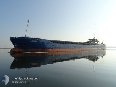
AMANDA
General Cargo
Current Trip
DK KOL VIA NOK
| Time Travelled | 15 h, 4 mins |
|---|---|
| Remaining Time | --- |
| Distance Travelled | 87.17 nm |
| Remaining Distance | --- |
| AVG Speed | 5.6 Noeuds |
| MAX Speed | 10.1 Noeuds |
| AVG Wind | 7.9 knots |
| MAX Wind | 9.9 knots |
| MIN Temp | 11.4°C / 52.52°F |
| MAX Temp | 15.8°C / 60.44°F |
| Tirant d eau | 3.4 m |
| Position reçue | Maintenant |
Current Position
| Longitude | 9.09170° |
|---|---|
| Latitude | 53.88446° |
| Etat | Under way using engine |
| Vitesse | 0.4 Noeuds |
| Parcours | 74° |
| Zone | North Sea |
| Station | T-AIS |
| Position reçue | Maintenant |
Info
Information
The current position of AMANDA is in North Sea with coordinates 53.88446° / 9.09170° as reported on 2024-04-30 00:23 by AIS to our vessel tracker app. The vessel's current speed is 0.4 Noeuds
The vessel AMANDA (IMO: 8104565, MMSI: 219002392) is a General Cargo that was built in 1981 ( 43 Age ). It's sailing under the flag of [DK] Denmark.
In this page you can find informations about the vessels current position, last detected port calls, and current voyage information. If the vessels is not in coverage by AIS you will find the latest position.
The current position of AMANDA is detected by our AIS receivers and we are not responsible for the reliability of the data. The last position was recorded while the vessel was in Coverage by the Ais receivers of our vessel tracking app.
The current draught of AMANDA as reported by AIS is 3.4 meters
Weather
| Temperature | 12.1°C / 53.78°F |
|---|---|
| Wind Speed | 9 knots |
| Direction | 114° ESE |
| Pressure | 1020.6 hPa |
| Humidity | 77.7 % |
| Cloud Coverage | 100 % |
Featured Company
Last Port Calls
| Port | Arrival | Departure | Time In Port |
|---|---|---|---|
| 2024-04-28 10:38 | 2024-04-29 09:20 | 22 h | |
| 2024-04-27 04:54 | 2024-04-27 10:22 | 5 h | |
| 2024-04-25 07:51 | 2024-04-25 14:54 | 7 h | |
| 2024-04-22 21:54 | 2024-04-23 21:41 | 23 h | |
| 2024-04-18 06:05 | 2024-04-19 15:11 | 1 d | |
| 2024-04-13 04:52 | 2024-04-14 05:34 | 1 d | |
| 2024-04-08 21:57 | 2024-04-10 08:33 | 1 d | |
| 2024-04-04 16:09 | 2024-04-05 13:55 | 21 h | |
| 2024-04-01 11:05 | 2024-04-03 16:37 | 2 d | |
| 2024-03-30 04:18 | 2024-03-30 18:30 | 14 h |
Last Trips
| Origin | Departure | Destination | Arrival | Distance | |
|---|---|---|---|---|---|
| 2024-04-27 12:22 | 2024-04-28 12:38 | 152.72 nm | |||
| 2024-04-25 16:54 | 2024-04-27 06:54 | 306.41 nm | |||
| 2024-04-23 22:41 | 2024-04-25 09:51 | 239.34 nm | |||
| 2024-04-19 16:11 | 2024-04-22 22:54 | 456.86 nm | |||
| 2024-04-14 06:34 | 2024-04-18 07:05 | 639.82 nm | |||
| 2024-04-10 10:33 | 2024-04-13 05:52 | 180.18 nm | |||
| 2024-04-05 15:55 | 2024-04-08 23:57 | 556.89 nm | |||
| 2024-04-03 18:37 | 2024-04-04 18:09 | 196.85 nm | |||
| 2024-03-30 20:30 | 2024-04-01 13:05 | 267.95 nm | |||
| 2024-03-27 14:35 | 2024-03-30 06:18 | 454.83 nm |
Events
| Heure | Evenement | Détails | Position/ Destination | Info |
|---|---|---|---|---|
| 2024-04-30 00:00 | Arret | 2.76 nm, South West of BRUNSBUETTEL |
53.88343 / 9.08949
DK KOL VIA NOK
|
Vitesse: 0.3 kn Parcours: 87° |
| 2024-04-29 18:52 | Changement d'ETA | 2024/04/30 18:00 2024/04/30 16:00 |
53.95764 / 8.60311
DK KOL VIA NOK
|
Vitesse: 4.7 kn Parcours: 117° |
| 2024-04-29 18:08 | Etat Changé | Under way using engine Default |
53.97239 / 8.49169
DK KOL VIA NOK
|
Vitesse: 5.6 kn Parcours: 102° |
| 2024-04-29 17:59 | Dans la zone couverte |
53.97189 / 8.49788
North Sea
DK KOL VIA NOK
|
Vitesse: 5.1 kn Parcours: 101.3° |
|
| 2024-04-29 15:03 | Etat Changé | Default Under way using engine |
53.89999 / 8.04571
DK KOL VIA NOK
|
Vitesse: 8.4 kn Parcours: 297.3° |
| 2024-04-29 14:58 | Hors de la zone couverte |
53.89369 / 8.06517
North Sea
DK KOL VIA NOK
|
Vitesse: 8.4 kn Parcours: 297.3° |
|
| 2024-04-29 14:55 | Etat Changé | Under way using engine Default |
53.89114 / 8.07337
DK KOL VIA NOK
|
Vitesse: 7.9 kn Parcours: 296° |
| 2024-04-29 14:20 | Etat Changé | Default Under way using engine |
53.83062 / 8.11970
DK KOL VIA NOK
|
Vitesse: 7.4 kn Parcours: 335.1° |
| 2024-04-29 14:00 | Etat Changé | Under way using engine Default |
53.79343 / 8.14781
DK KOL VIA NOK
|
Vitesse: 7.6 kn Parcours: 324° |
| 2024-04-29 13:52 | Etat Changé | Default Under way using engine |
53.77979 / 8.16398
DK KOL VIA NOK
|
Vitesse: 7.7 kn Parcours: 314.4° |