
ALFRED
Tanker
Current Trip
| Time Travelled | 3 days |
|---|---|
| Remaining Time | 22 h, 23 mins |
| Distance Travelled | 579.11 nm |
| Remaining Distance | 311.67 nm |
| AVG Speed | 10.6 Noeuds |
| MAX Speed | 15.6 Noeuds |
| AVG Wind | 7.4 knots |
| MAX Wind | 14.8 knots |
| MIN Temp | 19.7°C / 67.46°F |
| MAX Temp | 26.2°C / 79.16°F |
| Tirant d eau | 9.5 m |
| Position reçue | Maintenant |
Current Position
| Longitude | 19.09062° |
|---|---|
| Latitude | 36.16608° |
| Etat | Under way using engine |
| Vitesse | 15.7 Noeuds |
| Parcours | 88.5° |
| Zone | Mediterranean Sea - Eastern Basin |
| Station | T-AIS |
| Position reçue | Maintenant |
Info
Information
The current position of ALFRED is in Mediterranean Sea - Eastern Basin with coordinates 36.16608° / 19.09062° as reported on 2024-06-11 07:05 by AIS to our vessel tracker app. The vessel's current speed is 15.7 Noeuds and is heading at the port of ASPROPYRGOS. The estimated time of arrival as calculated by MyShipTracking vessel tracking app is 2024-06-12 08:29 LT
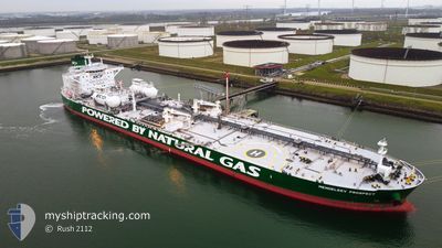
The vessel ALFRED (IMO: 9826897, MMSI: 636018830) is a Tanker It's sailing under the flag of [LR] Liberia.
In this page you can find informations about the vessels current position, last detected port calls, and current voyage information. If the vessels is not in coverage by AIS you will find the latest position.
The current position of ALFRED is detected by our AIS receivers and we are not responsible for the reliability of the data. The last position was recorded while the vessel was in Coverage by the Ais receivers of our vessel tracking app.
The current draught of ALFRED as reported by AIS is 9.5 meters
Weather
| Temperature | 24.2°C / 75.56°F |
|---|---|
| Wind Speed | 8 knots |
| Direction | 188° S |
| Pressure | 1012.7 hPa |
| Humidity | 67.1 % |
| Cloud Coverage | 60 % |
Featured Company
Last Port Calls
| Port | Arrival | Departure | Time In Port |
|---|---|---|---|
| 2024-06-06 16:33 | 2024-06-08 05:04 | 1 d | |
| 2024-05-25 15:08 | 2024-05-27 12:37 | 1 d | |
| 2024-04-10 05:58 | 2024-04-11 13:46 | 1 d |
Most Visited Ports (Last year)
| Port | Arrivals | |
|---|---|---|
| 3 | ||
| 2 | ||
| 2 | ||
| 2 | ||
| 2 | ||
| 1 |
Last Trips
| Origin | Departure | Destination | Arrival | Distance | |
|---|---|---|---|---|---|
| 2024-05-27 12:37 | 2024-06-06 16:33 | 1253.14 nm | |||
| 2024-04-11 13:46 | 2024-05-25 15:08 | 7068.18 nm | |||
| 2024-03-08 08:30 | 2024-04-10 05:58 | 6380.14 nm |
Events
| Heure | Evenement | Détails | Position/ Destination | Info |
|---|---|---|---|---|
| 2024-06-11 06:24 | Etat Changé | Under way using engine Default |
36.16245 / 18.86827
GR ASS
|
Vitesse: 14.4 kn Parcours: 89° |
| 2024-06-11 06:22 | Etat Changé | Default Under way using engine |
36.16224 / 18.85776
GR ASS
|
Vitesse: 14.3 kn Parcours: 88.6° |
| 2024-06-11 05:55 | Etat Changé | Under way using engine Default |
36.15859 / 18.73901
GR ASS
|
Vitesse: 12.7 kn Parcours: 84° |
| 2024-06-11 05:53 | Etat Changé | Default Under way using engine |
36.15787 / 18.73033
GR ASS
|
Vitesse: 12.8 kn Parcours: 84.4° |
| 2024-06-11 05:53 | Etat Changé | Under way using engine Default |
36.15769 / 18.72815
GR ASS
|
Vitesse: 13 kn Parcours: 84° |
| 2024-06-11 05:21 | Etat Changé | Default Under way using engine |
36.14734 / 18.58570
GR ASS
|
Vitesse: 13.3 kn Parcours: 85.7° |
| 2024-06-11 05:11 | Etat Changé | Under way using engine Default |
36.14469 / 18.53931
GR ASS
|
Vitesse: 13.4 kn Parcours: 86° |
| 2024-06-11 05:05 | Etat Changé | Default Under way using engine |
36.14328 / 18.51242
GR ASS
|
Vitesse: 13.6 kn Parcours: 87.3° |
| 2024-06-11 04:58 | Detecté en mer | Greek part of the Mediterranean Sea - Eastern Basin |
36.14191 / 18.47736
Mediterranean Sea - Eastern Basin
|
Vitesse: 13.6 kn Parcours: 87.3° |
| 2024-06-11 04:58 | Etat Changé | Under way using engine Default |
36.14191 / 18.47736
GR ASS
|
Vitesse: 13.6 kn Parcours: 88° |