
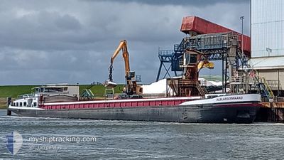
ALBLASSERWAARD
Other Type
Current Trip
| Time Travelled | --- |
|---|---|
| Remaining Time | --- |
| Distance Travelled | --- |
| Remaining Distance | --- |
| AVG Speed | --- |
| MAX Speed | --- |
| AVG Wind | --- |
| MAX Wind | --- |
| MIN Temp | --- |
| MAX Temp | --- |
| Tirant d eau | 0 m |
| Position reçue | 2 d depuis |
Current Position
| Longitude | 11.51904° |
|---|---|
| Latitude | 52.24394° |
| Etat | Under way using engine |
| Vitesse | 7.2 Noeuds |
| Parcours | 292° |
| Zone | North Sea |
| Station | T-AIS |
| Position reçue | 2 d depuis |
Info
Information
The current position of ALBLASSERWAARD is in North Sea with coordinates 52.24394° / 11.51904° as reported on 2024-05-03 11:08 by AIS to our vessel tracker app. The vessel's current speed is 7.2 Noeuds
The vessel ALBLASSERWAARD (MMSI: 244690402) is a Other Type It's sailing under the flag of [NL] Netherlands.
In this page you can find informations about the vessels current position, last detected port calls, and current voyage information. If the vessels is not in coverage by AIS you will find the latest position.
The current position of ALBLASSERWAARD is detected by our AIS receivers and we are not responsible for the reliability of the data. The last position was recorded while the vessel was in Coverage by the Ais receivers of our vessel tracking app.
Weather
| Temperature | 19.4°C / 66.92°F |
|---|---|
| Wind Speed | 6 knots |
| Direction | 198° SSW |
| Pressure | 1008.7 hPa |
| Humidity | 62.7 % |
| Cloud Coverage | 32 % |
Featured Company
Last Port Calls
| Port | Arrival | Departure | Time In Port |
|---|---|---|---|
| 2024-04-26 08:23 | 2024-04-26 09:34 | 1 h | |
| 2024-04-25 12:59 | 2024-04-25 13:44 | 45 m | |
| 2024-04-24 04:54 | 2024-04-25 05:31 | 1 d | |
| 2024-04-24 02:35 | 2024-04-24 04:27 | 1 h | |
| 2024-04-23 17:09 | 2024-04-23 19:32 | 2 h | |
| 2024-04-23 14:23 | 2024-04-23 15:10 | 47 m | |
| 2024-04-12 18:48 | 2024-04-15 03:58 | 2 d | |
| 2024-04-12 04:49 | 2024-04-12 05:05 | 15 m | |
| 2024-04-10 16:26 | 2024-04-10 16:37 | 11 m | |
| 2024-04-10 04:55 | 2024-04-10 05:08 | 13 m |
Last Trips
| Origin | Departure | Destination | Arrival | Distance | |
|---|---|---|---|---|---|
| 2024-04-25 15:44 | 2024-04-26 10:23 | 16.69 nm | |||
| 2024-04-25 07:31 | 2024-04-25 14:59 | 44.47 nm | |||
| 2024-04-24 06:27 | 2024-04-24 06:54 | 1.01 nm | |||
| 2024-04-23 21:32 | 2024-04-24 04:35 | 36.66 nm | |||
| 2024-04-23 17:10 | 2024-04-23 19:09 | 11.89 nm | |||
| 2024-04-23 17:10 | 2024-04-23 16:23 | 11.89 nm | |||
| 2024-04-12 07:05 | 2024-04-12 20:48 | 64.41 nm | |||
| 2024-04-10 18:37 | 2024-04-12 06:49 | 85.91 nm | |||
| 2024-04-10 07:08 | 2024-04-10 18:26 | 77.42 nm | |||
| 2024-04-10 00:35 | 2024-04-10 06:55 | 14.07 nm |
Events
| Heure | Evenement | Détails | Position/ Destination | Info |
|---|---|---|---|---|
| 2024-05-03 11:08 | Hors de la zone couverte |
52.24394 / 11.51904
North Sea
|
Vitesse: 7.2 kn Parcours: 292° |
|
| 2024-05-03 10:19 | Dans la zone couverte |
52.22528 / 11.66740
North Sea
|
Vitesse: 4.5 kn Parcours: 316.5° |
|
| 2024-05-03 09:05 | Hors de la zone couverte |
52.20024 / 11.68715
North Sea
|
Vitesse: 6.4 kn Parcours: 19.2° |
|
| 2024-05-03 08:54 | Dans la zone couverte |
52.18672 / 11.67913
North Sea
|
Vitesse: 5 kn Parcours: 95.1° |
|
| 2024-05-02 17:31 | Hors de la zone couverte |
52.18678 / 11.67709
North Sea
|
Vitesse: 1.3 kn Parcours: 267.5° |
|
| 2024-05-02 17:30 | Etat Changé | Moored Under way using engine |
52.18679 / 11.67753
MAGDEBURG
|
Vitesse: 0.6 kn Parcours: 511° |
| 2024-05-02 14:56 | Dans la zone couverte |
52.25198 / 11.49827
North Sea
|
Vitesse: 5.5 kn Parcours: 131° |
|
| 2024-05-01 14:47 | Hors de la zone couverte |
52.40707 / 9.74163
North Sea
|
Vitesse: 4.9 kn Parcours: 117.4° |
|
| 2024-05-01 11:46 | Dans la zone couverte |
52.38986 / 9.36202
North Sea
|
Vitesse: 4.6 kn Parcours: 84.9° |
|
| 2024-05-01 08:59 | Hors de la zone couverte |
52.30839 / 9.04730
North Sea
|
Vitesse: 4.6 kn Parcours: 54.5° |