
AILA
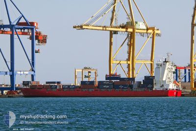
Container Ship
Current Trip
| Time Travelled | 21 h, 1 mins |
|---|---|
| Remaining Time | 1 day |
| Distance Travelled | 285.36 nm |
| Remaining Distance | 374.35 nm |
| AVG Speed | 14.8 Noeuds |
| MAX Speed | 18.5 Noeuds |
| AVG Wind | 6.6 knots |
| MAX Wind | 15 knots |
| MIN Temp | 1.6°C / 34.88°F |
| MAX Temp | 5.9°C / 42.62°F |
| Tirant d eau | 5.7 m |
| Position reçue | 17 m depuis |
Current Position
| Longitude | --- |
|---|---|
| Latitude | --- |
| Etat | Under way using engine |
| Vitesse | 13.2 Noeuds |
| Parcours | 22.3° |
| Zone | North Sea |
| Station | T-AIS |
| Position reçue | 17 m depuis |
Info
Information
The current position of AILA is in North Sea with coordinates 55.12873° / 6.01336° as reported on 2025-03-01 23:40 by AIS to our vessel tracker app. The vessel's current speed is 13.2 Noeuds and is heading at the port of LANDSKRONA. The estimated time of arrival as calculated by MyShipTracking vessel tracking app is 2025-03-03 03:39 LT
The vessel AILA (IMO: 9354337, MMSI: 230985000) is a Container Ship that was built in 2007 ( 18 Age ). It's sailing under the flag of [FI] Finland.
In this page you can find informations about the vessels current position, last detected port calls, and current voyage information. If the vessels is not in coverage by AIS you will find the latest position.
The current position of AILA is detected by our AIS receivers and we are not responsible for the reliability of the data. The last position was recorded while the vessel was in Coverage by the Ais receivers of our vessel tracking app.
The current draught of AILA as reported by AIS is 5.7 meters
Weather
| Temperature | 5.8°C / 42.44°F |
|---|---|
| Wind Speed | 15 knots |
| Direction | 262° W |
| Pressure | 1032.6 hPa |
| Humidity | 86.5 % |
| Cloud Coverage | 80 % |
Featured Company
Last Port Calls
| Port | Arrival | Departure | Time In Port |
|---|---|---|---|
| 2025-02-28 02:56 | 2025-03-01 02:56 | 23 h | |
| 2025-02-24 18:28 | 2025-02-25 21:28 | 1 d | |
| 2025-02-24 00:32 | 2025-02-24 08:57 | 8 h | |
| 2025-02-19 13:57 | 2025-02-21 14:59 | 2 d | |
| 2025-02-16 11:51 | 2025-02-17 04:26 | 16 h | |
| 2025-02-15 09:58 | 2025-02-15 23:13 | 13 h | |
| 2025-02-11 06:09 | 2025-02-13 00:17 | 1 d | |
| 2025-02-08 14:45 | 2025-02-09 13:19 | 22 h | |
| 2025-02-06 13:30 | 2025-02-07 11:12 | 21 h | |
| 2025-02-05 01:24 | 2025-02-06 00:31 | 23 h |
Last Trips
| Origin | Departure | Destination | Arrival | Distance | |
|---|---|---|---|---|---|
| 2025-02-25 21:28 | 2025-02-28 03:56 | 748.35 nm | |||
| 2025-02-24 08:57 | 2025-02-24 18:28 | 118.88 nm | |||
| 2025-02-21 15:59 | 2025-02-24 00:32 | 647.00 nm | |||
| 2025-02-17 05:26 | 2025-02-19 14:57 | 807.53 nm | |||
| 2025-02-15 23:13 | 2025-02-16 12:51 | 167.38 nm | |||
| 2025-02-13 01:17 | 2025-02-15 09:58 | 780.45 nm | |||
| 2025-02-09 13:19 | 2025-02-11 07:09 | 592.48 nm | |||
| 2025-02-07 11:12 | 2025-02-08 14:45 | 394.05 nm | |||
| 2025-02-06 00:31 | 2025-02-06 13:30 | 199.08 nm | |||
| 2025-02-02 00:45 | 2025-02-05 01:24 | 708.19 nm |
Events
| Heure | Evenement | Détails | Position/ Destination | Info |
|---|---|---|---|---|
| 2025-03-01 23:43 | Etat Changé | Default Under way using engine |
55.13875 / 6.02078
SELAA
|
Vitesse: 13.2 kn Parcours: 22.3° |
| 2025-03-01 22:46 | Etat Changé | Under way using engine Default |
54.95067 / 5.87599
SELAA
|
Vitesse: 13.2 kn Parcours: 24° |
| 2025-03-01 22:37 | Etat Changé | Default Under way using engine |
54.91927 / 5.85033
SELAA
|
Vitesse: 13.3 kn Parcours: 24.5° |
| 2025-03-01 22:34 | Changement de zone | German part of the North Sea Dutch part of the North Sea |
54.90973 / 5.84252
North Sea
SELAA
|
Vitesse: 13.3 kn Parcours: 24.5° |
| 2025-03-01 22:33 | Etat Changé | Under way using engine Default |
54.90757 / 5.84077
SELAA
|
Vitesse: 13.3 kn Parcours: 25° |
| 2025-03-01 22:33 | Dans la zone couverte |
54.90973 / 5.84252
North Sea
SELAA
|
Vitesse: 13.3 kn Parcours: 24.5° |
|
| 2025-03-01 18:36 | Etat Changé | Default Under way using engine |
54.11390 / 5.16522
SELAA
|
Vitesse: 13.4 kn Parcours: 19.7° |
| 2025-03-01 18:30 | Hors de la zone couverte |
54.09112 / 5.15177
North Sea
SELAA
|
Vitesse: 13.4 kn Parcours: 19.7° |
|
| 2025-03-01 16:47 | Etat Changé | Under way using engine Default |
53.71587 / 4.89248
SELAA
|
Vitesse: 14 kn Parcours: 24° |
| 2025-03-01 16:26 | Etat Changé | Default Under way using engine |
53.64133 / 4.83674
SELAA
|
Vitesse: 14 kn Parcours: 24.1° |