
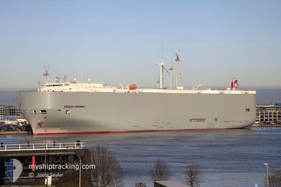
AEGEAN HIGHWAY
Vehicles Carrier
Current Trip
| Time Travelled | 14 days |
|---|---|
| Remaining Time | 1 h, 46 mins |
| Distance Travelled | 5384.81 nm |
| Remaining Distance | 19.97 nm |
| AVG Speed | 12.7 Noeuds |
| MAX Speed | 18.8 Noeuds |
| AVG Wind | 14.7 knots |
| MAX Wind | 48 knots |
| MIN Temp | 5.3°C / 41.54°F |
| MAX Temp | 21.5°C / 70.7°F |
| Tirant d eau | 9.9 m |
| Position reçue | Maintenant |
Current Position
| Longitude | --- |
|---|---|
| Latitude | --- |
| Etat | Under way using engine |
| Vitesse | 11.4 Noeuds |
| Parcours | 189° |
| Zone | North Pacific Ocean |
| Station | T-AIS |
| Position reçue | Maintenant |
Info
Information
The current position of AEGEAN HIGHWAY is in North Pacific Ocean with coordinates 45.92715° / -122.80610° as reported on 2024-11-22 12:57 by AIS to our vessel tracker app. The vessel's current speed is 11.4 Noeuds and is heading at the port of PORTLAND. The estimated time of arrival as calculated by MyShipTracking vessel tracking app is 2024-11-22 14:44 LT
The vessel AEGEAN HIGHWAY (IMO: 9464388, MMSI: 432666000) is a Vehicles Carrier that was built in 2008 ( 16 Age ). It's sailing under the flag of [JP] Japan.
In this page you can find informations about the vessels current position, last detected port calls, and current voyage information. If the vessels is not in coverage by AIS you will find the latest position.
The current position of AEGEAN HIGHWAY is detected by our AIS receivers and we are not responsible for the reliability of the data. The last position was recorded while the vessel was in Coverage by the Ais receivers of our vessel tracking app.
The current draught of AEGEAN HIGHWAY as reported by AIS is 9.9 meters
Weather
| Temperature | 8°C / 46.4°F |
|---|---|
| Wind Speed | 5 knots |
| Direction | 102° ESE |
| Pressure | 1001.3 hPa |
| Humidity | 92.8 % |
| Cloud Coverage | 100 % |
Featured Company
Last Port Calls
Most Visited Ports (Last year)
| Port | Arrivals | |
|---|---|---|
| 8 | ||
| 4 | ||
| 4 | ||
| 4 | ||
| 3 | ||
| 3 |
Last Trips
| Origin | Departure | Destination | Arrival | Distance | |
|---|---|---|---|---|---|
| 2024-11-06 16:10 | 2024-11-06 19:00 | 43.34 nm | |||
| 2024-10-05 21:51 | 2024-11-06 06:13 | 10906.88 nm | |||
| 2024-09-29 18:39 | 2024-10-04 21:07 | 843.59 nm | |||
| 2024-09-06 17:47 | 2024-09-29 03:55 | 9491.75 nm | |||
| 2024-08-19 02:38 | 2024-09-04 15:01 | 4949.35 nm |
Events
| Heure | Evenement | Détails | Position/ Destination | Info |
|---|---|---|---|---|
| 2024-11-21 22:45 | Tirant d'eau modifié | 9.9 9.8 |
45.87885 / -124.51678
US PDX
|
Vitesse: 6.3 kn Parcours: 351° |
| 2024-11-21 19:01 | Changement d'ETA | 2024/11/22 06:00 2024/11/21 21:30 |
45.76360 / -124.53285
US PDX
|
Vitesse: 14.5 kn Parcours: 359° |
| 2024-11-21 18:07 | Etat Changé | Under way using engine Default |
45.63272 / -124.70997
US PDX
|
Vitesse: 15.1 kn Parcours: 62° |
| 2024-11-21 17:54 | Dans la zone couverte |
45.63272 / -124.70997
North Pacific Ocean
US PDX
|
Vitesse: 15.3 kn Parcours: 85° |
|
| 2024-11-21 17:10 | Etat Changé | Default Under way using engine |
45.62232 / -124.79103
US PDX
|
Vitesse: 15.6 kn Parcours: 180° |
| 2024-11-21 17:02 | Hors de la zone couverte |
45.65780 / -124.79173
North Pacific Ocean
US PDX
|
Vitesse: 15.6 kn Parcours: 180° |
|
| 2024-11-21 15:06 | Etat Changé | Under way using engine Default |
45.76212 / -124.86133
US PDX
|
Vitesse: 16.3 kn Parcours: 1° |
| 2024-11-21 15:03 | Dans la zone couverte |
45.76955 / -124.86120
North Pacific Ocean
US PDX
|
Vitesse: 15.6 kn Parcours: 0° |
|
| 2024-11-21 13:02 | Etat Changé | Default Under way using engine |
45.79210 / -124.97875
US PDX
|
Vitesse: 13.7 kn Parcours: 178° |
| 2024-11-21 13:00 | Hors de la zone couverte |
45.79952 / -124.97937
North Pacific Ocean
US PDX
|
Vitesse: 13.7 kn Parcours: 178° |