
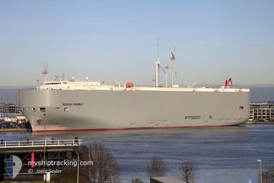
AEGEAN HIGHWAY
Vehicles Carrier
Current Trip
| Time Travelled | 22 h, 26 mins |
|---|---|
| Remaining Time | --- |
| Distance Travelled | 292.65 nm |
| Remaining Distance | --- |
| AVG Speed | 10.6 Knots |
| MAX Speed | 18 Knots |
| AVG Wind | 7.3 knots |
| MAX Wind | 10.6 knots |
| MIN Temp | 11.8°C / 53.24°F |
| MAX Temp | 20°C / 68°F |
| Dybgang | 8.2 m |
| Position Modtaget | 15 h, 30 m siden |
Current Position
| Longitude | -72.84057° |
|---|---|
| Latitude | 39.67860° |
| Status | Under way using engine |
| Fart | 16 Knots |
| Kurs | 133° |
| Område | North Atlantic Ocean |
| Station | T-AIS |
| Position Modtaget | 15 h, 30 m siden |
Info
Information
The current position of AEGEAN HIGHWAY is in North Atlantic Ocean with coordinates 39.67860° / -72.84057° as reported on 2024-05-21 08:26 by AIS to our vessel tracker app. The vessel's current speed is 16 Knots and is heading at the port of CRISTOBAL. The estimated time of arrival as calculated by MyShipTracking vessel tracking app is 2024-05-26 11:00 LT
The vessel AEGEAN HIGHWAY (IMO: 9464388, MMSI: 432666000) is a Vehicles Carrier that was built in 2008 ( 16 år gamle ). It's sailing under the flag of [JP] Japan.
In this page you can find informations about the vessels current position, last detected port calls, and current voyage information. If the vessels is not in coverage by AIS you will find the latest position.
The current position of AEGEAN HIGHWAY is detected by our AIS receivers and we are not responsible for the reliability of the data. The last position was recorded while the vessel was in Coverage by the Ais receivers of our vessel tracking app.
The current draught of AEGEAN HIGHWAY as reported by AIS is 8.2 meters
Weather
| Temperature | 20.4°C / 68.72°F |
|---|---|
| Wind Speed | 5 knots |
| Direction | 48° NE |
| Pressure | 1016.1 hPa |
| Humidity | 70.6 % |
| Cloud Coverage | 100 % |
Featured Company
Last Port Calls
| Port | Arrival | Departure | Time In Port |
|---|---|---|---|
| 2024-05-20 01:46 | 2024-05-21 01:31 | 23 h | |
| 2024-05-16 22:54 | 2024-05-17 21:46 | 22 h | |
| 2024-04-19 05:55 | 2024-04-22 08:56 | 3 d | |
| 2024-03-21 03:47 | 2024-03-22 06:07 | 1 d | |
| 2024-03-17 23:49 | 2024-03-18 21:44 | 21 h |
Most Visited Ports (Last year)
| Port | Arrivals | |
|---|---|---|
| 7 | ||
| 4 | ||
| 4 | ||
| 3 | ||
| 3 | ||
| 3 |
Last Trips
| Origin | Departure | Destination | Arrival | Distance | |
|---|---|---|---|---|---|
| 2024-05-17 17:46 | 2024-05-19 21:46 | 824.23 nm | |||
| 2024-04-22 17:56 | 2024-05-16 18:54 | 9544.21 nm | |||
| 2024-03-22 02:07 | 2024-04-19 14:55 | 10083.03 nm | |||
| 2024-03-18 17:44 | 2024-03-20 23:47 | 817.14 nm | |||
| 2024-02-19 17:37 | 2024-03-17 19:49 | 9642.84 nm |
Events
| Tid | Hændelsen | Detaljer | Position / Dest | Info |
|---|---|---|---|---|
| 2024-05-21 08:49 | Status er ændret | Default Under way using engine |
39.60965 / -72.73935
PA CTB
|
Fart: 16 kn Kurs: 133° |
| 2024-05-21 08:26 | Udenfor Dækning |
39.67860 / -72.84057
North Atlantic Ocean
PA CTB
|
Fart: 16 kn Kurs: 133° |
|
| 2024-05-21 08:23 | Status er ændret | Under way using engine Default |
39.68823 / -72.85267
PA CTB
|
Fart: 16 kn Kurs: 138° |
| 2024-05-21 08:19 | Status er ændret | Default Under way using engine |
39.70127 / -72.86774
PA CTB
|
Fart: 16 kn Kurs: 137° |
| 2024-05-21 07:02 | Status er ændret | Under way using engine Default |
39.94630 / -73.18185
PA CTB
|
Fart: 16.3 kn Kurs: 127° |
| 2024-05-21 06:44 | Status er ændret | Default Under way using engine |
39.99837 / -73.26045
PA CTB
|
Fart: 16.2 kn Kurs: 129° |
| 2024-05-21 04:50 | Dybgangen er ændret | 8.2 8.1 |
40.30323 / -73.65990
PA CTB
|
Fart: 4.6 kn Kurs: 141° |
| 2024-05-21 01:31 | Afsejlet fra sidste havn |
|
40.57722 / -74.03522
PA CTB
|
Fart: 14.7 kn Kurs: 166° |
| 2024-05-21 00:18 | START Sejllads |
40.68685 / -74.13287
[US] NEW YORK
|
Fart: 3.1 kn Kurs: 141° |
|
| 2024-05-21 00:00 | Status er ændret | Under way using engine Moored |
40.69113 / -74.13498
[US] NEW YORK
|
Fart: Kurs: 324° |