
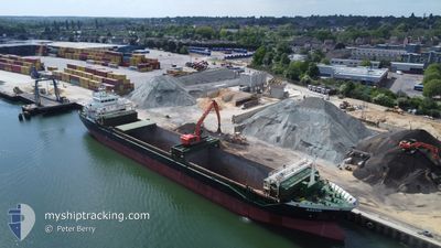
AASVIK
General Cargo
Current Trip
| Time Travelled | 9 h, 37 mins |
|---|---|
| Remaining Time | 2 days |
| Distance Travelled | 79.61 nm |
| Remaining Distance | 497.46 nm |
| AVG Speed | 9.3 Noeuds |
| MAX Speed | 10.7 Noeuds |
| AVG Wind | 11.7 knots |
| MAX Wind | 18 knots |
| MIN Temp | 8.2°C / 46.76°F |
| MAX Temp | 10.2°C / 50.36°F |
| Tirant d eau | 4.3 m |
| Position reçue | 2 m depuis |
Current Position
| Longitude | --- |
|---|---|
| Latitude | --- |
| Etat | Under way using engine |
| Vitesse | 7.2 Noeuds |
| Parcours | 221.9° |
| Zone | Celtic Sea |
| Station | T-AIS |
| Position reçue | 2 m depuis |
Info
Information
The current position of AASVIK is in Celtic Sea with coordinates 50.61536° / -5.52086° as reported on 2026-02-06 16:25 by AIS to our vessel tracker app. The vessel's current speed is 7.2 Noeuds and is heading at the port of AMSTERDAM. The estimated time of arrival as calculated by MyShipTracking vessel tracking app is 2026-02-08 20:39 LT
The vessel AASVIK (IMO: 9433389, MMSI: 255752000) is a General Cargo that was built in 2011 ( 15 Age ). It's sailing under the flag of [PT] Portugal.
In this page you can find informations about the vessels current position, last detected port calls, and current voyage information. If the vessels is not in coverage by AIS you will find the latest position.
The current position of AASVIK is detected by our AIS receivers and we are not responsible for the reliability of the data. The last position was recorded while the vessel was in Coverage by the Ais receivers of our vessel tracking app.
The current draught of AASVIK as reported by AIS is 4.3 meters
Weather
| Temperature | 10°C / 50°F |
|---|---|
| Wind Speed | 18 knots |
| Direction | 192° SSW |
| Pressure | 983.4 hPa |
| Humidity | 86.6 % |
| Cloud Coverage | 51 % |
Featured Company
Last Port Calls
| Port | Arrival | Departure | Time In Port |
|---|---|---|---|
| 2026-02-05 07:21 | 2026-02-06 06:51 | 23 h | |
| 2026-02-02 04:05 | 2026-02-02 17:49 | 13 h | |
| 2026-01-31 20:15 | 2026-02-01 11:55 | 15 h | |
| 2026-01-30 10:16 | 2026-01-30 22:54 | 12 h | |
| 2026-01-30 08:56 | 2026-01-30 09:26 | 29 m | |
| 2026-01-28 07:08 | 2026-01-28 07:28 | 20 m | |
| 2026-01-23 06:27 | 2026-01-24 12:59 | 1 d | |
| 2026-01-20 19:58 | 2026-01-22 18:26 | 1 d | |
| 2026-01-10 18:56 | 2026-01-10 23:08 | 4 h | |
| 2026-01-02 03:35 | 2026-01-06 21:21 | 4 d |
Last Trips
| Origin | Departure | Destination | Arrival | Distance | |
|---|---|---|---|---|---|
| 2026-02-02 18:49 | 2026-02-05 07:21 | 583.93 nm | |||
| 2026-02-01 11:55 | 2026-02-02 05:05 | 190.16 nm | |||
| 2026-01-30 23:54 | 2026-01-31 20:15 | 190.61 nm | |||
| 2026-01-30 10:26 | 2026-01-30 11:16 | 7.68 nm | |||
| 2026-01-30 10:26 | 2026-01-30 09:56 | 7.68 nm | |||
| 2026-01-24 12:59 | 2026-01-28 07:08 | 650.91 nm | |||
| 2026-01-22 18:26 | 2026-01-23 06:27 | 87.94 nm | |||
| 2026-01-11 00:08 | 2026-01-20 19:58 | 2160.93 nm | |||
| 2026-01-06 21:21 | 2026-01-10 19:56 | 927.20 nm | |||
| 2025-12-30 20:58 | 2026-01-02 03:35 | 584.60 nm |
Events
| Heure | Evenement | Détails | Position/ Destination | Info |
|---|---|---|---|---|
| 2026-02-06 16:24 | Etat Changé | Under way using engine Default |
50.61655 / -5.51920
AMSTERDAM
|
Vitesse: 6.8 kn Parcours: 221° |
| 2026-02-06 16:23 | Etat Changé | Default Under way using engine |
50.61821 / -5.51679
AMSTERDAM
|
Vitesse: 6.6 kn Parcours: 227.1° |
| 2026-02-06 16:16 | Etat Changé | Under way using engine Default |
50.62848 / -5.50053
AMSTERDAM
|
Vitesse: 7.8 kn Parcours: 233° |
| 2026-02-06 16:03 | Etat Changé | Default Under way using engine |
50.64692 / -5.46803
AMSTERDAM
|
Vitesse: 7.3 kn Parcours: 232.1° |
| 2026-02-06 15:35 | Tirant d'eau modifié | 4.3 4 |
50.68750 / -5.39849
AMSTERDAM
|
Vitesse: 8.7 kn Parcours: 223.4° |
| 2026-02-06 15:35 | Changement d'ETA | 2026/02/08 21:00 |
50.68750 / -5.39849
AMSTERDAM
|
Vitesse: 8.7 kn Parcours: 223.4° |
| 2026-02-06 15:12 | Etat Changé | Under way using engine Default |
50.72280 / -5.33795
AMSTERDAM
|
Vitesse: 8.2 kn Parcours: 223° |
| 2026-02-06 15:11 | Etat Changé | Default Under way using engine |
50.72404 / -5.33581
AMSTERDAM
|
Vitesse: 8.4 kn Parcours: 229.8° |
| 2026-02-06 14:42 | Detecté en mer | United Kingdom part of the Celtic Sea |
50.77005 / -5.25452
Celtic Sea
|
Vitesse: 8.5 kn Parcours: 229.4° |
| 2026-02-06 14:41 | Etat Changé | Under way using engine Default |
50.77168 / -5.25164
AMSTERDAM
|
Vitesse: 9 kn Parcours: 231° |