
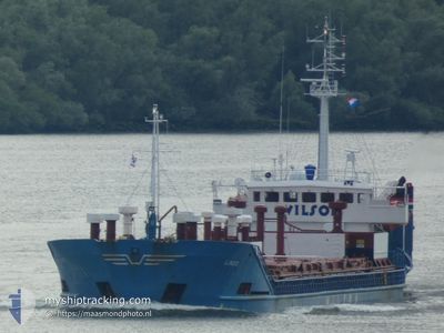
LINDO
General Cargo
Current Trip
| Time Travelled | 2 days |
|---|---|
| Remaining Time | 7 h, 12 mins |
| Distance Travelled | 537.17 nm |
| Remaining Distance | 67.67 nm |
| AVG Speed | 8.6 Knoten |
| MAX Speed | 10.7 Knoten |
| AVG Wind | 12.9 knots |
| MAX Wind | 22 knots |
| MIN Temp | 1.9°C / 35.42°F |
| MAX Temp | 8°C / 46.4°F |
| Tiefgang | 4.9 m |
| Position erhalten | 1 m alt |
Current Position
| Länge | 14.17922° |
|---|---|
| Breite | 54.88345° |
| Zustand | Under way using engine |
| Geschwindigkeit | 9.3 Knoten |
| Kurs | 113.8° |
| Gebiet | Kattegat |
| Station | T-AIS |
| Position erhalten | 1 m alt |
Info
Information
Die aktuelle Position von LINDO befindet sich in Kattegat mit den Koordinaten 54.88345° / 14.17922°, wie von AIS am 2024-04-26 17:05 an unsere Schiffsverfolgungs-App. Die aktuelle Geschwindigkeit des Schiffes betragt 9.3 Knoten und fahrt in den Hafen von KOLOBRZEG. Die geschatzte Ankunftszeit, berechnet von der MyShipTracking-App zur Schiffsverfolgung, ist 2024-04-27 00:19 LT
Das Schiff LINDO (IMO: 8028527, MMSI: 314303000) ist General Cargo das wurde im Jahr 1982 ( 42 Jahre alt ) gebaut. Es segelt unter der Flagge [BB] Barbados.
Auf dieser Seite finden Sie Informationen zur aktuellen Position des Schiffes, zu den zuletzt erkannten Hafenanlaufen und zu aktuellen Reiseinformationen. Wenn die Schiffe nicht von AIS abgedeckt werden, finden Sie die neueste Position.
Die aktuelle Position von LINDO wird von unseren AIS-Empfangern erkannt und wir sind nicht fur die Zuverlassigkeit der Daten verantwortlich. Die letzte Position wurde von den Ais-Empfangern unserer Schiffsverfolgungs-App aufgezeichnet, wahrend sich das Schiff in Deckung befand.
Der aktuelle Entwurf von LINDO, wie von AIS gemeldet, betragt 4.9 meter
Weather
| Temperature | 7.3°C / 45.14°F |
|---|---|
| Wind Speed | 11 knots |
| Direction | 162° SSE |
| Pressure | 1006.3 hPa |
| Humidity | 82.2 % |
| Cloud Coverage | 100 % |
Featured Company
Last Port Calls
| Port | Arrival | Departure | Time In Port |
|---|---|---|---|
| 2024-04-24 00:18 | 2024-04-24 04:00 | 3 h | |
| 2024-04-16 18:00 | 2024-04-23 23:17 | 7 d | |
| 2024-04-15 10:48 | 2024-04-16 03:25 | 16 h | |
| 2024-04-11 07:56 | 2024-04-13 18:56 | 2 d | |
| 2024-04-09 12:40 | 2024-04-09 15:23 | 2 h | |
| 2024-04-06 20:12 | 2024-04-07 18:20 | 22 h | |
| 2024-04-04 07:28 | 2024-04-05 09:24 | 1 d | |
| 2024-03-30 07:35 | 2024-04-03 02:18 | 3 d | |
| 2024-03-27 00:04 | 2024-03-27 15:28 | 15 h | |
| 2024-03-26 04:19 | 2024-03-26 13:24 | 9 h |
Most Visited Ports (Last year)
| Port | Arrivals | |
|---|---|---|
| 14 | ||
| 13 | ||
| 8 | ||
| 8 | ||
| 7 | ||
| 4 |
Last Trips
| Origin | Departure | Destination | Arrival | Distance | |
|---|---|---|---|---|---|
| 2024-04-24 01:17 | 2024-04-24 02:18 | 7.80 nm | |||
| 2024-04-16 05:25 | 2024-04-16 20:00 | 23.41 nm | |||
| 2024-04-13 20:56 | 2024-04-15 12:48 | 304.48 nm | |||
| 2024-04-09 17:23 | 2024-04-11 09:56 | 369.95 nm | |||
| 2024-04-07 20:20 | 2024-04-09 14:40 | 390.40 nm | |||
| 2024-04-05 11:24 | 2024-04-06 22:12 | 312.19 nm | |||
| 2024-04-03 04:18 | 2024-04-04 09:28 | 278.11 nm | |||
| 2024-03-27 16:28 | 2024-03-30 08:35 | 513.92 nm | |||
| 2024-03-26 14:24 | 2024-03-27 01:04 | 114.47 nm | |||
| 2024-03-22 19:49 | 2024-03-26 05:19 | 713.91 nm |
Events
| Zeit | Ereignis | Details | Position / Ziel | Information |
|---|---|---|---|---|
| 2024-04-26 16:35 | Ändere Seegebiet | Danish part of the Kattegat German part of the Baltic Sea |
54.91652 / 14.05168
Kattegat
PLKOL
|
Geschwindigkeit: 9.4 kn Kurs: 111.4° |
| 2024-04-26 15:05 | Ändere Seegebiet | German part of the Baltic Sea Swedish part of the Baltic Sea |
55.01722 / 13.70692
Baltic Sea
PLKOL
|
Geschwindigkeit: 8.8 kn Kurs: 113.9° |
| 2024-04-26 10:26 | Ändere Seegebiet | Swedish part of the Baltic Sea Danish part of the Baltic Sea |
55.30741 / 12.63992
Baltic Sea
PLKOL
|
Geschwindigkeit: 8.5 kn Kurs: 143.9° |
| 2024-04-26 10:20 | Ändere Seegebiet | Danish part of the Baltic Sea Danish part of the Kattegat |
55.32176 / 12.63356
Baltic Sea
PLKOL
|
Geschwindigkeit: 8.9 kn Kurs: 178.4° |
| 2024-04-26 10:11 | Auf See entdeckt | Danish part of the Kattegat |
55.34400 / 12.63881
Kattegat
PLKOL
|
Geschwindigkeit: 9.1 kn Kurs: 191.8° |
| 2024-04-26 09:20 | Ändere Seegebiet | Swedish part of the Kattegat Danish part of the Kattegat |
55.46814 / 12.68338
Kattegat
PLKOL
|
Geschwindigkeit: 8.9 kn Kurs: 190.6° |
| 2024-04-26 03:22 | Ändere Seegebiet | Danish part of the Kattegat Swedish part of the Kattegat |
56.19620 / 12.39330
Kattegat
PLKOL
|
Geschwindigkeit: 6.5 kn Kurs: 163.8° |
| 2024-04-25 17:16 | Ändere Seegebiet | Swedish part of the Kattegat Danish part of the Kattegat |
57.50971 / 11.34456
Kattegat
PLKOL
|
Geschwindigkeit: 9.1 kn Kurs: 132.8° |
| 2024-04-25 14:50 | Ändere Seegebiet | Danish part of the Kattegat Danish part of the Skaggerak |
57.77690 / 10.86507
Kattegat
PLKOL
|
Geschwindigkeit: 9 kn Kurs: 131° |
| 2024-04-25 08:55 | Ändere Seegebiet | Danish part of the Skaggerak Norwegian part of the Skaggerak |
57.80506 / 9.09889
Skaggerak
PLKOL
|
Geschwindigkeit: 9.7 kn Kurs: 95° |