
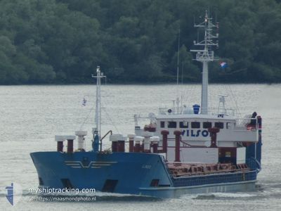
LINDO
General Cargo
Current Trip
| Trip Time | 14 h, 35 mins |
|---|---|
| Trip Distance | 23.41 nm |
| AVG Speed | 5.1 Knots |
| MAX Speed | 9.3 Knots |
| Draught | 4.9 m |
| AVG Wind | 6.2 knots |
| MAX Wind | 7 knots |
| MIN Temp | -0.8°C / 30.56°F |
| MAX Temp | 7°C / 44.6°F |
| Position Received | 2 m ago |
Current Position
| Longitude | 5.29277° |
|---|---|
| Latitude | 60.39166° |
| Status | Moored |
| Speed | |
| Course | 124° |
| Area | North Sea |
| Station | T-AIS |
| Position Received | 2 m ago |
Info
Information
The current position of LINDO is in North Sea with coordinates 60.39166° / 5.29277° as reported on 2024-04-19 20:41 by AIS to our vessel tracker app. The vessel's current speed is 0 Knots and is currently inside the port of BERGEN.
The vessel LINDO (IMO: 8028527, MMSI: 314303000) is a General Cargo that was built in 1982 ( 42 years old ). It's sailing under the flag of [BB] Barbados.
In this page you can find informations about the vessels current position, last detected port calls, and current voyage information. If the vessels is not in coverage by AIS you will find the latest position.
The current position of LINDO is detected by our AIS receivers and we are not responsible for the reliability of the data. The last position was recorded while the vessel was in Coverage by the Ais receivers of our vessel tracking app.
The current draught of LINDO as reported by AIS is 4.9 meters
Weather
| Temperature | 4.1°C / 39.38°F |
|---|---|
| Wind Speed | 8 knots |
| Direction | 346° NNW |
| Pressure | 1012.3 hPa |
| Humidity | 90.1 % |
| Cloud Coverage | 100 % |
Featured Company
Last Port Calls
| Port | Arrival | Departure | Time In Port |
|---|---|---|---|
| 2024-04-16 18:00 | |||
| 2024-04-15 10:48 | 2024-04-16 03:25 | 16 h | |
| 2024-04-11 07:56 | 2024-04-13 18:56 | 2 d | |
| 2024-04-09 12:40 | 2024-04-09 15:23 | 2 h | |
| 2024-04-06 20:12 | 2024-04-07 18:20 | 22 h | |
| 2024-04-04 07:28 | 2024-04-05 09:24 | 1 d | |
| 2024-03-30 07:35 | 2024-04-03 02:18 | 3 d | |
| 2024-03-27 00:04 | 2024-03-27 15:28 | 15 h | |
| 2024-03-26 04:19 | 2024-03-26 13:24 | 9 h | |
| 2024-03-22 18:49 |
Most Visited Ports (Last year)
| Port | Arrivals | |
|---|---|---|
| 15 | ||
| 13 | ||
| 9 | ||
| 8 | ||
| 7 | ||
| 4 |
Last Trips
| Origin | Departure | Destination | Arrival | Distance | |
|---|---|---|---|---|---|
| 2024-04-16 05:25 | 2024-04-16 20:00 | 23.41 nm | |||
| 2024-04-13 20:56 | 2024-04-15 12:48 | 304.48 nm | |||
| 2024-04-09 17:23 | 2024-04-11 09:56 | 369.95 nm | |||
| 2024-04-07 20:20 | 2024-04-09 14:40 | 390.40 nm | |||
| 2024-04-05 11:24 | 2024-04-06 22:12 | 312.19 nm | |||
| 2024-04-03 04:18 | 2024-04-04 09:28 | 278.11 nm | |||
| 2024-03-27 16:28 | 2024-03-30 08:35 | 513.92 nm | |||
| 2024-03-26 14:24 | 2024-03-27 01:04 | 114.47 nm | |||
| 2024-03-22 19:49 | 2024-03-26 05:19 | 713.91 nm | |||
| 2024-03-16 13:32 | 2024-03-19 22:37 | 612.90 nm |
Events
| Time | Event | Details | Position / Dest | Info |
|---|---|---|---|---|
| 2024-04-16 18:56 | Status Changed | Moored Pushing Ahead - Towing |
60.39221 / 5.29149
[NO] BERGEN
|
Speed: Course: 134° |
| 2024-04-16 18:00 | PORT ARRIVAL |
|
60.39618 / 5.28780
[NO] BERGEN
|
Speed: 2.6 kn Course: 153° |
| 2024-04-16 17:29 | Status Changed | Pushing Ahead - Towing Default |
60.40570 / 5.27966
AGOTNES
|
Speed: 1.2 kn Course: 162° |
| 2024-04-16 17:19 | STOP Moving | 1.12 nm, East of FLORVAG |
60.40862 / 5.27940
AGOTNES
|
Speed: 0.3 kn Course: 160° |
| 2024-04-16 14:47 | START Moving | 4.89 nm, North of VALESTRANDSFOSSEN |
60.58557 / 5.42275
AGOTNES
|
Speed: 3.6 kn Course: 219° |
| 2024-04-16 14:42 | Status Changed | Default At anchor |
60.58653 / 5.42618
AGOTNES
|
Speed: 0.2 kn Course: 313° |
| 2024-04-16 05:19 | STOP Moving | 4.86 nm, North of VALESTRANDSFOSSEN |
60.58511 / 5.42689
AGOTNES
|
Speed: 0.3 kn Course: 327° |
| 2024-04-16 05:08 | Status Changed | At anchor Under way using engine |
60.58665 / 5.42639
AGOTNES
|
Speed: 0.8 kn Course: 265° |
| 2024-04-16 03:25 | START Moving | 0.34 nm, South East of EIKEFET |
60.69539 / 5.55944
AGOTNES
|
Speed: 6.5 kn Course: 157° |
| 2024-04-16 03:25 | PORT DEPARTURE |
|
60.69539 / 5.55944
AGOTNES
|
Speed: 4.4 kn Course: 154° |