
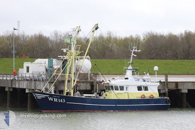
WR 143 FRANS NAN
Fishing
Current Trip
Unknown
| Time Travelled | 38 days |
|---|---|
| Remaining Time | --- |
| Distance Travelled | 402.71 nm |
| Remaining Distance | --- |
| AVG Speed | 4.7 Knots |
| MAX Speed | 11.3 Knots |
| AVG Wind | 16.5 knots |
| MAX Wind | 27.7 knots |
| MIN Temp | 3.2°C / 37.76°F |
| MAX Temp | 8.3°C / 46.94°F |
| Dybgang | 0 m |
| Position Modtaget | 1 d siden |
Current Position
| Longitude | 8.86069° |
|---|---|
| Latitude | 54.11735° |
| Status | Under way using engine |
| Fart | 4 Knots |
| Kurs | 99.8° |
| Område | North Sea |
| Station | T-AIS |
| Position Modtaget | 1 d siden |
Info
Information
The current position of WR 143 FRANS NAN is in North Sea with coordinates 54.11735° / 8.86069° as reported on 2024-04-25 06:06 by AIS to our vessel tracker app. The vessel's current speed is 4 Knots
The vessel WR 143 FRANS NAN (MMSI: 246150000) is a Fishing It's sailing under the flag of [NL] Netherlands.
In this page you can find informations about the vessels current position, last detected port calls, and current voyage information. If the vessels is not in coverage by AIS you will find the latest position.
The current position of WR 143 FRANS NAN is detected by our AIS receivers and we are not responsible for the reliability of the data. The last position was recorded while the vessel was in Coverage by the Ais receivers of our vessel tracking app.
Weather
| Temperature | 5.2°C / 41.36°F |
|---|---|
| Wind Speed | 4 knots |
| Direction | 136° SE |
| Pressure | 1003 hPa |
| Humidity | 81.2 % |
| Cloud Coverage | 100 % |
Featured Company
Events
| Tid | Hændelsen | Detaljer | Position / Dest | Info |
|---|---|---|---|---|
| 2024-04-25 06:06 | Udenfor Dækning |
54.11735 / 8.86069
North Sea
|
Fart: 4 kn Kurs: 99.8° |
|
| 2024-04-25 02:11 | Indenfor Dækning |
54.32890 / 8.37172
North Sea
|
Fart: 2.6 kn Kurs: 161.9° |
|
| 2024-04-24 12:43 | Udenfor Dækning |
54.45170 / 8.33560
North Sea
|
Fart: 2.7 kn Kurs: 101.9° |
|
| 2024-04-23 13:18 | Indenfor Dækning |
54.60137 / 8.18953
North Sea
|
Fart: 3.9 kn Kurs: 334° |
|
| 2024-04-23 11:29 | Udenfor Dækning |
54.58327 / 8.21645
North Sea
|
Fart: 4 kn Kurs: 107.7° |
|
| 2024-04-22 21:45 | Indenfor Dækning |
54.77297 / 7.92393
North Sea
|
Fart: 3.1 kn Kurs: 128.8° |
|
| 2024-04-21 15:34 | Udenfor Dækning |
54.76061 / 8.11572
North Sea
|
Fart: 2.5 kn Kurs: 160° |
|
| 2024-04-21 09:38 | Indenfor Dækning |
54.79459 / 8.07008
North Sea
|
Fart: 2.8 kn Kurs: 144.9° |
|
| 2024-04-20 19:50 | Udenfor Dækning |
55.05568 / 8.20023
North Sea
|
Fart: 3.3 kn Kurs: 159.4° |
|
| 2024-04-20 15:11 | Ændre havområde | German part of the North Sea Danish part of the North Sea |
55.05969 / 8.45833
North Sea
|
Fart: 10.3 kn Kurs: 278° |