
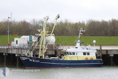
WR 143 FRANS NAN
Fishing
Current Trip
Unknown
| Time Travelled | 32 days |
|---|---|
| Remaining Time | --- |
| Distance Travelled | 202.66 nm |
| Remaining Distance | --- |
| AVG Speed | 6.4 Noeuds |
| MAX Speed | 10.5 Noeuds |
| AVG Wind | 18.2 knots |
| MAX Wind | 23.4 knots |
| MIN Temp | 5.4°C / 41.72°F |
| MAX Temp | 8.3°C / 46.94°F |
| Tirant d eau | 0 m |
| Position reçue | Maintenant |
Current Position
| Longitude | 8.56778° |
|---|---|
| Latitude | 55.08651° |
| Etat | Under way using engine |
| Vitesse | |
| Parcours | --- |
| Zone | North Sea |
| Station | T-AIS |
| Position reçue | Maintenant |
Info
Information
The current position of WR 143 FRANS NAN is in North Sea with coordinates 55.08651° / 8.56778° as reported on 2024-04-20 01:07 by AIS to our vessel tracker app. The vessel's current speed is 0 Noeuds
The vessel WR 143 FRANS NAN (MMSI: 246150000) is a Fishing It's sailing under the flag of [NL] Netherlands.
In this page you can find informations about the vessels current position, last detected port calls, and current voyage information. If the vessels is not in coverage by AIS you will find the latest position.
The current position of WR 143 FRANS NAN is detected by our AIS receivers and we are not responsible for the reliability of the data. The last position was recorded while the vessel was in Coverage by the Ais receivers of our vessel tracking app.
Weather
| Temperature | 5.7°C / 42.26°F |
|---|---|
| Wind Speed | 13 knots |
| Direction | 7° N |
| Pressure | 1012.7 hPa |
| Humidity | 69.4 % |
| Cloud Coverage | 20 % |
Featured Company
Events
| Heure | Evenement | Détails | Position/ Destination | Info |
|---|---|---|---|---|
| 2024-04-19 04:54 | Arret | 6.13 nm, North East of LIST SYLT |
55.08700 / 8.56782
|
Vitesse: 0.3 kn Parcours: 511° |
| 2024-04-19 04:22 | Changement de zone | Danish part of the North Sea German part of the North Sea |
55.05716 / 8.47475
North Sea
|
Vitesse: 8.6 kn Parcours: 98.4° |
| 2024-04-19 03:27 | Dans la zone couverte |
55.05377 / 8.30132
North Sea
|
Vitesse: 6.4 kn Parcours: 71.8° |
|
| 2024-04-16 23:14 | Hors de la zone couverte |
54.86597 / 8.01838
North Sea
|
Vitesse: 2.6 kn Parcours: 58.4° |
|
| 2024-04-16 22:40 | Dans la zone couverte |
54.86082 / 8.00873
North Sea
|
Vitesse: 3.3 kn Parcours: 235.9° |
|
| 2024-04-16 21:23 | Hors de la zone couverte |
54.86056 / 8.02946
North Sea
|
Vitesse: 2.6 kn Parcours: 19.9° |
|
| 2024-04-16 18:43 | Changement de zone | German part of the North Sea Danish part of the North Sea |
54.90336 / 8.10142
North Sea
|
Vitesse: 1.2 kn Parcours: 198.6° |
| 2024-04-16 18:41 | Dans la zone couverte |
54.90336 / 8.10142
North Sea
|
Vitesse: 1.2 kn Parcours: 198.6° |