
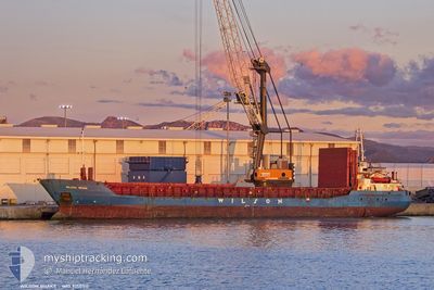
WILSON BRAKE
General Cargo
Current Trip
| Time Travelled | 11 days |
|---|---|
| Remaining Time | 2 days |
| Distance Travelled | 2413.94 nm |
| Remaining Distance | 684.45 nm |
| AVG Speed | 8.7 Knots |
| MAX Speed | 12.1 Knots |
| AVG Wind | 13 knots |
| MAX Wind | 36.5 knots |
| MIN Temp | 6.2°C / 43.16°F |
| MAX Temp | 18.2°C / 64.76°F |
| Dybgang | 5.6 m |
| Position Modtaget | 23 h, 42 m siden |
Current Position
| Longitude | --- |
|---|---|
| Latitude | --- |
| Status | Under way using engine |
| Fart | 9.9 Knots |
| Kurs | 1.2° |
| Område | North Atlantic Ocean |
| Station | T-AIS |
| Position Modtaget | 23 h, 42 m siden |
Info
Information
The current position of WILSON BRAKE is in North Atlantic Ocean with coordinates 39.22136° / -9.83881° as reported on 2025-03-17 04:29 by AIS to our vessel tracker app. The vessel's current speed is 9.9 Knots and is heading at the port of WATERFORD. The estimated time of arrival as calculated by MyShipTracking vessel tracking app is 2025-03-20 17:14 LT
The vessel WILSON BRAKE (IMO: 9150511, MMSI: 314701000) is a General Cargo that was built in 1997 ( 28 år gamle ). It's sailing under the flag of [BB] Barbados.
In this page you can find informations about the vessels current position, last detected port calls, and current voyage information. If the vessels is not in coverage by AIS you will find the latest position.
The current position of WILSON BRAKE is detected by our AIS receivers and we are not responsible for the reliability of the data. The last position was recorded while the vessel was in Coverage by the Ais receivers of our vessel tracking app.
The current draught of WILSON BRAKE as reported by AIS is 5.6 meters
Weather
| Temperature | 13.2°C / 55.76°F |
|---|---|
| Wind Speed | 10 knots |
| Direction | 158° SSE |
| Pressure | 1006.9 hPa |
| Humidity | 77.8 % |
| Cloud Coverage | 68 % |
Featured Company
Last Port Calls
| Port | Arrival | Departure | Time In Port |
|---|---|---|---|
| 2025-03-01 08:44 | 2025-03-06 08:37 | 4 d | |
| 2025-02-22 19:51 | 2025-02-26 07:27 | 3 d | |
| 2025-02-16 00:37 | 2025-02-16 02:52 | 2 h | |
| 2025-02-07 22:43 | 2025-02-09 10:05 | 1 d | |
| 2025-02-04 20:43 | 2025-02-06 12:45 | 1 d | |
| 2025-01-31 22:09 | 2025-02-04 04:48 | 3 d | |
| 2025-01-30 07:52 | 2025-01-30 19:30 | 11 h | |
| 2025-01-24 05:33 | 2025-01-24 20:25 | 14 h | |
| 2025-01-23 07:32 | 2025-01-23 17:40 | 10 h | |
| 2025-01-22 02:49 | 2025-01-22 23:55 | 21 h |
Most Visited Ports (Last year)
| Port | Arrivals | |
|---|---|---|
| 3 | ||
| 3 | ||
| 3 | ||
| 3 | ||
| 2 | ||
| 2 |
Last Trips
| Origin | Departure | Destination | Arrival | Distance | |
|---|---|---|---|---|---|
| 2025-02-26 07:27 | 2025-03-01 08:44 | 688.97 nm | |||
| 2025-02-16 02:52 | 2025-02-22 19:51 | 1407.11 nm | |||
| 2025-02-09 10:05 | 2025-02-16 00:37 | 1442.31 nm | |||
| 2025-02-06 12:45 | 2025-02-07 22:43 | 161.31 nm | |||
| 2025-02-04 04:48 | 2025-02-04 20:43 | 156.20 nm | |||
| 2025-01-30 19:30 | 2025-01-31 22:09 | 253.12 nm | |||
| 2025-01-24 20:25 | 2025-01-30 07:52 | 1121.62 nm | |||
| 2025-01-23 17:40 | 2025-01-24 05:33 | 122.72 nm | |||
| 2025-01-22 23:55 | 2025-01-23 07:32 | 35.21 nm | |||
| 2025-01-13 20:31 | 2025-01-22 02:49 | 1713.35 nm |
Events
| Tid | Hændelsen | Detaljer | Position / Dest | Info |
|---|---|---|---|---|
| 2025-03-17 04:36 | Status er ændret | Default Under way using engine |
39.24076 / -9.83786
IE WAT
|
Fart: 9.9 kn Kurs: 1.2° |
| 2025-03-17 04:29 | Udenfor Dækning |
39.22136 / -9.83881
North Atlantic Ocean
IE WAT
|
Fart: 9.9 kn Kurs: 1.2° |
|
| 2025-03-16 17:41 | Status er ændret | Under way using engine Default |
37.52670 / -9.49043
IE WAT
|
Fart: 9.3 kn Kurs: 347° |
| 2025-03-16 17:40 | Status er ændret | Default Under way using engine |
37.52414 / -9.48966
IE WAT
|
Fart: 9.6 kn Kurs: 352.2° |
| 2025-03-16 17:34 | Status er ændret | Under way using engine Default |
37.50985 / -9.48511
IE WAT
|
Fart: 9.1 kn Kurs: 347° |
| 2025-03-16 17:16 | Indenfor Dækning |
37.50985 / -9.48511
North Atlantic Ocean
IE WAT
|
Fart: 9.5 kn Kurs: 345.8° |
|
| 2025-03-16 09:28 | Status er ændret | Default Under way using engine |
36.60886 / -8.60917
IE WAT
|
Fart: 9.2 kn Kurs: 290.6° |
| 2025-03-16 09:21 | Udenfor Dækning |
36.60353 / -8.58929
North Atlantic Ocean
IE WAT
|
Fart: 9.2 kn Kurs: 290.6° |
|
| 2025-03-16 08:57 | Fundet i havområde | Portuguese part of the North Atlantic Ocean |
36.58453 / -8.51728
North Atlantic Ocean
IE WAT
|
Fart: 9.1 kn Kurs: 288.1° |
| 2025-03-16 08:57 | Status er ændret | Under way using engine Default |
36.58453 / -8.51728
IE WAT
|
Fart: 9.3 kn Kurs: 293° |