
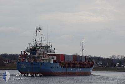
WILSON BRAKE
General Cargo
Current Trip
| Trip Time | 3 days |
|---|---|
| Trip Distance | 722.48 nm |
| AVG Speed | 9.3 Knots |
| MAX Speed | 11.5 Knots |
| Draught | 5.7 m |
| AVG Wind | 18.7 knots |
| MAX Wind | 22 knots |
| MIN Temp | 7°C / 44.6°F |
| MAX Temp | 13.9°C / 57.02°F |
| Position Received | 3 m ago |
Current Position
| Longitude | -3.82266° |
|---|---|
| Latitude | 43.44859° |
| Status | Moored |
| Speed | |
| Course | 95° |
| Area | Bay of Biscay |
| Station | T-AIS |
| Position Received | 3 m ago |
Info
Information
The current position of WILSON BRAKE is in Bay of Biscay with coordinates 43.44859° / -3.82266° as reported on 2024-04-20 09:23 by AIS to our vessel tracker app. The vessel's current speed is 0 Knots and is currently inside the port of SANTANDER.
The vessel WILSON BRAKE (IMO: 9150511, MMSI: 314701000) is a General Cargo that was built in 1997 ( 27 years old ). It's sailing under the flag of [BB] Barbados.
In this page you can find informations about the vessels current position, last detected port calls, and current voyage information. If the vessels is not in coverage by AIS you will find the latest position.
The current position of WILSON BRAKE is detected by our AIS receivers and we are not responsible for the reliability of the data. The last position was recorded while the vessel was in Coverage by the Ais receivers of our vessel tracking app.
The current draught of WILSON BRAKE as reported by AIS is 5.7 meters
Weather
| Temperature | 13.8°C / 56.84°F |
|---|---|
| Wind Speed | 8 knots |
| Direction | 70° ENE |
| Pressure | 1021.7 hPa |
| Humidity | 68 % |
| Cloud Coverage | 6 % |
Featured Company
Last Port Calls
| Port | Arrival | Departure | Time In Port |
|---|---|---|---|
| 2024-04-19 15:49 | |||
| 2024-04-11 11:04 | 2024-04-16 13:08 | 5 d | |
| 2024-04-08 06:00 | 2024-04-09 18:15 | 1 d | |
| 2024-04-05 16:14 | 2024-04-08 05:22 | 2 d | |
| 2024-04-05 15:56 | 2024-04-05 16:08 | 11 m | |
| 2024-04-03 00:00 | 2024-04-04 14:58 | 1 d | |
| 2024-03-22 12:37 | 2024-03-22 14:40 | 2 h | |
| 2024-03-09 08:23 | 2024-03-10 13:52 | 1 d | |
| 2024-03-07 16:23 | 2024-03-08 15:30 | 23 h | |
| 2024-02-29 13:41 | 2024-03-01 18:46 | 1 d |
Most Visited Ports (Last year)
| Port | Arrivals | |
|---|---|---|
| 5 | ||
| 4 | ||
| 4 | ||
| 3 | ||
| 3 | ||
| 2 |
Last Trips
| Origin | Departure | Destination | Arrival | Distance | |
|---|---|---|---|---|---|
| 2024-04-16 14:08 | 2024-04-19 17:49 | 722.48 nm | |||
| 2024-04-09 19:15 | 2024-04-11 12:04 | 266.74 nm | |||
| 2024-04-08 06:22 | 2024-04-08 07:00 | 3.01 nm | |||
| 2024-04-05 17:08 | 2024-04-05 17:14 | 0.39 nm | |||
| 2024-04-04 15:58 | 2024-04-05 16:56 | 216.91 nm | |||
| 2024-03-22 15:40 | 2024-04-03 01:00 | 1416.10 nm | |||
| 2024-03-10 14:52 | 2024-03-22 13:37 | 2420.96 nm | |||
| 2024-03-08 16:30 | 2024-03-09 09:23 | 168.36 nm | |||
| 2024-03-01 19:46 | 2024-03-07 17:23 | 813.20 nm | |||
| 2024-02-29 14:29 | 2024-02-29 14:41 | 0.28 nm |
Events
| Time | Event | Details | Position / Dest | Info |
|---|---|---|---|---|
| 2024-04-19 16:29 | Status Changed | Moored Under way using engine |
43.44859 / -3.82262
[ES] SANTANDER
|
Speed: Course: 95° |
| 2024-04-19 16:01 | STOP Moving |
43.44888 / -3.81285
[ES] SANTANDER
|
Speed: 0.3 kn Course: 110° |
|
| 2024-04-19 15:49 | PORT ARRIVAL |
|
43.45799 / -3.79324
[ES] SANTANDER
|
Speed: 9.3 kn Course: 259.1° |
| 2024-04-19 14:25 | Change Sea Area | Spanish part of the Bay of Biscay Irish part of the Irish Sea and St. George's Channel |
43.56235 / -3.78083
Bay of Biscay
GB BEL > ES SDR
|
Speed: 9.2 kn Course: 157.4° |
| 2024-04-19 14:24 | Status Changed | Under way using engine Default |
43.56551 / -3.78291
GB BEL > ES SDR
|
Speed: 8.8 kn Course: 160° |
| 2024-04-19 14:24 | IN Coverage |
43.56235 / -3.78083
Bay of Biscay
GB BEL > ES SDR
|
Speed: 9.2 kn Course: 157.4° |
|
| 2024-04-17 06:51 | Status Changed | Default Under way using engine |
52.10902 / -5.83402
GB BEL > ES SDR
|
Speed: 10.2 kn Course: 187.6° |
| 2024-04-17 06:35 | OUT of Coverage |
52.15306 / -5.82367
Irish Sea and St. George's Channel
GB BEL > ES SDR
|
Speed: 10.2 kn Course: 187.6° |
|
| 2024-04-17 04:51 | Status Changed | Under way using engine Default |
52.42507 / -5.75800
GB BEL > ES SDR
|
Speed: 9 kn Course: 192° |
| 2024-04-17 04:38 | IN Coverage |
52.42507 / -5.75800
Irish Sea and St. George's Channel
GB BEL > ES SDR
|
Speed: 9 kn Course: 190.1° |