
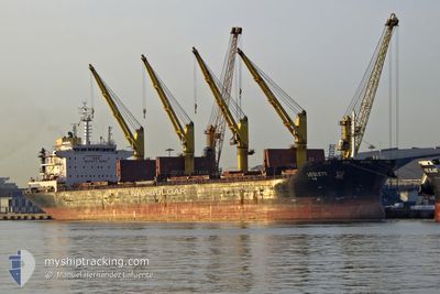
VESLETS
Bulk Carrier
Current Trip
TO ORDER
| Time Travelled | 1 day |
|---|---|
| Remaining Time | --- |
| Distance Travelled | 317.60 nm |
| Remaining Distance | --- |
| AVG Speed | 12.2 Knots |
| MAX Speed | 13.8 Knots |
| AVG Wind | 14.5 knots |
| MAX Wind | 20 knots |
| MIN Temp | 5.2°C / 41.36°F |
| MAX Temp | 12.5°C / 54.5°F |
| Dybgang | 6.6 m |
| Position Modtaget | 10 h, 33 m siden |
Current Position
| Longitude | --- |
|---|---|
| Latitude | --- |
| Status | Under way using engine |
| Fart | 12.8 Knots |
| Kurs | 19° |
| Område | North Sea |
| Station | T-AIS |
| Position Modtaget | 10 h, 33 m siden |
Info
Information
The current position of VESLETS is in North Sea with coordinates 53.74107° / 4.91878° as reported on 2026-02-27 13:19 by AIS to our vessel tracker app. The vessel's current speed is 12.8 Knots
The vessel VESLETS (IMO: 9621883, MMSI: 229012000) is a Bulk Carrier that was built in 2012 ( 14 år gamle ). It's sailing under the flag of [MT] Malta.
In this page you can find informations about the vessels current position, last detected port calls, and current voyage information. If the vessels is not in coverage by AIS you will find the latest position.
The current position of VESLETS is detected by our AIS receivers and we are not responsible for the reliability of the data. The last position was recorded while the vessel was in Coverage by the Ais receivers of our vessel tracking app.
The current draught of VESLETS as reported by AIS is 6.6 meters
Weather
| Temperature | 5.3°C / 41.54°F |
|---|---|
| Wind Speed | 4 knots |
| Direction | 126° SE |
| Pressure | 1011.5 hPa |
| Humidity | 99.8 % |
| Cloud Coverage | 100 % |
Featured Company
Last Port Calls
| Port | Arrival | Departure | Time In Port |
|---|---|---|---|
| 2026-02-18 23:04 | 2026-02-26 22:22 | 7 d | |
| 2026-02-09 08:59 | 2026-02-11 10:47 | 2 d | |
| 2026-01-30 19:07 | 2026-02-04 23:07 | 5 d | |
| 2026-01-16 16:13 | 2026-01-22 19:19 | 6 d | |
| 2025-12-07 03:11 | 2025-12-10 05:54 | 3 d |
Most Visited Ports (Last year)
| Port | Arrivals | |
|---|---|---|
| 3 | ||
| 1 | ||
| 1 | ||
| 1 | ||
| 1 | ||
| 1 |
Last Trips
| Origin | Departure | Destination | Arrival | Distance | |
|---|---|---|---|---|---|
| 2026-02-11 10:47 | 2026-02-18 23:04 | 1439.52 nm | |||
| 2026-02-04 23:07 | 2026-02-09 08:59 | 113.18 nm | |||
| 2026-01-22 19:19 | 2026-01-30 19:07 | 338.43 nm | |||
| 2025-12-10 05:54 | 2026-01-16 16:13 | 5427.58 nm | |||
| 2025-11-19 08:21 | 2025-12-07 03:11 | 731.37 nm |
Events
| Tid | Hændelsen | Detaljer | Position / Dest | Info |
|---|---|---|---|---|
| 2026-02-27 13:23 | Status er ændret | Default Under way using engine |
53.75692 / 4.92801
TO ORDER
|
Fart: 12.8 kn Kurs: 19° |
| 2026-02-27 13:19 | Udenfor Dækning |
53.74107 / 4.91878
North Sea
|
Fart: 12.8 kn Kurs: 19° |
|
| 2026-02-27 07:22 | Status er ændret | Under way using engine Default |
52.63096 / 3.91677
TO ORDER
|
Fart: 11.6 kn Kurs: 42° |
| 2026-02-27 07:13 | Status er ændret | Default Under way using engine |
52.60991 / 3.88477
TO ORDER
|
Fart: 11.6 kn Kurs: 42.7° |
| 2026-02-27 07:08 | Status er ændret | Under way using engine Default |
52.59694 / 3.86500
TO ORDER
|
Fart: 11.6 kn Kurs: 43° |
| 2026-02-27 06:33 | Status er ændret | Default Under way using engine |
52.51606 / 3.74195
TO ORDER
|
Fart: 11.4 kn Kurs: 42° |
| 2026-02-27 06:33 | Status er ændret | Under way using engine Default |
52.51572 / 3.74142
TO ORDER
|
Fart: 11.4 kn Kurs: 44° |
| 2026-02-27 05:54 | Status er ændret | Default Under way using engine |
52.41772 / 3.62261
TO ORDER
|
Fart: 11.2 kn Kurs: 21.9° |
| 2026-02-27 05:50 | Status er ændret | Under way using engine Default |
52.40553 / 3.61464
TO ORDER
|
Fart: 11.2 kn Kurs: 22° |
| 2026-02-27 05:29 | Status er ændret | Default Under way using engine |
52.34500 / 3.57500
TO ORDER
|
Fart: 11.1 kn Kurs: 21.8° |