
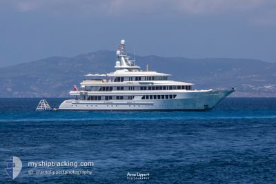
UTOPIA
Yacht
Current Trip
MARIGMNG
| Time Travelled | 11 days |
|---|---|
| Remaining Time | --- |
| Distance Travelled | 2195.64 nm |
| Remaining Distance | --- |
| AVG Speed | 9.3 Knots |
| MAX Speed | 11 Knots |
| AVG Wind | 14.5 knots |
| MAX Wind | 20 knots |
| MIN Temp | 12.1°C / 53.78°F |
| MAX Temp | 25.6°C / 78.08°F |
| Dybgang | 3.6 m |
| Position Modtaget | 2 m siden |
Current Position
| Longitude | --- |
|---|---|
| Latitude | --- |
| Status | Moored |
| Fart | |
| Kurs | 223° |
| Område | North Atlantic Ocean |
| Station | T-AIS |
| Position Modtaget | 2 m siden |
Info
Information
The current position of UTOPIA is in North Atlantic Ocean with coordinates 38.53983° / -28.62067° as reported on 2026-03-29 14:21 by AIS to our vessel tracker app. The vessel's current speed is 0 Knots
The vessel UTOPIA (IMO: 1007263, MMSI: 319326000) is a Yacht that was built in 2004 ( 22 år gamle ). It's sailing under the flag of [KY] Cayman Is.
In this page you can find informations about the vessels current position, last detected port calls, and current voyage information. If the vessels is not in coverage by AIS you will find the latest position.
The current position of UTOPIA is detected by our AIS receivers and we are not responsible for the reliability of the data. The last position was recorded while the vessel was in Coverage by the Ais receivers of our vessel tracking app.
The current draught of UTOPIA as reported by AIS is 3.6 meters
Weather
| Temperature | 15.1°C / 59.18°F |
|---|---|
| Wind Speed | 12 knots |
| Direction | 114° ESE |
| Pressure | 1033.5 hPa |
| Humidity | 74.5 % |
| Cloud Coverage | 62 % |
Featured Company
Last Port Calls
| Port | Arrival | Departure | Time In Port |
|---|---|---|---|
| 2026-03-17 13:23 | 2026-03-18 12:01 | 22 h | |
| 2026-01-07 13:37 | 2026-02-20 20:14 | ||
| 2026-01-03 16:30 | 2026-01-05 19:48 | 2 d |
Most Visited Ports (Last year)
| Port | Arrivals | |
|---|---|---|
| 7 | ||
| 4 | ||
| 3 | ||
| 2 | ||
| 1 | ||
| 1 |
Last Trips
| Origin | Departure | Destination | Arrival | Distance | |
|---|---|---|---|---|---|
| 2026-02-20 16:14 | 2026-03-17 09:23 | 278.73 nm | |||
| 2026-01-05 15:48 | 2026-01-07 09:37 | 23.11 nm | |||
| 2025-12-26 16:07 | 2026-01-03 12:30 | 28.45 nm |
Events
| Tid | Hændelsen | Detaljer | Position / Dest | Info |
|---|---|---|---|---|
| 2026-03-27 12:10 | Status er ændret | Moored At anchor |
38.53976 / -28.62065
MARIGMNG
|
Fart: Kurs: 223° |
| 2026-03-27 09:27 | Status er ændret | At anchor Under way using engine |
38.53976 / -28.62064
MARIGMNG
|
Fart: Kurs: 223° |
| 2026-03-27 09:26 | Status er ændret | Under way using engine At anchor |
38.53976 / -28.62064
MARIGMNG
|
Fart: Kurs: 223° |
| 2026-03-27 09:25 | Status er ændret | At anchor Under way using engine |
38.53983 / -28.62067
MARIGMNG
|
Fart: Kurs: 223° |
| 2026-03-27 08:59 | STOP Sejllads | --- |
38.53739 / -28.62327
MARIGMNG
|
Fart: 0.1 kn Kurs: 194° |
| 2026-03-27 02:53 | Ændre havområde | Portuguese (Azores) part of the North Atlantic Ocean Anguilla part of the Caribbean Sea |
38.02567 / -29.66617
North Atlantic Ocean
|
Fart: 10.4 kn Kurs: 59° |
| 2026-03-27 02:52 | Indenfor Dækning |
38.02567 / -29.66617
North Atlantic Ocean
|
Fart: 10.4 kn Kurs: 59° |
|
| 2026-03-19 16:04 | Udenfor Dækning |
18.23567 / -62.60233
Caribbean Sea
|
Fart: 10.4 kn Kurs: 57° |
|
| 2026-03-19 15:14 | Ændre havområde | Anguilla part of the Caribbean Sea Saint-Martin part of the Caribbean Sea |
18.15934 / -62.73208
Caribbean Sea
|
Fart: 9.9 kn Kurs: 61° |