
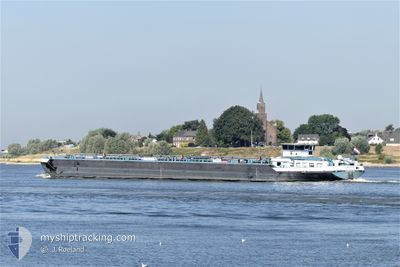
UNITY
Cargo
Current Trip
KARLSRUHE MIRO
| Time Travelled | 5 days |
|---|---|
| Remaining Time | --- |
| Distance Travelled | 201.36 nm |
| Remaining Distance | --- |
| AVG Speed | 10.6 Knots |
| MAX Speed | 12.2 Knots |
| AVG Wind | 1.8 knots |
| MAX Wind | 5.8 knots |
| MIN Temp | 6.1°C / 42.98°F |
| MAX Temp | 16.3°C / 61.34°F |
| Dybgang | 2.6 m |
| Position Modtaget | 2 d siden |
Current Position
| Longitude | --- |
|---|---|
| Latitude | --- |
| Status | Under way using engine |
| Fart | 9.5 Knots |
| Kurs | 353.7° |
| Område | North Sea |
| Station | T-AIS |
| Position Modtaget | 2 d siden |
Info
Information
The current position of UNITY is in North Sea with coordinates 51.43912° / 6.71165° as reported on 2026-03-07 10:34 by AIS to our vessel tracker app. The vessel's current speed is 9.5 Knots
The vessel UNITY (MMSI: 244660836) is a Cargo It's sailing under the flag of [NL] Netherlands.
In this page you can find informations about the vessels current position, last detected port calls, and current voyage information. If the vessels is not in coverage by AIS you will find the latest position.
The current position of UNITY is detected by our AIS receivers and we are not responsible for the reliability of the data. The last position was recorded while the vessel was in Coverage by the Ais receivers of our vessel tracking app.
The current draught of UNITY as reported by AIS is 2.6 meters
Weather
| Temperature | 11.9°C / 53.42°F |
|---|---|
| Wind Speed | 4 knots |
| Direction | 202° SSW |
| Pressure | 1017.5 hPa |
| Humidity | 68 % |
| Cloud Coverage | 40 % |
Featured Company
Last Port Calls
| Port | Arrival | Departure | Time In Port |
|---|---|---|---|
| 2026-03-04 10:31 | 2026-03-05 02:13 | 15 h | |
| 2026-03-03 15:41 | |||
| 2026-03-02 15:31 | 2026-03-03 15:28 | 23 h | |
| 2026-02-28 09:47 | 2026-03-01 10:28 | 1 d | |
| 2026-02-26 19:13 | 2026-02-27 16:16 | 21 h | |
| 2026-02-19 16:35 | |||
| 2026-02-15 19:55 | 2026-02-16 21:25 | 1 d | |
| 2026-02-15 02:48 | 2026-02-15 19:34 | 16 h | |
| 2026-02-14 05:07 | 2026-02-14 05:55 | 47 m | |
| 2026-02-12 17:40 | 2026-02-13 17:08 | 23 h |
Last Trips
| Origin | Departure | Destination | Arrival | Distance | |
|---|---|---|---|---|---|
| 2026-03-03 15:28 | 2026-03-03 15:41 | 0.83 nm | |||
| 2026-03-01 10:28 | 2026-03-02 15:31 | 98.11 nm | |||
| 2026-02-27 16:16 | 2026-02-28 09:47 | 99.08 nm | |||
| 2026-02-19 16:35 | 2026-02-26 19:13 | 351.53 nm | |||
| 2026-02-15 19:34 | 2026-02-15 19:55 | 1.67 nm | |||
| 2026-02-14 05:55 | 2026-02-15 02:48 | 100.54 nm | |||
| 2026-02-13 17:08 | 2026-02-14 05:07 | 75.70 nm | |||
| 2026-02-12 16:31 | 2026-02-12 17:40 | 8.51 nm | |||
| 2026-02-12 01:36 | 2026-02-12 02:04 | 0.44 nm | |||
| 2026-02-10 12:56 | 2026-02-11 15:35 | 275.51 nm |
Events
| Tid | Hændelsen | Detaljer | Position / Dest | Info |
|---|---|---|---|---|
| 2026-03-07 10:34 | Udenfor Dækning |
51.43912 / 6.71165
North Sea
|
Fart: 9.5 kn Kurs: 353.7° |
|
| 2026-03-07 02:41 | Indenfor Dækning |
50.51710 / 7.29855
North Sea
|
Fart: 10.5 kn Kurs: 340.1° |
|
| 2026-03-06 21:14 | Udenfor Dækning |
49.99628 / 8.02157
North Sea
|
Fart: 8.6 kn Kurs: 228.7° |
|
| 2026-03-06 21:05 | Indenfor Dækning |
50.00735 / 8.04255
North Sea
|
Fart: 9.2 kn Kurs: 241.8° |
|
| 2026-03-06 19:37 | Udenfor Dækning |
49.95952 / 8.33702
North Sea
|
Fart: 9.9 kn Kurs: 335.3° |
|
| 2026-03-06 18:35 | Indenfor Dækning |
49.82237 / 8.37963
North Sea
|
Fart: 9.1 kn Kurs: 336.6° |
|
| 2026-03-06 15:28 | Udenfor Dækning |
49.44337 / 8.45505
North Sea
|
Fart: 9.2 kn Kurs: 282.5° |
|
| 2026-03-06 14:51 | Indenfor Dækning |
49.37887 / 8.50065
North Sea
|
Fart: 9.9 kn Kurs: 2.7° |
|
| 2026-03-06 13:20 | Udenfor Dækning |
49.19602 / 8.38400
North Sea
|
Fart: 9.8 kn Kurs: 7.6° |
|
| 2026-03-06 12:41 | Indenfor Dækning |
49.09133 / 8.35318
North Sea
|
Fart: 10.1 kn Kurs: 39.4° |