
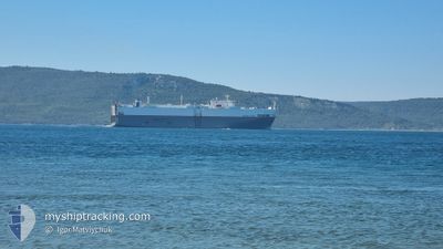
UNITED SPIRIT
Vehicles Carrier
Current Trip
| Time Travelled | 4 days |
|---|---|
| Remaining Time | 2 days |
| Distance Travelled | 1614.45 nm |
| Remaining Distance | 1027.42 nm |
| AVG Speed | 15.9 Knots |
| MAX Speed | 18.4 Knots |
| AVG Wind | 9.2 knots |
| MAX Wind | 28.8 knots |
| MIN Temp | 15.2°C / 59.36°F |
| MAX Temp | 20.9°C / 69.62°F |
| Dybgang | 6.5 m |
| Position Modtaget | 7 h, 39 m siden |
Current Position
| Longitude | --- |
|---|---|
| Latitude | --- |
| Status | Under way using engine |
| Fart | 15.9 Knots |
| Kurs | 24.1° |
| Område | North Atlantic Ocean |
| Station | T-AIS |
| Position Modtaget | 7 h, 39 m siden |
Info
Information
The current position of UNITED SPIRIT is in North Atlantic Ocean with coordinates 43.86702° / -9.31196° as reported on 2024-11-08 06:53 by AIS to our vessel tracker app. The vessel's current speed is 15.9 Knots and is heading at the port of TYNE. The estimated time of arrival as calculated by MyShipTracking vessel tracking app is 2024-11-10 21:00 LT
The vessel UNITED SPIRIT (IMO: 9185047, MMSI: 636011280) is a Vehicles Carrier that was built in 2000 ( 24 år gamle ). It's sailing under the flag of [LR] Liberia.
In this page you can find informations about the vessels current position, last detected port calls, and current voyage information. If the vessels is not in coverage by AIS you will find the latest position.
The current position of UNITED SPIRIT is detected by our AIS receivers and we are not responsible for the reliability of the data. The last position was recorded while the vessel was in Coverage by the Ais receivers of our vessel tracking app.
The current draught of UNITED SPIRIT as reported by AIS is 6.5 meters
Weather
| Temperature | 17.1°C / 62.78°F |
|---|---|
| Wind Speed | 9 knots |
| Direction | 201° SSW |
| Pressure | 1016.1 hPa |
| Humidity | 85.8 % |
| Cloud Coverage | 100 % |
Featured Company
Last Port Calls
| Port | Arrival | Departure | Time In Port |
|---|---|---|---|
| 2024-11-03 07:25 | 2024-11-04 08:49 | 1 d | |
| 2024-10-29 20:41 | 2024-10-30 16:11 | 19 h | |
| 2024-10-25 22:56 | 2024-10-26 20:29 | 21 h | |
| 2024-10-24 18:30 | 2024-10-24 19:21 | 50 m | |
| 2024-10-23 21:48 | 2024-10-24 17:29 | 19 h | |
| 2024-10-21 07:56 | 2024-10-22 20:32 | 1 d | |
| 2024-10-18 11:33 | 2024-10-19 01:58 | 14 h | |
| 2024-10-09 00:39 | 2024-10-09 17:44 | 17 h | |
| 2024-10-07 07:48 | 2024-10-07 14:55 | 7 h | |
| 2024-10-03 11:22 | 2024-10-04 09:23 | 22 h |
Last Trips
| Origin | Departure | Destination | Arrival | Distance | |
|---|---|---|---|---|---|
| 2024-10-30 16:11 | 2024-11-03 07:25 | 1213.57 nm | |||
| 2024-10-26 20:29 | 2024-10-29 20:41 | 1118.19 nm | |||
| 2024-10-24 19:21 | 2024-10-25 22:56 | 173.04 nm | |||
| 2024-10-24 17:29 | 2024-10-24 18:30 | 4.79 nm | |||
| 2024-10-22 20:32 | 2024-10-23 21:48 | 293.90 nm | |||
| 2024-10-19 01:58 | 2024-10-21 07:56 | 433.22 nm | |||
| 2024-10-09 17:44 | 2024-10-18 11:33 | 3230.16 nm | |||
| 2024-10-07 14:55 | 2024-10-09 00:39 | 416.02 nm | |||
| 2024-10-04 09:23 | 2024-10-07 07:48 | 966.91 nm | |||
| 2024-09-23 06:22 | 2024-10-03 11:22 | 2590.78 nm |
Events
| Tid | Hændelsen | Detaljer | Position / Dest | Info |
|---|---|---|---|---|
| 2024-11-08 06:56 | Status er ændret | Default Under way using engine |
43.88125 / -9.30350
GBTYN
|
Fart: 15.9 kn Kurs: 24.1° |
| 2024-11-08 06:53 | Status er ændret | Under way using engine Default |
43.86702 / -9.31196
GBTYN
|
Fart: 15.9 kn Kurs: 22° |
| 2024-11-08 06:53 | Udenfor Dækning |
43.86702 / -9.31196
North Atlantic Ocean
GBTYN
|
Fart: 15.9 kn Kurs: 24.1° |
|
| 2024-11-08 06:37 | Indenfor Dækning |
43.86702 / -9.31196
North Atlantic Ocean
GBTYN
|
Fart: 15.9 kn Kurs: 24.1° |
|
| 2024-11-08 04:54 | Status er ændret | Default Under way using engine |
43.40973 / -9.65865
GBTYN
|
Fart: 16 kn Kurs: 29.2° |
| 2024-11-08 04:52 | Ændre havområde | Spanish part of the North Atlantic Ocean Portuguese part of the North Atlantic Ocean |
43.39926 / -9.66672
North Atlantic Ocean
GBTYN
|
Fart: 16 kn Kurs: 29.2° |
| 2024-11-08 04:52 | Udenfor Dækning |
43.39926 / -9.66672
North Atlantic Ocean
GBTYN
|
Fart: 16 kn Kurs: 29.2° |
|
| 2024-11-08 04:50 | Status er ændret | Under way using engine Default |
43.39464 / -9.67029
GBTYN
|
Fart: 16 kn Kurs: 28° |
| 2024-11-08 04:50 | Indenfor Dækning |
43.39926 / -9.66672
North Atlantic Ocean
GBTYN
|
Fart: 16 kn Kurs: 29.2° |
|
| 2024-11-07 20:53 | Udenfor Dækning |
41.35397 / -9.81533
North Atlantic Ocean
GBTYN
|
Fart: 15.6 kn Kurs: 1.9° |