
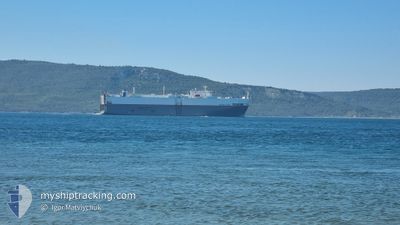
UNITED SPIRIT
Vehicles Carrier
Current Trip
| Time Travelled | 22 h, 27 mins |
|---|---|
| Remaining Time | 3 days |
| Distance Travelled | 349.04 nm |
| Remaining Distance | 1511.55 nm |
| AVG Speed | 15.5 Noeuds |
| MAX Speed | 17 Noeuds |
| AVG Wind | 14.4 knots |
| MAX Wind | 23.6 knots |
| MIN Temp | 11.5°C / 52.7°F |
| MAX Temp | 16.6°C / 61.88°F |
| Tirant d eau | 6.5 m |
| Position reçue | 2 m depuis |
Current Position
| Longitude | -2.10572° |
|---|---|
| Latitude | 36.48669° |
| Etat | Under way using engine |
| Vitesse | 16.4 Noeuds |
| Parcours | 230.8° |
| Zone | Mediterranean Sea - Western Basin |
| Station | T-AIS |
| Position reçue | 2 m depuis |
Info
Information
The current position of UNITED SPIRIT is in Mediterranean Sea - Western Basin with coordinates 36.48669° / -2.10572° as reported on 2024-04-23 18:20 by AIS to our vessel tracker app. The vessel's current speed is 16.4 Noeuds and is heading at the port of ZEEBRUGGE. The estimated time of arrival as calculated by MyShipTracking vessel tracking app is 2024-04-27 15:32 LT
The vessel UNITED SPIRIT (IMO: 9185047, MMSI: 636011280) is a Vehicles Carrier that was built in 2000 ( 24 Age ). It's sailing under the flag of [LR] Liberia.
In this page you can find informations about the vessels current position, last detected port calls, and current voyage information. If the vessels is not in coverage by AIS you will find the latest position.
The current position of UNITED SPIRIT is detected by our AIS receivers and we are not responsible for the reliability of the data. The last position was recorded while the vessel was in Coverage by the Ais receivers of our vessel tracking app.
The current draught of UNITED SPIRIT as reported by AIS is 6.5 meters
Weather
| Temperature | 16.2°C / 61.16°F |
|---|---|
| Wind Speed | 8 knots |
| Direction | 100° E |
| Pressure | 1014.9 hPa |
| Humidity | 71.2 % |
| Cloud Coverage | --- |
Featured Company
Last Port Calls
| Port | Arrival | Departure | Time In Port |
|---|---|---|---|
| 2024-04-21 12:53 | 2024-04-22 19:55 | 1 d | |
| 2024-04-16 01:11 | 2024-04-16 17:06 | 15 h | |
| 2024-04-03 06:00 | 2024-04-04 05:07 | 23 h | |
| 2024-04-01 08:42 | 2024-04-01 19:08 | 10 h | |
| 2024-03-30 14:15 | 2024-03-31 12:19 | 22 h | |
| 2024-03-26 10:45 | 2024-03-28 14:56 | 2 d | |
| 2024-03-24 15:50 | 2024-03-25 16:44 | 1 d | |
| 2024-03-24 14:07 | 2024-03-24 14:56 | 48 m | |
| 2024-03-21 12:47 | 2024-03-23 18:10 | 2 d | |
| 2024-03-18 04:08 | 2024-03-18 13:14 | 9 h |
Last Trips
| Origin | Departure | Destination | Arrival | Distance | |
|---|---|---|---|---|---|
| 2024-04-16 20:06 | 2024-04-21 14:53 | 1544.00 nm | |||
| 2024-04-04 06:07 | 2024-04-16 04:11 | 3463.33 nm | |||
| 2024-04-01 21:08 | 2024-04-03 07:00 | 520.19 nm | |||
| 2024-03-31 14:19 | 2024-04-01 10:42 | 276.90 nm | |||
| 2024-03-28 15:56 | 2024-03-30 15:15 | 697.09 nm | |||
| 2024-03-25 17:44 | 2024-03-26 11:45 | 153.64 nm | |||
| 2024-03-24 15:56 | 2024-03-24 16:50 | 6.32 nm | |||
| 2024-03-23 18:10 | 2024-03-24 15:07 | 286.67 nm | |||
| 2024-03-18 13:14 | 2024-03-21 12:47 | 373.47 nm | |||
| 2024-03-12 21:07 | 2024-03-18 04:08 | 1865.74 nm |
Events
| Heure | Evenement | Détails | Position/ Destination | Info |
|---|---|---|---|---|
| 2024-04-23 16:52 | Etat Changé | Under way using engine Default |
36.72086 / -1.76298
BEZEE
|
Vitesse: 16.4 kn Parcours: 226° |
| 2024-04-23 16:52 | Dans la zone couverte |
36.72086 / -1.76298
Mediterranean Sea - Western Basin
BEZEE
|
Vitesse: 16.7 kn Parcours: 223.9° |
|
| 2024-04-23 16:52 | Tirant d'eau modifié | 6.5 6 |
36.72086 / -1.76298
BEZEE
|
Vitesse: 16.7 kn Parcours: 223.9° |
| 2024-04-23 16:52 | Changement d'ETA | 2024/04/27 21:00 |
36.72086 / -1.76298
BEZEE
|
Vitesse: 16.7 kn Parcours: 223.9° |
| 2024-04-23 14:30 | Etat Changé | Default Under way using engine |
37.14476 / -1.17259
BEZEE
|
Vitesse: 15.9 kn Parcours: 229° |
| 2024-04-23 14:23 | Hors de la zone couverte |
37.16490 / -1.14271
Mediterranean Sea - Western Basin
|
Vitesse: 15.9 kn Parcours: 229° |
|
| 2024-04-23 14:09 | Etat Changé | Under way using engine Default |
37.20659 / -1.08110
BEZEE
|
Vitesse: 16.3 kn Parcours: 230° |
| 2024-04-23 13:46 | Etat Changé | Default Under way using engine |
37.27318 / -.98414
BEZEE
|
Vitesse: 15.9 kn Parcours: 228° |
| 2024-04-23 13:29 | Tirant d'eau modifié | 6 6.5 |
37.32965 / -.90502
BEZEE
|
Vitesse: 15.9 kn Parcours: 223° |
| 2024-04-23 13:11 | Tirant d'eau modifié | 6.5 6 |
37.37910 / -.83231
BEZEE
|
Vitesse: 15.9 kn Parcours: 229° |