
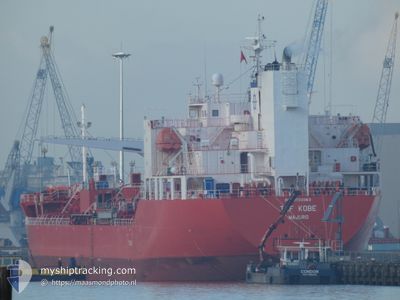
TRF KOBE
Tanker
Current Trip
| Time Travelled | 12 days |
|---|---|
| Remaining Time | --- |
| Distance Travelled | 2502.81 nm |
| Remaining Distance | --- |
| AVG Speed | 12.4 Knots |
| MAX Speed | 15.3 Knots |
| AVG Wind | 6.1 knots |
| MAX Wind | 13 knots |
| MIN Temp | 26.4°C / 79.52°F |
| MAX Temp | 31.7°C / 89.06°F |
| Dybgang | 9.1 m |
| Position Modtaget | 6 d siden |
Current Position
| Longitude | 76.91131° |
|---|---|
| Latitude | 7.81604° |
| Status | Under way using engine |
| Fart | 13.6 Knots |
| Kurs | 322.4° |
| Område | Laccadive Sea |
| Station | T-AIS |
| Position Modtaget | 6 d siden |
Info
Information
The current position of TRF KOBE is in Laccadive Sea with coordinates 7.81604° / 76.91131° as reported on 2024-04-29 14:43 by AIS to our vessel tracker app. The vessel's current speed is 13.6 Knots
The vessel TRF KOBE (IMO: 9733363, MMSI: 538006856) is a Tanker It's sailing under the flag of [MH] Marshall Is.
In this page you can find informations about the vessels current position, last detected port calls, and current voyage information. If the vessels is not in coverage by AIS you will find the latest position.
The current position of TRF KOBE is detected by our AIS receivers and we are not responsible for the reliability of the data. The last position was recorded while the vessel was in Coverage by the Ais receivers of our vessel tracking app.
The current draught of TRF KOBE as reported by AIS is 9.1 meters
Weather
| Temperature | 31.8°C / 89.24°F |
|---|---|
| Wind Speed | 9 knots |
| Direction | 278° W |
| Pressure | 1009.2 hPa |
| Humidity | 55.9 % |
| Cloud Coverage | 2 % |
Featured Company
Last Port Calls
| Port | Arrival | Departure | Time In Port |
|---|---|---|---|
| 2024-04-22 07:55 | 2024-04-24 01:41 | 1 d | |
| 2024-04-20 09:06 | 2024-04-22 07:34 | 1 d | |
| 2024-04-11 09:15 | 2024-04-13 12:09 | 2 d | |
| 2024-03-04 11:08 | 2024-03-05 10:59 | 23 h |
Most Visited Ports (Last year)
| Port | Arrivals | |
|---|---|---|
| 5 | ||
| 4 | ||
| 4 | ||
| 2 | ||
| 2 | ||
| 1 |
Last Trips
| Origin | Departure | Destination | Arrival | Distance | |
|---|---|---|---|---|---|
| 2024-04-22 15:34 | 2024-04-22 15:55 | 0.82 nm | |||
| 2024-04-13 20:09 | 2024-04-20 17:06 | 1090.63 nm | |||
| 2024-03-05 10:59 | 2024-04-11 17:15 | 10191.87 nm | |||
| 2024-02-27 00:26 | 2024-03-04 11:08 | 1797.21 nm |
Events
| Tid | Hændelsen | Detaljer | Position / Dest | Info |
|---|---|---|---|---|
| 2024-05-04 04:02 | START Sejllads | 5.09 nm, South of MUMBAI |
18.90124 / 72.85541
IN BOM
|
Fart: 3.6 kn Kurs: 57° |
| 2024-05-02 04:40 | STOP Sejllads | 5.28 nm, South of MUMBAI |
18.89878 / 72.85143
IN BOM
|
Fart: 0.2 kn Kurs: 64° |
| 2024-04-29 14:49 | Status er ændret | Default Under way using engine |
7.83338 / 76.89576
IN BOM
|
Fart: 13.6 kn Kurs: 322.4° |
| 2024-04-29 14:43 | Udenfor Dækning |
7.81604 / 76.91131
Laccadive Sea
IN BOM
|
Fart: 13.6 kn Kurs: 322.4° |
|
| 2024-04-29 14:25 | Status er ændret | Under way using engine Default |
7.76358 / 76.94886
IN BOM
|
Fart: 13 kn Kurs: 283° |
| 2024-04-29 14:03 | Status er ændret | Default Under way using engine |
7.72283 / 77.01666
IN BOM
|
Fart: 13.4 kn Kurs: 324.2° |
| 2024-04-29 13:38 | Fundet i havområde | Indian part of the Laccadive Sea |
7.65522 / 77.07853
Laccadive Sea
IN BOM
|
Fart: 13.3 kn Kurs: 323.3° |
| 2024-04-29 13:38 | Status er ændret | Under way using engine Default |
7.65522 / 77.07853
IN BOM
|
Fart: 13.1 kn Kurs: 314° |
| 2024-04-29 13:38 | Indenfor Dækning |
7.65522 / 77.07853
Laccadive Sea
IN BOM
|
Fart: 13.3 kn Kurs: 323.3° |