
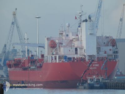
TRF KOBE
Tanker
Current Trip
| Time Travelled | 10 h, 39 mins |
|---|---|
| Remaining Time | --- |
| Distance Travelled | 121.37 nm |
| Remaining Distance | --- |
| AVG Speed | 10.4 Knots |
| MAX Speed | 13.9 Knots |
| AVG Wind | 6.3 knots |
| MAX Wind | 10 knots |
| MIN Temp | 28.8°C / 83.84°F |
| MAX Temp | 30.3°C / 86.54°F |
| Draught | 9.1 m |
| Position Received | 9 h, 3 m ago |
Current Position
| Longitude | 103.53342° |
|---|---|
| Latitude | 1.20659° |
| Status | Under way using engine |
| Speed | 11.7 Knots |
| Course | 283.9° |
| Area | Singapore Strait |
| Station | T-AIS |
| Position Received | 9 h, 3 m ago |
Info
Information
The current position of TRF KOBE is in Singapore Strait with coordinates 1.20659° / 103.53342° as reported on 2024-04-24 03:17 by AIS to our vessel tracker app. The vessel's current speed is 11.7 Knots and is heading at the port of MUMBAI. The estimated time of arrival as calculated by MyShipTracking vessel tracking app is 2024-05-02 12:00 LT
The vessel TRF KOBE (IMO: 9733363, MMSI: 538006856) is a Tanker It's sailing under the flag of [MH] Marshall Is.
In this page you can find informations about the vessels current position, last detected port calls, and current voyage information. If the vessels is not in coverage by AIS you will find the latest position.
The current position of TRF KOBE is detected by our AIS receivers and we are not responsible for the reliability of the data. The last position was recorded while the vessel was in Coverage by the Ais receivers of our vessel tracking app.
The current draught of TRF KOBE as reported by AIS is 9.1 meters
Weather
| Temperature | 29.3°C / 84.74°F |
|---|---|
| Wind Speed | 10 knots |
| Direction | 130° SE |
| Pressure | 1006.4 hPa |
| Humidity | 78.8 % |
| Cloud Coverage | 66 % |
Featured Company
Last Port Calls
| Port | Arrival | Departure | Time In Port |
|---|---|---|---|
| 2024-04-22 07:55 | 2024-04-24 01:41 | 1 d | |
| 2024-04-20 09:06 | 2024-04-22 07:34 | 1 d | |
| 2024-04-11 09:15 | 2024-04-13 12:09 | 2 d | |
| 2024-03-04 11:08 | 2024-03-05 10:59 | 23 h | |
| 2024-02-24 20:08 | 2024-02-26 23:26 | 2 d | |
| 2024-02-24 08:05 | 2024-02-24 16:47 | 8 h | |
| 2024-02-21 00:39 | 2024-02-24 06:14 | 3 d | |
| 2024-02-18 11:21 | 2024-02-19 14:40 | 1 d | |
| 2024-02-14 07:46 | 2024-02-17 10:36 | 3 d | |
| 2024-02-10 11:00 | 2024-02-11 08:13 | 21 h |
Most Visited Ports (Last year)
| Port | Arrivals | |
|---|---|---|
| 5 | ||
| 5 | ||
| 4 | ||
| 2 | ||
| 2 | ||
| 2 |
Last Trips
| Origin | Departure | Destination | Arrival | Distance | |
|---|---|---|---|---|---|
| 2024-04-22 15:34 | 2024-04-22 15:55 | 0.82 nm | |||
| 2024-04-13 20:09 | 2024-04-20 17:06 | 1090.63 nm | |||
| 2024-03-05 10:59 | 2024-04-11 17:15 | 10191.87 nm | |||
| 2024-02-27 00:26 | 2024-03-04 11:08 | 1797.21 nm | |||
| 2024-02-24 17:47 | 2024-02-24 21:08 | 26.08 nm | |||
| 2024-02-24 07:14 | 2024-02-24 09:05 | 21.72 nm | |||
| 2024-02-19 15:40 | 2024-02-21 01:39 | 372.83 nm | |||
| 2024-02-17 11:36 | 2024-02-18 12:21 | 243.26 nm | |||
| 2024-02-11 09:13 | 2024-02-14 08:46 | 776.45 nm | |||
| 2024-01-17 12:14 | 2024-02-10 12:00 | 6391.35 nm |
Events
| Time | Event | Details | Position / Dest | Info |
|---|---|---|---|---|
| 2024-04-24 03:24 | Status Changed | Default Under way using engine |
1.21212 / 103.51116
IN BOM
|
Speed: 11.7 kn Course: 283.9° |
| 2024-04-24 03:17 | OUT of Coverage |
1.20659 / 103.53342
Singapore Strait
IN BOM
|
Speed: 11.7 kn Course: 283.9° |
|
| 2024-04-24 03:13 | Status Changed | Under way using engine Default |
1.20302 / 103.54761
IN BOM
|
Speed: 11.7 kn Course: 283° |
| 2024-04-24 03:08 | Status Changed | Default Under way using engine |
1.19935 / 103.56200
IN BOM
|
Speed: 11.8 kn Course: 284° |
| 2024-04-24 03:02 | Change Sea Area | Malaysian part of the Singapore Strait Indonesian part of the Singapore Strait |
1.19391 / 103.58313
Singapore Strait
IN BOM
|
Speed: 11.9 kn Course: 281.6° |
| 2024-04-24 02:40 | Change Sea Area | Indonesian part of the Singapore Strait Singaporean part of the Singapore Strait |
1.19760 / 103.64647
Singapore Strait
IN BOM
|
Speed: 6.2 kn Course: 242.8° |
| 2024-04-24 01:41 | PORT DEPARTURE |
|
1.29509 / 103.68540
IN BOM
|
Speed: 3.1 kn Course: 235° |
| 2024-04-24 01:41 | START Moving |
1.29518 / 103.68552
[SG] SINGAPORE
|
Speed: 3.1 kn Course: 235° |
|
| 2024-04-24 01:35 | Draught Changed | 9.1 6.4 |
1.29681 / 103.68750
[SG] SINGAPORE
|
Speed: 0.3 kn Course: 245° |
| 2024-04-24 01:35 | Destination Changed | IN BOM PGPG SG SIN |
1.29681 / 103.68750
[SG] SINGAPORE
|
Speed: 0.3 kn Course: 245° |