

TRANSUND
General Cargo

Current Trip
| Trip Time | 12 h, 8 mins |
|---|---|
| Trip Distance | 100.41 nm |
| AVG Speed | 8.3 Knots |
| MAX Speed | 10.8 Knots |
| Dybgang | 6.3 m |
| AVG Wind | 17.2 knots |
| MAX Wind | 23.3 knots |
| MIN Temp | -3.6°C / 25.52°F |
| MAX Temp | 1.7°C / 35.06°F |
| Position Modtaget | 7 d siden |
Current Position
| Longitude | --- |
|---|---|
| Latitude | --- |
| Status | Under way using engine |
| Fart | 9.2 Knots |
| Kurs | 123.7° |
| Område | Gulf of Bothnia |
| Station | T-AIS |
| Position Modtaget | 7 d siden |
Information
The current position of TRANSUND is in Gulf of Bothnia with coordinates 65.48797° / 22.42328° as reported on 2025-03-20 12:42 by AIS to our vessel tracker app. The vessel's current speed is 9.2 Knots and is currently inside the port of HARAHOLMEN.
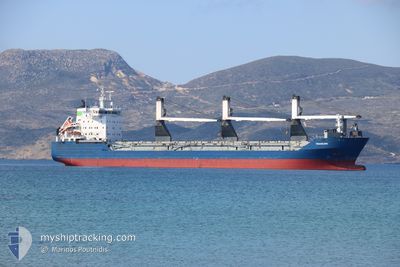
The vessel TRANSUND (IMO: 9213088, MMSI: 636022504) is a General Cargo that was built in 2002 ( 23 år gamle ). It's sailing under the flag of [LR] Liberia.
In this page you can find informations about the vessels current position, last detected port calls, and current voyage information. If the vessels is not in coverage by AIS you will find the latest position.
The current position of TRANSUND is detected by our AIS receivers and we are not responsible for the reliability of the data. The last position was recorded while the vessel was in Coverage by the Ais receivers of our vessel tracking app.
The current draught of TRANSUND as reported by AIS is 6.3 meters
Weather
| Temperature | 3.7°C / 38.66°F |
|---|---|
| Wind Speed | 15 knots |
| Direction | 249° WSW |
| Pressure | 996.8 hPa |
| Humidity | 78.4 % |
| Cloud Coverage | 97 % |


Featured Company
Last Port Calls
| Port | Arrival | Departure | Time In Port |
|---|---|---|---|
| 2025-03-22 08:42 | |||
| 2025-03-21 01:46 | 2025-03-21 21:34 | 19 h | |
| 2025-03-17 04:48 | 2025-03-20 13:11 | 3 d | |
| 2025-02-25 07:58 | 2025-02-28 18:54 | 3 d | |
| 2025-02-16 15:53 | 2025-02-23 09:47 | 6 d | |
| 2025-01-19 03:49 | 2025-01-24 16:08 | 5 d | |
| 2025-01-13 20:27 | 2025-01-17 00:56 | 3 d |
Most Visited Ports (Last year)
| Port | Arrivals | |
|---|---|---|
| 6 | ||
| 6 | ||
| 6 | ||
| 3 | ||
| 2 | ||
| 2 |
Last Trips
| Origin | Departure | Destination | Arrival | Distance | |
|---|---|---|---|---|---|
| 2025-03-21 21:34 | 2025-03-22 08:42 | 100.41 nm | |||
| 2025-03-20 13:11 | 2025-03-21 01:46 | 127.44 nm | |||
| 2025-02-28 18:54 | 2025-03-17 04:48 | 4396.88 nm | |||
| 2025-02-23 09:47 | 2025-02-25 07:58 | 450.77 nm | |||
| 2025-01-24 16:08 | 2025-02-16 15:53 | 4806.51 nm | |||
| 2025-01-17 00:56 | 2025-01-19 03:49 | 118.30 nm | |||
| 2024-12-26 09:00 | 2025-01-13 20:27 | 4424.34 nm |
Events
| Tid | Hændelsen | Detaljer | Position / Dest | Info |
|---|---|---|---|---|
| 2025-03-22 07:54 | STOP Sejllads |
65.23455 / 21.62793
[SE] HARAHOLMEN
|
Fart: Kurs: 330° |
|
| 2025-03-22 07:42 | Skibe i havn |
|
65.23287 / 21.62971
[SE] HARAHOLMEN
|
Fart: 1.3 kn Kurs: 323° |
| 2025-03-21 19:34 | Afsejlet fra sidste havn |
|
63.72267 / 22.66928
FI PRS
|
Fart: 5.5 kn Kurs: 308° |
| 2025-03-21 19:30 | START Sejllads |
63.71984 / 22.68530
[FI] PIETARSAARI
|
Fart: 5.5 kn Kurs: 308° |
|
| 2025-03-21 00:10 | STOP Sejllads |
63.71522 / 22.69085
[FI] PIETARSAARI
|
Fart: 0.3 kn Kurs: 350° |
|
| 2025-03-20 23:46 | Skibe i havn |
|
63.71795 / 22.68770
[FI] PIETARSAARI
|
Fart: 2.9 kn Kurs: 147° |
| 2025-03-20 12:50 | Status er ændret | Default Under way using engine |
65.47920 / 22.44756
FI PRS
|
Fart: 9.2 kn Kurs: 123.7° |
| 2025-03-20 12:42 | Udenfor Dækning |
65.48797 / 22.42328
Gulf of Bothnia
FI PRS
|
Fart: 9.2 kn Kurs: 123.7° |
|
| 2025-03-20 12:16 | ETA er ændret | 2025/03/21 00:30 2025/03/21 23:00 |
65.53535 / 22.31693
FI PRS
|
Fart: 8.6 kn Kurs: 127.7° |
| 2025-03-20 12:11 | Afsejlet fra sidste havn |
|
65.54230 / 22.29304
FI PRS
|
Fart: 8 kn Kurs: 114° |