
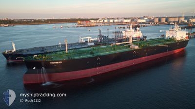
THORNBURY
Tanker A
Current Trip
| Time Travelled | 4 days |
|---|---|
| Remaining Time | --- |
| Distance Travelled | 496.95 nm |
| Remaining Distance | --- |
| AVG Speed | 9.3 Knots |
| MAX Speed | 12.6 Knots |
| AVG Wind | 21.5 knots |
| MAX Wind | 27.7 knots |
| MIN Temp | 3.9°C / 39.02°F |
| MAX Temp | 7.2°C / 44.96°F |
| Dybgang | 13.4 m |
| Position Modtaget | 4 m siden |
Current Position
| Longitude | --- |
|---|---|
| Latitude | --- |
| Status | Moored |
| Fart | |
| Kurs | 23° |
| Område | Kattegat |
| Station | T-AIS |
| Position Modtaget | 4 m siden |
Info
Information
The current position of THORNBURY is in Kattegat with coordinates 57.68201° / 11.78800° as reported on 2025-03-05 11:43 by AIS to our vessel tracker app. The vessel's current speed is 0 Knots
The vessel THORNBURY (IMO: 9910533, MMSI: 311001025) is a Tanker A It's sailing under the flag of [BS] Bahamas.
In this page you can find informations about the vessels current position, last detected port calls, and current voyage information. If the vessels is not in coverage by AIS you will find the latest position.
The current position of THORNBURY is detected by our AIS receivers and we are not responsible for the reliability of the data. The last position was recorded while the vessel was in Coverage by the Ais receivers of our vessel tracking app.
The current draught of THORNBURY as reported by AIS is 13.4 meters
Weather
| Temperature | 5.1°C / 41.18°F |
|---|---|
| Wind Speed | 21 knots |
| Direction | 241° WSW |
| Pressure | 1007.3 hPa |
| Humidity | 91.6 % |
| Cloud Coverage | 100 % |
Featured Company
Last Trips
| Origin | Departure | Destination | Arrival | Distance | |
|---|---|---|---|---|---|
| 2025-02-15 13:27 | 2025-02-27 09:00 | 299.03 nm | |||
| 2025-02-08 11:10 | 2025-02-14 08:43 | 241.01 nm | |||
| 2025-01-30 10:34 | 2025-02-07 08:40 | 645.44 nm | |||
| 2025-01-03 11:53 | 2025-01-29 13:26 | 1126.09 nm | |||
| 2024-12-29 09:51 | 2025-01-02 09:18 | 951.25 nm |
Events
| Tid | Hændelsen | Detaljer | Position / Dest | Info |
|---|---|---|---|---|
| 2025-03-05 09:16 | Status er ændret | Moored Default |
57.68204 / 11.78801
GBTEE>SEGOT
|
Fart: Kurs: 23° |
| 2025-03-05 09:13 | Status er ændret | Default Moored |
57.68202 / 11.78799
GBTEE>SEGOT
|
Fart: Kurs: 23° |
| 2025-03-04 19:04 | Status er ændret | Moored Default |
57.68202 / 11.78801
GBTEE>SEGOT
|
Fart: Kurs: 23° |
| 2025-03-04 19:01 | Status er ændret | Default Moored |
57.68202 / 11.78801
GBTEE>SEGOT
|
Fart: Kurs: 23° |
| 2025-03-04 14:55 | Status er ændret | Moored Under way using engine |
57.68202 / 11.78803
GBTEE>SEGOT
|
Fart: Kurs: 23° |
| 2025-03-04 14:41 | STOP Sejllads | 0.79 nm, South East of KROSSHOLMEN |
57.68196 / 11.78760
GBTEE>SEGOT
|
Fart: 0.3 kn Kurs: 29° |
| 2025-03-04 12:53 | START Sejllads | 5.42 nm, West of VRANGO |
57.56856 / 11.61027
GBTEE>SEGOT
|
Fart: 3.1 kn Kurs: 52° |
| 2025-03-04 11:58 | Status er ændret | Under way using engine At anchor |
57.55007 / 11.58455
GBTEE>SEGOT
|
Fart: 0.1 kn Kurs: 302° |
| 2025-03-04 08:28 | Dybgangen er ændret | 13.4 13.3 |
57.54892 / 11.58427
GBTEE>SEGOT
|
Fart: Kurs: 294° |
| 2025-03-02 19:10 | Status er ændret | At anchor Default |
57.54770 / 11.57969
GBTEE>SEGOT
|
Fart: Kurs: 333° |