
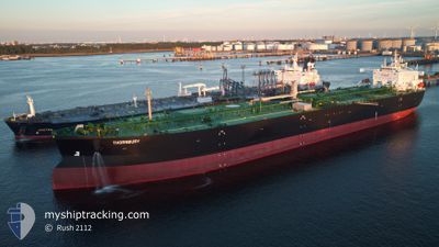
THORNBURY
Tanker A
Current Trip
NOSTU>GBTTL
| Time Travelled | 4 days |
|---|---|
| Remaining Time | --- |
| Distance Travelled | 478.38 nm |
| Remaining Distance | --- |
| AVG Speed | 10.4 Knop |
| MAX Speed | 12.2 Knop |
| AVG Wind | 18.7 knots |
| MAX Wind | 30 knots |
| MIN Temp | 3.6°C / 38.48°F |
| MAX Temp | 7.7°C / 45.86°F |
| Djupgående | 13.2 m |
| Position mottagen | 4 h, 49 m sen |
Current Position
| Longitud | 0.39609° |
|---|---|
| Latitude | 53.75220° |
| Status | At anchor |
| Fart | 0.1 Knop |
| Kurs | 184° |
| Område | North Sea |
| Station | T-AIS |
| Position mottagen | 4 h, 49 m sen |
Info
Information
The current position of THORNBURY is in North Sea with coordinates 53.75220° / 0.39609° as reported on 2024-04-23 09:12 by AIS to our vessel tracker app. The vessel's current speed is 0.1 Knop
The vessel THORNBURY (IMO: 9910533, MMSI: 311001025) is a Tanker A It's sailing under the flag of [BS] Bahamas.
In this page you can find informations about the vessels current position, last detected port calls, and current voyage information. If the vessels is not in coverage by AIS you will find the latest position.
The current position of THORNBURY is detected by our AIS receivers and we are not responsible for the reliability of the data. The last position was recorded while the vessel was in Coverage by the Ais receivers of our vessel tracking app.
The current draught of THORNBURY as reported by AIS is 13.2 meters
Weather
| Temperature | 7.1°C / 44.78°F |
|---|---|
| Wind Speed | 22 knots |
| Direction | 352° N |
| Pressure | 1022.3 hPa |
| Humidity | 76.5 % |
| Cloud Coverage | 44 % |
Featured Company
Last Port Calls
| Port | Arrival | Departure | Time In Port |
|---|---|---|---|
| 2024-04-17 17:58 | 2024-04-18 18:23 | 1 d | |
| 2024-04-06 02:29 | 2024-04-08 10:35 | 2 d | |
| 2024-03-30 01:17 | 2024-04-02 03:10 | 3 d | |
| 2024-03-05 10:48 | 2024-03-06 11:32 | 1 d | |
| 2024-02-29 22:42 | 2024-03-01 18:47 | 20 h | |
| 2024-02-24 16:31 | 2024-02-25 18:45 | 1 d | |
| 2024-02-19 04:35 | 2024-02-20 14:28 | 1 d |
Last Trips
| Origin | Departure | Destination | Arrival | Distance | |
|---|---|---|---|---|---|
| 2024-04-08 12:35 | 2024-04-17 19:58 | 1132.44 nm | |||
| 2024-04-02 05:10 | 2024-04-06 04:29 | 506.67 nm | |||
| 2024-03-06 12:32 | 2024-03-30 02:17 | 1367.80 nm | |||
| 2024-03-01 19:47 | 2024-03-05 11:48 | 481.36 nm | |||
| 2024-02-25 19:45 | 2024-02-29 23:42 | 634.57 nm | |||
| 2024-02-20 15:28 | 2024-02-24 17:31 | 632.29 nm | |||
| 2024-01-04 18:37 | 2024-02-19 05:35 | 6821.35 nm |
Events
| Tid | Event | Detaljer | Position / Dest | Information |
|---|---|---|---|---|
| 2024-04-23 09:15 | Status ändrad | Default At anchor |
53.75209 / .39596
NOSTU>GBTTL
|
Fart: 0.1 kn Kurs: 184° |
| 2024-04-23 09:12 | UTANFÖR täckningsområde |
53.75220 / .39609
North Sea
|
Fart: 0.1 kn Kurs: 228.6° |
|
| 2024-04-23 09:09 | Status ändrad | At anchor Default |
53.75232 / .39623
NOSTU>GBTTL
|
Fart: Kurs: 193° |
| 2024-04-23 08:27 | Status ändrad | Default At anchor |
53.75162 / .39948
NOSTU>GBTTL
|
Fart: 0.2 kn Kurs: 240° |
| 2024-04-23 08:21 | Status ändrad | At anchor Default |
53.75127 / .40011
NOSTU>GBTTL
|
Fart: 0.2 kn Kurs: 244° |
| 2024-04-23 08:21 | I täckningsområde |
53.75127 / .40011
North Sea
|
Fart: 0.2 kn Kurs: 301.9° |
|
| 2024-04-23 01:06 | Status ändrad | Default At anchor |
53.74780 / .39991
NOSTU>GBTTL
|
Fart: 0.4 kn Kurs: 13° |
| 2024-04-23 01:03 | Status ändrad | At anchor Default |
53.74797 / .39941
NOSTU>GBTTL
|
Fart: 0.5 kn Kurs: 46° |
| 2024-04-23 01:03 | UTANFÖR täckningsområde |
53.74797 / .39941
North Sea
|
Fart: 0.4 kn Kurs: 125.4° |
|
| 2024-04-23 00:48 | I täckningsområde |
53.74797 / .39941
North Sea
|
Fart: 0.4 kn Kurs: 125.4° |