

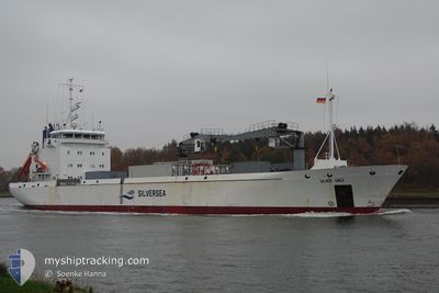
SILVER GALE
Reefer

Current Trip
| Trip Time | 5 days |
|---|---|
| Trip Distance | 1613.30 nm |
| AVG Speed | 12.5 Knots |
| MAX Speed | 15.4 Knots |
| Dybgang | 4.2 m |
| AVG Wind | 13 knots |
| MAX Wind | 22 knots |
| MIN Temp | -9.1°C / 15.62°F |
| MAX Temp | 7.2°C / 44.96°F |
| Position Modtaget | 7 d siden |
Current Position
| Longitude | --- |
|---|---|
| Latitude | --- |
| Status | Under way using engine |
| Fart | 12 Knots |
| Kurs | 179.8° |
| Område | Barentsz Sea |
| Station | T-AIS |
| Position Modtaget | 7 d siden |
Information
The current position of SILVER GALE is in Barentsz Sea with coordinates 69.88220° / 33.54769° as reported on 2025-02-13 14:37 by AIS to our vessel tracker app. The vessel's current speed is 12 Knots and is currently inside the port of MURMANSK.
The vessel SILVER GALE (IMO: 9140956, MMSI: 257900000) is a Reefer that was built in 1997 ( 28 år gamle ). It's sailing under the flag of [NO] Norway.
In this page you can find informations about the vessels current position, last detected port calls, and current voyage information. If the vessels is not in coverage by AIS you will find the latest position.
The current position of SILVER GALE is detected by our AIS receivers and we are not responsible for the reliability of the data. The last position was recorded while the vessel was in Coverage by the Ais receivers of our vessel tracking app.
The current draught of SILVER GALE as reported by AIS is 4.2 meters
Weather
| Temperature | -4.9°C / 23.18°F |
|---|---|
| Wind Speed | 7 knots |
| Direction | 249° WSW |
| Pressure | 1010.3 hPa |
| Humidity | 91.7 % |
| Cloud Coverage | 39 % |


Featured Company
Last Port Calls
| Port | Arrival | Departure | Time In Port |
|---|---|---|---|
| 2025-02-13 20:36 | |||
| 2025-02-03 23:56 | 2025-02-08 14:43 | 4 d | |
| 2025-02-03 22:50 | 2025-02-03 23:42 | 52 m | |
| 2025-01-23 13:15 | 2025-01-29 15:35 | 6 d | |
| 2025-01-16 20:15 | 2025-01-17 12:10 | 15 h | |
| 2025-01-09 19:14 | 2025-01-10 15:15 | 20 h | |
| 2024-12-27 09:10 | 2025-01-06 17:14 | 10 d | |
| 2024-12-24 15:49 | 2024-12-26 20:33 | 2 d | |
| 2024-12-20 15:11 | 2024-12-20 21:11 | 6 h | |
| 2024-12-19 12:45 | 2024-12-20 14:13 | 1 d |
Most Visited Ports (Last year)
| Port | Arrivals | |
|---|---|---|
| 5 | ||
| 4 | ||
| 4 | ||
| 4 | ||
| 4 | ||
| 3 |
Last Trips
| Origin | Departure | Destination | Arrival | Distance | |
|---|---|---|---|---|---|
| 2025-02-08 15:43 | 2025-02-13 23:36 | 1613.30 nm | |||
| 2025-02-04 00:42 | 2025-02-04 00:56 | 1.11 nm | |||
| 2025-01-29 18:35 | 2025-02-03 23:50 | 1613.31 nm | |||
| 2025-01-17 15:10 | 2025-01-23 16:15 | 512.93 nm | |||
| 2025-01-10 16:15 | 2025-01-16 23:15 | 1186.38 nm | |||
| 2025-01-06 19:14 | 2025-01-09 20:14 | 889.74 nm | |||
| 2024-12-26 22:33 | 2024-12-27 11:10 | 236.88 nm | |||
| 2024-12-20 21:11 | 2024-12-24 17:49 | 1078.30 nm | |||
| 2024-12-20 14:13 | 2024-12-20 15:11 | 3.19 nm | |||
| 2024-12-19 07:29 | 2024-12-19 12:45 | 15.03 nm |
Events
| Tid | Hændelsen | Detaljer | Position / Dest | Info |
|---|---|---|---|---|
| 2025-02-16 07:04 | STOP Sejllads |
68.93984 / 33.02697
[RU] MURMANSK
|
Fart: Kurs: 191° |
|
| 2025-02-16 06:34 | START Sejllads |
68.95139 / 33.01876
[RU] MURMANSK
|
Fart: 3.9 kn Kurs: 179° |
|
| 2025-02-13 20:46 | STOP Sejllads |
68.96219 / 33.02179
[RU] MURMANSK
|
Fart: 0.3 kn Kurs: 198° |
|
| 2025-02-13 20:36 | Skibe i havn |
|
68.96416 / 33.02678
[RU] MURMANSK
|
Fart: 8.5 kn Kurs: 22° |
| 2025-02-13 14:37 | Udenfor Dækning |
69.88220 / 33.54769
Barentsz Sea
RUMMK
|
Fart: 12 kn Kurs: 179.8° |
|
| 2025-02-13 14:37 | Status er ændret | Under way using engine Default |
69.88220 / 33.54769
RUMMK
|
Fart: 12 kn Kurs: 174° |
| 2025-02-13 14:29 | Status er ændret | Default Under way using engine |
69.90951 / 33.54054
RUMMK
|
Fart: 13.2 kn Kurs: 130.8° |
| 2025-02-13 11:29 | Ændre havområde | Russian part of the Barentsz Sea Norwegian part of the Barentsz Sea |
70.34986 / 32.19085
Barentsz Sea
RUMMK
|
Fart: 12.6 kn Kurs: 134.9° |
| 2025-02-13 09:25 | ETA er ændret | 2025/02/13 18:30 2025/02/13 17:00 |
70.62081 / 31.15470
RUMMK
|
Fart: 13.6 kn Kurs: 128.2° |
| 2025-02-13 00:56 | Fundet i havområde | Norwegian part of the Barentsz Sea |
71.25182 / 25.60680
Barentsz Sea
RUMMK
|
Fart: 12.3 kn Kurs: 81.3° |