
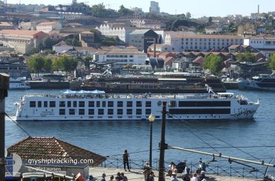
SAO GABRIEL
Passenger
Current Trip
PTGAIA
| Time Travelled | 5 days |
|---|---|
| Remaining Time | --- |
| Distance Travelled | 20.94 nm |
| Remaining Distance | --- |
| AVG Speed | 7.5 Knots |
| MAX Speed | 9.3 Knots |
| AVG Wind | 6.2 knots |
| MAX Wind | 8 knots |
| MIN Temp | 8°C / 46.4°F |
| MAX Temp | 12.3°C / 54.14°F |
| Dybgang | 1.6 m |
| Position Modtaget | 5 d siden |
Current Position
| Longitude | --- |
|---|---|
| Latitude | --- |
| Status | Under way using engine |
| Fart | 9.3 Knots |
| Kurs | 12.8° |
| Område | North Atlantic Ocean |
| Station | T-AIS |
| Position Modtaget | 5 d siden |
Information
The current position of SAO GABRIEL is in North Atlantic Ocean with coordinates 41.05240° / -8.41899° as reported on 2025-03-17 11:33 by AIS to our vessel tracker app. The vessel's current speed is 9.3 Knots
The vessel SAO GABRIEL (MMSI: 263753860) is a Passenger It's sailing under the flag of [PT] Portugal.
In this page you can find informations about the vessels current position, last detected port calls, and current voyage information. If the vessels is not in coverage by AIS you will find the latest position.
The current position of SAO GABRIEL is detected by our AIS receivers and we are not responsible for the reliability of the data. The last position was recorded while the vessel was in Coverage by the Ais receivers of our vessel tracking app.
The current draught of SAO GABRIEL as reported by AIS is 1.6 meters
Weather
| Temperature | 6.1°C / 42.98°F |
|---|---|
| Wind Speed | 1 knots |
| Direction | 317° NW |
| Pressure | 1010.3 hPa |
| Humidity | 98.6 % |
| Cloud Coverage | 100 % |
Featured Company
Last Port Calls
| Port | Arrival | Departure | Time In Port |
|---|---|---|---|
| 2025-03-16 12:22 | 2025-03-17 09:08 | 20 h | |
| 2025-01-18 12:56 | 2025-03-16 08:28 |
Most Visited Ports (Last year)
| Port | Arrivals | |
|---|---|---|
| 58 | ||
| 1 |
Last Trips
| Origin | Departure | Destination | Arrival | Distance | |
|---|---|---|---|---|---|
| 2025-03-16 08:28 | 2025-03-16 12:22 | 25.00 nm | |||
| 2024-11-30 13:26 | 2025-01-18 12:56 | 38.00 nm |
Events
| Tid | Hændelsen | Detaljer | Position / Dest | Info |
|---|---|---|---|---|
| 2025-03-17 12:19 | Status er ændret | Default Under way using engine |
41.05838 / -8.32182
PTGAIA
|
Fart: 9.3 kn Kurs: 12.8° |
| 2025-03-17 11:33 | Udenfor Dækning |
41.05240 / -8.41899
North Atlantic Ocean
|
Fart: 9.3 kn Kurs: 12.8° |
|
| 2025-03-17 09:08 | Afsejlet fra sidste havn |
|
41.14140 / -8.62224
PTGAIA
|
Fart: 8.1 kn Kurs: 124° |
| 2025-03-17 09:00 | START Sejllads |
41.14736 / -8.64131
[PT] PORTO
|
Fart: 6.5 kn Kurs: 82.9° |
|
| 2025-03-16 12:22 | STOP Sejllads |
41.14780 / -8.64377
[PT] PORTO
|
Fart: 0.2 kn Kurs: 511° |
|
| 2025-03-16 12:22 | Skibe i havn |
|
41.14780 / -8.64377
[PT] PORTO
|
Fart: 1 kn Kurs: 511° |
| 2025-03-16 10:09 | Status er ændret | Under way using engine Default |
41.39884 / -8.85865
PTGAIA
|
Fart: 10 kn Kurs: 158° |
| 2025-03-16 10:09 | Destination er ændret | PTGAIA PTVDC |
41.40517 / -8.86169
PTGAIA
|
Fart: 10 kn Kurs: 158° |
| 2025-03-16 10:09 | ETA er ændret | 2025/03/16 12:30 2025/01/18 13:00 |
41.40517 / -8.86169
PTGAIA
|
Fart: 10 kn Kurs: 158° |
| 2025-03-16 10:07 | Status er ændret | Default Under way using engine |
41.40517 / -8.86169
PTVDC
|
Fart: 10.5 kn Kurs: 156.2° |