
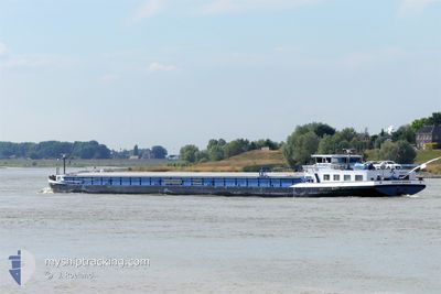
SANTA MARIA
Wing in ground
Current Trip
OSS NL
| Time Travelled | 6 days |
|---|---|
| Remaining Time | --- |
| Distance Travelled | 198.43 nm |
| Remaining Distance | --- |
| AVG Speed | 6.6 Knots |
| MAX Speed | 9.3 Knots |
| AVG Wind | 4.3 knots |
| MAX Wind | 9 knots |
| MIN Temp | 4.6°C / 40.28°F |
| MAX Temp | 13°C / 55.4°F |
| Dybgang | 1.8 m |
| Position Modtaget | 2 d siden |
Current Position
| Longitude | --- |
|---|---|
| Latitude | --- |
| Status | Under way using engine |
| Fart | 5.2 Knots |
| Kurs | 41.6° |
| Område | North Sea |
| Station | T-AIS |
| Position Modtaget | 2 d siden |
Info
Information
The current position of SANTA MARIA is in North Sea with coordinates 49.68774° / 11.04110° as reported on 2025-03-15 17:08 by AIS to our vessel tracker app. The vessel's current speed is 5.2 Knots
The vessel SANTA MARIA (MMSI: 211482270) is a Wing in ground It's sailing under the flag of [DE] Germany.
In this page you can find informations about the vessels current position, last detected port calls, and current voyage information. If the vessels is not in coverage by AIS you will find the latest position.
The current position of SANTA MARIA is detected by our AIS receivers and we are not responsible for the reliability of the data. The last position was recorded while the vessel was in Coverage by the Ais receivers of our vessel tracking app.
The current draught of SANTA MARIA as reported by AIS is 1.8 meters
Weather
| Temperature | 5.3°C / 41.54°F |
|---|---|
| Wind Speed | 8 knots |
| Direction | 75° ENE |
| Pressure | 1014.3 hPa |
| Humidity | 62.5 % |
| Cloud Coverage | 83 % |
Featured Company
Last Port Calls
| Port | Arrival | Departure | Time In Port |
|---|---|---|---|
| 2025-03-10 17:26 | 2025-03-11 07:26 | 14 h | |
| 2025-03-09 20:21 | 2025-03-10 16:22 | 20 h | |
| 2025-02-23 19:48 | 2025-02-24 05:53 | 10 h | |
| 2025-02-23 18:10 | 2025-02-23 18:37 | 27 m | |
| 2025-02-23 13:37 | 2025-02-23 14:11 | 33 m | |
| 2025-02-21 19:37 | 2025-02-22 06:18 | 10 h | |
| 2025-02-20 16:50 | 2025-02-20 18:06 | 1 h | |
| 2025-02-20 08:19 | 2025-02-20 09:24 | 1 h | |
| 2025-02-18 17:30 | 2025-02-20 05:32 | 1 d | |
| 2025-02-18 09:32 | 2025-02-18 10:00 | 28 m |
Most Visited Ports (Last year)
| Port | Arrivals | |
|---|---|---|
| 13 | ||
| 13 | ||
| 12 | ||
| 12 | ||
| 8 | ||
| 7 |
Last Trips
| Origin | Departure | Destination | Arrival | Distance | |
|---|---|---|---|---|---|
| 2025-03-10 16:22 | 2025-03-10 17:26 | 3.24 nm | |||
| 2025-02-24 05:53 | 2025-03-09 20:21 | 336.95 nm | |||
| 2025-02-23 18:37 | 2025-02-23 19:48 | 6.65 nm | |||
| 2025-02-23 14:11 | 2025-02-23 18:10 | 16.95 nm | |||
| 2025-02-22 06:18 | 2025-02-23 13:37 | 95.48 nm | |||
| 2025-02-20 18:06 | 2025-02-21 19:37 | 85.03 nm | |||
| 2025-02-20 09:24 | 2025-02-20 16:50 | 49.15 nm | |||
| 2025-02-20 05:32 | 2025-02-20 08:19 | 23.28 nm | |||
| 2025-02-18 10:00 | 2025-02-18 17:30 | 56.28 nm | |||
| 2025-02-18 07:14 | 2025-02-18 09:32 | 18.16 nm |
Events
| Tid | Hændelsen | Detaljer | Position / Dest | Info |
|---|---|---|---|---|
| 2025-03-15 17:08 | Udenfor Dækning |
49.68774 / 11.04110
North Sea
OSS NL
|
Fart: 5.2 kn Kurs: 41.6° |
|
| 2025-03-15 17:08 | Status er ændret | Under way using engine Moored |
49.68774 / 11.04110
OSS NL
|
Fart: Kurs: 511° |
| 2025-03-15 17:08 | START Sejllads | 13.81 nm, South East of BAMBERG |
49.68774 / 11.04110
OSS NL
|
Fart: 5.2 kn Kurs: 41.6° |
| 2025-03-15 16:51 | Status er ændret | Moored Under way using engine |
49.68499 / 11.03737
OSS NL
|
Fart: Kurs: 511° |
| 2025-03-15 16:46 | STOP Sejllads | 13.9 nm, South East of BAMBERG |
49.68499 / 11.03737
OSS NL
|
Fart: 0.2 kn Kurs: 511° |
| 2025-03-15 16:12 | Indenfor Dækning |
49.64220 / 10.99869
North Sea
OSS NL
|
Fart: 5.6 kn Kurs: 42.8° |
|
| 2025-03-12 07:20 | Udenfor Dækning |
48.30998 / 14.12231
North Sea
OSS NL
|
Fart: 8.4 kn Kurs: 254.3° |
|
| 2025-03-12 05:50 | START Sejllads | 1.37 nm, West of LINZ |
48.31010 / 14.28895
OSS NL
|
Fart: 5.6 kn Kurs: 232.9° |
| 2025-03-12 05:47 | STOP Sejllads | 1.21 nm, West of LINZ |
48.31211 / 14.29238
OSS NL
|
Fart: 0.3 kn Kurs: 511° |
| 2025-03-12 05:17 | START Sejllads | 1.1 nm, South East of LINZ |
48.30083 / 14.33630
OSS NL
|
Fart: 5.2 kn Kurs: 357.7° |