
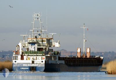
RIX MARINER
General Cargo
Current Trip
| Time Travelled | 1 day |
|---|---|
| Remaining Time | 18 h, 0 mins |
| Distance Travelled | 166.18 nm |
| Remaining Distance | 151.53 nm |
| AVG Speed | 8.9 Knots |
| MAX Speed | 11.7 Knots |
| AVG Wind | 7.9 knots |
| MAX Wind | 16 knots |
| MIN Temp | -7.9°C / 17.78°F |
| MAX Temp | 2.7°C / 36.86°F |
| Dybgang | 5.6 m |
| Position Modtaget | 1 m siden |
Current Position
| Longitude | --- |
|---|---|
| Latitude | --- |
| Status | Under way using engine |
| Fart | 8.4 Knots |
| Kurs | 158.1° |
| Område | Kattegat |
| Station | T-AIS |
| Position Modtaget | 1 m siden |
Info
Information
The current position of RIX MARINER is in Kattegat with coordinates 57.10002° / 10.76362° as reported on 2024-11-22 12:33 by AIS to our vessel tracker app. The vessel's current speed is 8.4 Knots and is heading at the port of NAKSKOV. The estimated time of arrival as calculated by MyShipTracking vessel tracking app is 2024-11-23 06:34 LT
The vessel RIX MARINER (IMO: 9197387, MMSI: 210552000) is a General Cargo that was built in 2001 ( 23 år gamle ). It's sailing under the flag of [CY] Cyprus.
In this page you can find informations about the vessels current position, last detected port calls, and current voyage information. If the vessels is not in coverage by AIS you will find the latest position.
The current position of RIX MARINER is detected by our AIS receivers and we are not responsible for the reliability of the data. The last position was recorded while the vessel was in Coverage by the Ais receivers of our vessel tracking app.
The current draught of RIX MARINER as reported by AIS is 5.6 meters
Weather
| Temperature | 1.6°C / 34.88°F |
|---|---|
| Wind Speed | 3 knots |
| Direction | 331° NNW |
| Pressure | 993.9 hPa |
| Humidity | 38.3 % |
| Cloud Coverage | 28 % |
Featured Company
Last Port Calls
| Port | Arrival | Departure | Time In Port |
|---|---|---|---|
| 2024-11-19 23:10 | 2024-11-20 19:06 | 19 h | |
| 2024-11-17 06:59 | 2024-11-18 17:18 | 1 d | |
| 2024-11-15 09:26 | 2024-11-16 09:40 | 1 d | |
| 2024-11-13 08:31 | 2024-11-14 17:44 | 1 d | |
| 2024-11-10 16:45 | 2024-11-11 18:26 | 1 d | |
| 2024-11-05 07:53 | 2024-11-06 15:08 | 1 d | |
| 2024-11-01 20:55 | 2024-11-04 13:27 | 2 d | |
| 2024-10-28 19:25 | 2024-10-30 00:09 | 1 d | |
| 2024-10-22 20:41 | 2024-10-25 23:59 | 3 d | |
| 2024-10-09 13:15 | 2024-10-15 13:40 | 6 d |
Last Trips
| Origin | Departure | Destination | Arrival | Distance | |
|---|---|---|---|---|---|
| 2024-11-18 18:18 | 2024-11-20 00:10 | 267.54 nm | |||
| 2024-11-16 10:40 | 2024-11-17 07:59 | 152.53 nm | |||
| 2024-11-14 18:44 | 2024-11-15 10:26 | 135.51 nm | |||
| 2024-11-11 19:26 | 2024-11-13 09:31 | 288.99 nm | |||
| 2024-11-06 16:08 | 2024-11-10 17:45 | 628.65 nm | |||
| 2024-11-04 14:27 | 2024-11-05 08:53 | 158.70 nm | |||
| 2024-10-30 01:09 | 2024-11-01 21:55 | 605.40 nm | |||
| 2024-10-26 00:59 | 2024-10-28 20:25 | 594.21 nm | |||
| 2024-10-15 15:40 | 2024-10-22 21:41 | 622.36 nm | |||
| 2024-10-07 07:38 | 2024-10-09 15:15 | 420.06 nm |
Events
| Tid | Hændelsen | Detaljer | Position / Dest | Info |
|---|---|---|---|---|
| 2024-11-22 07:49 | Ændre havområde | Danish part of the Kattegat Danish part of the Skaggerak |
57.76066 / 10.76780
Kattegat
DKNAK
|
Fart: 8.7 kn Kurs: 184° |
| 2024-11-22 06:10 | Ændre havområde | Danish part of the Skaggerak Swedish part of the Skaggerak |
57.98759 / 10.76878
Skaggerak
DKNAK
|
Fart: 8 kn Kurs: 183.8° |
| 2024-11-21 23:43 | Ændre havområde | Swedish part of the Skaggerak Norwegian part of the Skaggerak |
58.90514 / 10.74834
Skaggerak
DKNAK
|
Fart: 9.6 kn Kurs: 178.5° |
| 2024-11-21 21:34 | Ændre havområde | Norwegian part of the Skaggerak Swedish part of the Skaggerak |
59.01108 / 11.10990
Skaggerak
DKNAK
|
Fart: 10.4 kn Kurs: 205.2° |
| 2024-11-21 20:40 | Ændre havområde | Swedish part of the Skaggerak Norwegian part of the Skaggerak |
59.10066 / 11.29044
Skaggerak
DKNAK
|
Fart: 9.5 kn Kurs: 235.3° |
| 2024-11-21 19:46 | START Sejllads | 5.85 nm, South of HALDEN |
59.02193 / 11.44125
DKNAK
|
Fart: 3.3 kn Kurs: 323° |
| 2024-11-21 19:38 | Status er ændret | Under way using engine Default |
59.02050 / 11.44232
DKNAK
|
Fart: Kurs: 355° |
| 2024-11-21 19:36 | Status er ændret | Default Under way using engine |
59.02051 / 11.44229
DKNAK
|
Fart: Kurs: 0° |
| 2024-11-21 19:36 | Status er ændret | Under way using engine Moored |
59.02051 / 11.44231
DKNAK
|
Fart: Kurs: 359° |
| 2024-11-21 19:13 | Status er ændret | Moored Default |
59.02053 / 11.44229
DKNAK
|
Fart: Kurs: 359° |