

PIANO LAND
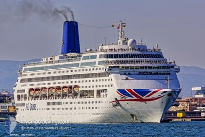
Passengers Ship
Current Trip
| Trip Time | 13 h, 15 mins |
|---|---|
| Trip Distance | 185.92 nm |
| AVG Speed | 13.7 Knots |
| MAX Speed | 17.2 Knots |
| Dybgang | 8.3 m |
| AVG Wind | 6.3 knots |
| MAX Wind | 9 knots |
| MIN Temp | 10.3°C / 50.54°F |
| MAX Temp | 14.8°C / 58.64°F |
| Position Modtaget | 19 d siden |
Current Position
| Longitude | --- |
|---|---|
| Latitude | --- |
| Status | Under way using engine |
| Fart | 11.2 Knots |
| Kurs | 295° |
| Område | Japan Sea |
| Station | T-AIS |
| Position Modtaget | 19 d siden |
Information
The current position of PIANO LAND is in Japan Sea with coordinates 33.63654° / 130.34016° as reported on 2025-02-09 13:12 by AIS to our vessel tracker app. The vessel's current speed is 11.2 Knots and is currently inside the port of NAGASAKI.
The vessel PIANO LAND (IMO: 9050137, MMSI: 310529000) is a Passengers Ship that was built in 1995 ( 30 år gamle ). It's sailing under the flag of [BM] Bermuda.
In this page you can find informations about the vessels current position, last detected port calls, and current voyage information. If the vessels is not in coverage by AIS you will find the latest position.
The current position of PIANO LAND is detected by our AIS receivers and we are not responsible for the reliability of the data. The last position was recorded while the vessel was in Coverage by the Ais receivers of our vessel tracking app.
The current draught of PIANO LAND as reported by AIS is 8.3 meters
Weather
| Temperature | 15.1°C / 59.18°F |
|---|---|
| Wind Speed | 8 knots |
| Direction | 156° SSE |
| Pressure | 1021.3 hPa |
| Humidity | 86 % |
| Cloud Coverage | 90 % |
Featured Company
Last Port Calls
| Port | Arrival | Departure | Time In Port |
|---|---|---|---|
| 2025-03-01 01:35 | |||
| 2025-02-28 03:56 | 2025-02-28 12:20 | 8 h | |
| 2025-02-13 01:37 | 2025-02-13 13:09 | 11 h | |
| 2025-02-09 00:37 | 2025-02-09 13:17 | 12 h | |
| 2025-02-05 01:45 | 2025-02-05 13:17 | 11 h | |
| 2025-01-31 22:59 | 2025-02-01 10:40 | 11 h | |
| 2025-01-30 03:33 | 2025-01-30 12:14 | 8 h | |
| 2025-01-26 23:46 | 2025-01-27 13:27 | 13 h | |
| 2025-01-26 03:50 | 2025-01-26 12:13 | 8 h | |
| 2025-01-23 03:27 | 2025-01-23 12:13 | 8 h |
Last Trips
| Origin | Departure | Destination | Arrival | Distance | |
|---|---|---|---|---|---|
| 2025-02-28 21:20 | 2025-03-01 10:35 | 185.92 nm | |||
| 2025-02-13 22:09 | 2025-02-28 12:56 | 1727.11 nm | |||
| 2025-02-09 22:17 | 2025-02-13 10:37 | 1005.75 nm | |||
| 2025-02-05 22:17 | 2025-02-09 09:37 | 948.73 nm | |||
| 2025-02-01 19:40 | 2025-02-05 10:45 | 998.75 nm | |||
| 2025-01-30 21:14 | 2025-02-01 07:59 | 291.40 nm | |||
| 2025-01-27 22:27 | 2025-01-30 12:33 | 810.42 nm | |||
| 2025-01-26 21:13 | 2025-01-27 08:46 | 188.30 nm | |||
| 2025-01-23 21:13 | 2025-01-26 12:50 | 637.69 nm | |||
| 2025-01-20 22:15 | 2025-01-23 12:27 | 812.83 nm |
Events
| Tid | Hændelsen | Detaljer | Position / Dest | Info |
|---|---|---|---|---|
| 2025-03-01 01:36 | STOP Sejllads |
32.73612 / 129.86574
[JP] NAGASAKI
|
Fart: 0.1 kn Kurs: 163° |
|
| 2025-03-01 01:35 | Skibe i havn |
|
32.73612 / 129.86574
[JP] NAGASAKI
|
Fart: 0.8 kn Kurs: 132° |
| 2025-02-28 12:20 | Afsejlet fra sidste havn |
|
33.56282 / 126.60573
CN>SHA
|
Fart: 9.8 kn Kurs: 63° |
| 2025-02-28 12:05 | START Sejllads |
33.53004 / 126.55480
[KR] JEJU
|
Fart: 7.8 kn Kurs: 60° |
|
| 2025-02-28 03:56 | STOP Sejllads |
33.52523 / 126.54635
[KR] JEJU
|
Fart: Kurs: 178° |
|
| 2025-02-28 03:56 | Skibe i havn |
|
33.52523 / 126.54635
[KR] JEJU
|
Fart: 1.3 kn Kurs: 233° |
| 2025-02-22 22:39 | STOP Sejllads | 5.65 nm, North West of SHANGHAI |
31.41050 / 121.50802
CN>SHA
|
Fart: 0.1 kn Kurs: 121° |
| 2025-02-21 10:06 | START Sejllads |
26.22513 / 127.66660
CN>SHA
|
Fart: 7.5 kn Kurs: 264° |