
OMISHIMA ISLAND
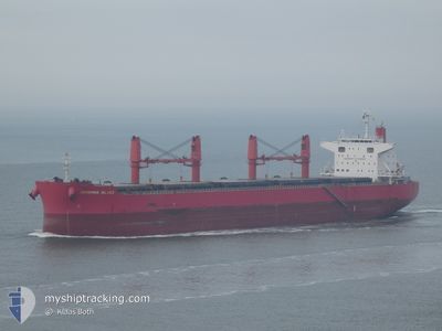
Bulker
Current Trip
| Trip Time | 24 days |
|---|---|
| Trip Distance | 530.85 nm |
| AVG Speed | 12.3 Knots |
| MAX Speed | 15.7 Knots |
| Dybgang | 6.4 m |
| AVG Wind | 9.6 knots |
| MAX Wind | 17.8 knots |
| MIN Temp | 11.7°C / 53.06°F |
| MAX Temp | 24.1°C / 75.38°F |
| Position Modtaget | 25 d siden |
Current Position
| Longitude | 129.82056° |
|---|---|
| Latitude | 35.84154° |
| Status | Under way using engine |
| Fart | 14.2 Knots |
| Kurs | 1.8° |
| Område | Japan Sea |
| Station | T-AIS |
| Position Modtaget | 25 d siden |
Info
Information
The current position of OMISHIMA ISLAND is in Japan Sea with coordinates 35.84154° / 129.82056° as reported on 2024-05-18 03:57 by AIS to our vessel tracker app. The vessel's current speed is 14.2 Knots and is currently inside the port of POHANG.
The vessel OMISHIMA ISLAND (IMO: 9642203, MMSI: 355142000) is a Bulker that was built in 2013 ( 11 år gamle ). It's sailing under the flag of [PA] Panama.
In this page you can find informations about the vessels current position, last detected port calls, and current voyage information. If the vessels is not in coverage by AIS you will find the latest position.
The current position of OMISHIMA ISLAND is detected by our AIS receivers and we are not responsible for the reliability of the data. The last position was recorded while the vessel was in Coverage by the Ais receivers of our vessel tracking app.
The current draught of OMISHIMA ISLAND as reported by AIS is 6.4 meters
Weather
| Temperature | 20.8°C / 69.44°F |
|---|---|
| Wind Speed | 5 knots |
| Direction | 220° SW |
| Pressure | 1003.2 hPa |
| Humidity | 78.2 % |
| Cloud Coverage | 63 % |
Featured Company
Last Port Calls
| Port | Arrival | Departure | Time In Port |
|---|---|---|---|
| 2024-06-10 08:01 | |||
| 2024-05-12 12:08 | 2024-05-16 23:24 | 4 d | |
| 2024-05-02 15:44 | 2024-05-03 17:16 | 1 d | |
| 2024-04-27 15:36 | 2024-04-30 12:04 | 2 d |
Last Trips
| Origin | Departure | Destination | Arrival | Distance | |
|---|---|---|---|---|---|
| 2024-05-16 23:24 | 2024-06-10 08:01 | 530.85 nm | |||
| 2024-05-03 17:16 | 2024-05-12 12:08 | 1327.45 nm | |||
| 2024-04-30 12:04 | 2024-05-02 15:44 | 516.79 nm | |||
| 2024-03-14 12:57 | 2024-04-27 15:36 | 10736.74 nm |
Events
| Tid | Hændelsen | Detaljer | Position / Dest | Info |
|---|---|---|---|---|
| 2024-06-09 23:33 | STOP Sejllads |
36.01458 / 129.41835
[KR] POHANG
|
Fart: Kurs: 183° |
|
| 2024-06-09 23:01 | Skibe i havn |
|
36.01497 / 129.41846
[KR] POHANG
|
Fart: 3.1 kn Kurs: 180° |
| 2024-06-09 22:16 | START Sejllads | 3.49 nm, North East of POHANG |
36.06007 / 129.46481
KR KPO
|
Fart: 3.1 kn Kurs: 180° |