
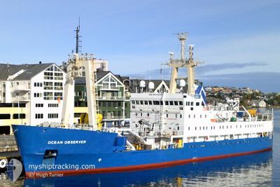
OCEAN OBSERVER
Research/Survey Vessel
Current Trip
SURVEY SITE
| Time Travelled | 1 day |
|---|---|
| Remaining Time | --- |
| Distance Travelled | 187.28 nm |
| Remaining Distance | --- |
| AVG Speed | 5.4 Knots |
| MAX Speed | 10.2 Knots |
| AVG Wind | 11.3 knots |
| MAX Wind | 20 knots |
| MIN Temp | 3.7°C / 38.66°F |
| MAX Temp | 8.1°C / 46.58°F |
| Dybgang | 5 m |
| Position Modtaget | 1 d siden |
Current Position
| Longitude | --- |
|---|---|
| Latitude | --- |
| Status | Restricted manoeuverability |
| Fart | 3.5 Knots |
| Kurs | 255° |
| Område | Irish Sea and St. George's Channel |
| Station | T-AIS |
| Position Modtaget | 1 d siden |
Info
Information
The current position of OCEAN OBSERVER is in Irish Sea and St. George's Channel with coordinates 53.64416° / -3.92305° as reported on 2025-03-16 21:33 by AIS to our vessel tracker app. The vessel's current speed is 3.5 Knots
The vessel OCEAN OBSERVER (IMO: 8511275, MMSI: 232217000) is a Research/Survey Vessel that was built in 1987 ( 38 år gamle ). It's sailing under the flag of [GB] United Kingdom.
In this page you can find informations about the vessels current position, last detected port calls, and current voyage information. If the vessels is not in coverage by AIS you will find the latest position.
The current position of OCEAN OBSERVER is detected by our AIS receivers and we are not responsible for the reliability of the data. The last position was recorded while the vessel was in Coverage by the Ais receivers of our vessel tracking app.
The current draught of OCEAN OBSERVER as reported by AIS is 5 meters
Weather
| Temperature | 5.5°C / 41.9°F |
|---|---|
| Wind Speed | 20 knots |
| Direction | 114° ESE |
| Pressure | 1027.7 hPa |
| Humidity | 78.9 % |
| Cloud Coverage | 11 % |
Featured Company
Last Port Calls
| Port | Arrival | Departure | Time In Port |
|---|---|---|---|
| 2025-03-16 07:48 | 2025-03-16 08:11 | 23 m | |
| 2025-03-05 14:27 | 2025-03-07 15:51 | 2 d | |
| 2025-02-27 10:23 |
Most Visited Ports (Last year)
| Port | Arrivals | |
|---|---|---|
| 9 | ||
| 6 | ||
| 4 | ||
| 4 | ||
| 3 | ||
| 3 |
Last Trips
| Origin | Departure | Destination | Arrival | Distance | |
|---|---|---|---|---|---|
| 2025-03-07 15:51 | 2025-03-16 07:48 | 769.41 nm | |||
| 2025-02-27 10:23 | 2025-03-05 14:27 | 971.58 nm |
Events
| Tid | Hændelsen | Detaljer | Position / Dest | Info |
|---|---|---|---|---|
| 2025-03-16 21:40 | Status er ændret | Default Restricted manoeuverability |
53.64453 / -3.93485
SURVEY SITE
|
Fart: 3.5 kn Kurs: 255° |
| 2025-03-16 21:33 | Status er ændret | Restricted manoeuverability Default |
53.64416 / -3.92305
SURVEY SITE
|
Fart: 4.4 kn Kurs: 171° |
| 2025-03-16 21:33 | Udenfor Dækning |
53.64416 / -3.92305
Irish Sea and St. George's Channel
|
Fart: 3.5 kn Kurs: 229.1° |
|
| 2025-03-16 20:44 | Status er ændret | Default Restricted manoeuverability |
53.61433 / -3.90161
SURVEY SITE
|
Fart: 4 kn Kurs: 270° |
| 2025-03-16 20:37 | Status er ændret | Restricted manoeuverability Default |
53.61398 / -3.88906
SURVEY SITE
|
Fart: 4 kn Kurs: 269° |
| 2025-03-16 20:32 | Status er ændret | Default Restricted manoeuverability |
53.61375 / -3.87904
SURVEY SITE
|
Fart: 4.2 kn Kurs: 271° |
| 2025-03-16 20:17 | Status er ændret | Restricted manoeuverability Default |
53.61469 / -3.87382
SURVEY SITE
|
Fart: 4.1 kn Kurs: 91° |
| 2025-03-16 19:48 | Status er ændret | Default Restricted manoeuverability |
53.61451 / -3.93171
SURVEY SITE
|
Fart: 3.9 kn Kurs: 270° |
| 2025-03-16 19:39 | Status er ændret | Restricted manoeuverability Default |
53.61521 / -3.91840
SURVEY SITE
|
Fart: 3.9 kn Kurs: 270° |
| 2025-03-16 19:32 | Status er ændret | Default Restricted manoeuverability |
53.61487 / -3.90510
SURVEY SITE
|
Fart: 4.2 kn Kurs: 270° |