
NYKSUND
Cargo
Current Trip
AAGOTNES
| Time Travelled | 3 h, 9 mins |
|---|---|
| Remaining Time | --- |
| Distance Travelled | 22.06 nm |
| Remaining Distance | --- |
| AVG Speed | 9.6 Knots |
| MAX Speed | 12.5 Knots |
| AVG Wind | 4.3 knots |
| MAX Wind | 4.9 knots |
| MIN Temp | 1.1°C / 33.98°F |
| MAX Temp | 1.7°C / 35.06°F |
| Dybgang | 5.8 m |
| Position Modtaget | 1 m siden |
Current Position
| Longitude | --- |
|---|---|
| Latitude | --- |
| Status | Under way using engine |
| Fart | 1.4 Knots |
| Kurs | 297° |
| Område | North Sea |
| Station | T-AIS |
| Position Modtaget | 1 m siden |
Info
Information
The current position of NYKSUND is in North Sea with coordinates 60.66997° / 4.92159° as reported on 2024-11-21 16:44 by AIS to our vessel tracker app. The vessel's current speed is 1.4 Knots
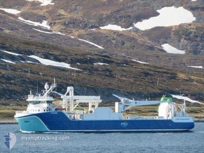
The vessel NYKSUND (IMO: 9803534, MMSI: 257178000) is a Cargo It's sailing under the flag of [NO] Norway.
In this page you can find informations about the vessels current position, last detected port calls, and current voyage information. If the vessels is not in coverage by AIS you will find the latest position.
The current position of NYKSUND is detected by our AIS receivers and we are not responsible for the reliability of the data. The last position was recorded while the vessel was in Coverage by the Ais receivers of our vessel tracking app.
The current draught of NYKSUND as reported by AIS is 5.8 meters
Weather
| Temperature | 1.2°C / 34.16°F |
|---|---|
| Wind Speed | 5 knots |
| Direction | 49° NE |
| Pressure | 991.4 hPa |
| Humidity | 57.8 % |
| Cloud Coverage | 58 % |
Featured Company
Last Port Calls
| Port | Arrival | Departure | Time In Port |
|---|---|---|---|
| 2024-11-21 10:59 | 2024-11-21 13:36 | 2 h | |
| 2024-11-20 03:39 | 2024-11-21 03:02 | 23 h | |
| 2024-11-20 01:59 | 2024-11-20 03:15 | 1 h | |
| 2024-11-19 06:06 | 2024-11-19 06:29 | 22 m | |
| 2024-11-15 03:59 | 2024-11-15 04:24 | 25 m | |
| 2024-11-15 01:06 | 2024-11-15 01:49 | 42 m | |
| 2024-11-13 15:36 | 2024-11-13 17:44 | 2 h | |
| 2024-11-13 10:24 | 2024-11-13 11:13 | 49 m | |
| 2024-11-12 01:30 | 2024-11-13 05:29 | 1 d | |
| 2024-11-11 20:50 | 2024-11-11 22:08 | 1 h |
Last Trips
| Origin | Departure | Destination | Arrival | Distance | |
|---|---|---|---|---|---|
| 2024-11-21 04:02 | 2024-11-21 11:59 | 84.28 nm | |||
| 2024-11-20 04:15 | 2024-11-20 04:39 | 3.98 nm | |||
| 2024-11-19 07:29 | 2024-11-20 02:59 | 228.08 nm | |||
| 2024-11-15 05:24 | 2024-11-19 07:06 | 678.82 nm | |||
| 2024-11-15 02:49 | 2024-11-15 04:59 | 14.29 nm | |||
| 2024-11-13 18:44 | 2024-11-15 02:06 | 249.42 nm | |||
| 2024-11-13 12:13 | 2024-11-13 16:36 | 21.18 nm | |||
| 2024-11-13 06:29 | 2024-11-13 11:24 | 57.65 nm | |||
| 2024-11-11 23:08 | 2024-11-12 02:30 | 25.05 nm | |||
| 2024-11-11 13:22 | 2024-11-11 21:50 | 101.02 nm |
Events
| Tid | Hændelsen | Detaljer | Position / Dest | Info |
|---|---|---|---|---|
| 2024-11-21 16:14 | STOP Sejllads | 3.48 nm, North East of STURE |
60.66791 / 4.92400
AAGOTNES
|
Fart: 0.1 kn Kurs: 132° |
| 2024-11-21 15:28 | START Sejllads | 4.44 nm, East of STURE |
60.62786 / 5.00932
AAGOTNES
|
Fart: 4.6 kn Kurs: 142° |
| 2024-11-21 14:56 | STOP Sejllads | 4.34 nm, East of STURE |
60.62900 / 5.00553
AAGOTNES
|
Fart: 0.1 kn Kurs: 102° |
| 2024-11-21 13:36 | Afsejlet fra sidste havn |
|
60.42389 / 5.02464
AAGOTNES
|
Fart: 9.1 kn Kurs: 38° |
| 2024-11-21 13:32 | START Sejllads |
60.41782 / 5.01474
[NO] AAGOTNES
|
Fart: 3.9 kn Kurs: 44° |
|
| 2024-11-21 11:10 | STOP Sejllads |
60.41606 / 5.01252
[NO] AAGOTNES
|
Fart: 0.3 kn Kurs: 324° |
|
| 2024-11-21 10:59 | Skibe i havn |
|
60.41680 / 5.02312
[NO] AAGOTNES
|
Fart: 5.7 kn Kurs: 275.7° |
| 2024-11-21 10:29 | Status er ændret | Under way using engine Default |
60.37116 / 5.16679
AAGOTNES
|
Fart: 12.4 kn Kurs: 352° |
| 2024-11-21 10:29 | Status er ændret | Default Under way using engine |
60.36829 / 5.16756
AAGOTNES
|
Fart: 12.3 kn Kurs: 350.3° |
| 2024-11-21 09:13 | START Sejllads | 3.59 nm, South West of KLOKKARVIK |
60.17498 / 5.08821
AAGOTNES
|
Fart: 6.3 kn Kurs: 189.9° |