
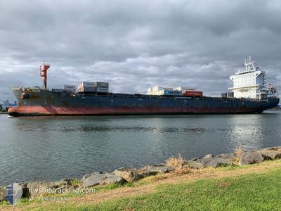
NORDMAAS
Cargo A
Current Trip
| Time Travelled | 1 day |
|---|---|
| Remaining Time | 2 days |
| Distance Travelled | 105.17 nm |
| Remaining Distance | 1353.06 nm |
| AVG Speed | 16.1 Knots |
| MAX Speed | 17.2 Knots |
| AVG Wind | 11.3 knots |
| MAX Wind | 16 knots |
| MIN Temp | 26.7°C / 80.06°F |
| MAX Temp | 29°C / 84.2°F |
| Dybgang | 6.9 m |
| Position Modtaget | 5 d siden |
Current Position
| Longitude | --- |
|---|---|
| Latitude | --- |
| Status | Under way using engine |
| Fart | 9.5 Knots |
| Kurs | 286.6° |
| Område | South China Sea |
| Station | T-AIS |
| Position Modtaget | 5 d siden |
Info
Information
The current position of NORDMAAS is in South China Sea with coordinates 10.66747° / 106.75405° as reported on 2024-09-23 14:20 by AIS to our vessel tracker app. The vessel's current speed is 9.5 Knots and is heading at the port of LAEM CHABANG. The estimated time of arrival as calculated by MyShipTracking vessel tracking app is 2024-10-01 00:55 LT
The vessel NORDMAAS (IMO: 9822736, MMSI: 209695000) is a Cargo A It's sailing under the flag of [CY] Cyprus.
In this page you can find informations about the vessels current position, last detected port calls, and current voyage information. If the vessels is not in coverage by AIS you will find the latest position.
The current position of NORDMAAS is detected by our AIS receivers and we are not responsible for the reliability of the data. The last position was recorded while the vessel was in Coverage by the Ais receivers of our vessel tracking app.
The current draught of NORDMAAS as reported by AIS is 6.9 meters
Weather
| Temperature | 28.9°C / 84.02°F |
|---|---|
| Wind Speed | 24 knots |
| Direction | 46° NE |
| Pressure | 1007.3 hPa |
| Humidity | 81.1 % |
| Cloud Coverage | 92 % |
Featured Company
Last Port Calls
| Port | Arrival | Departure | Time In Port |
|---|---|---|---|
| 2024-09-26 19:46 | 2024-09-27 10:47 | 15 h | |
| 2024-09-20 02:38 | 2024-09-20 17:29 | 14 h | |
| 2024-09-18 23:08 | 2024-09-19 23:10 | 1 d | |
| 2024-09-13 20:45 | 2024-09-14 02:57 | 6 h | |
| 2024-09-13 01:00 | 2024-09-13 09:11 | 8 h | |
| 2024-09-11 05:56 | 2024-09-11 13:55 | 7 h | |
| 2024-09-09 00:45 | 2024-09-09 14:16 | 13 h | |
| 2024-08-13 06:43 | 2024-08-13 18:37 | 11 h | |
| 2024-07-29 14:52 | 2024-07-30 20:15 | 1 d | |
| 2024-07-18 07:16 | 2024-07-19 10:33 | 1 d |
Last Trips
| Origin | Departure | Destination | Arrival | Distance | |
|---|---|---|---|---|---|
| 2024-09-21 00:29 | 2024-09-27 03:46 | 1548.08 nm | |||
| 2024-09-20 06:10 | 2024-09-20 09:38 | 39.76 nm | |||
| 2024-09-14 10:57 | 2024-09-19 06:08 | 1534.51 nm | |||
| 2024-09-13 17:11 | 2024-09-14 04:45 | 139.08 nm | |||
| 2024-09-11 21:55 | 2024-09-13 09:00 | 84.14 nm | |||
| 2024-09-09 22:16 | 2024-09-11 13:56 | 328.77 nm | |||
| 2024-08-14 02:37 | 2024-09-09 08:45 | 1501.04 nm | |||
| 2024-07-31 08:15 | 2024-08-13 14:43 | 5218.02 nm | |||
| 2024-07-19 22:33 | 2024-07-30 02:52 | 829.55 nm | |||
| 2024-07-17 18:24 | 2024-07-18 19:16 | 117.13 nm |
Events
| Tid | Hændelsen | Detaljer | Position / Dest | Info |
|---|---|---|---|---|
| 2024-09-27 10:47 | START Sejllads | 0.55 nm, West of BATANGAS |
13.75466 / 121.02684
TH LCH
|
Fart: 7.8 kn Kurs: 232° |
| 2024-09-27 10:47 | Afsejlet fra sidste havn |
|
13.75466 / 121.02684
TH LCH
|
Fart: 0.6 kn Kurs: 20° |
| 2024-09-26 19:46 | STOP Sejllads |
13.76032 / 121.04153
[PH] BATANGAS
|
Fart: Kurs: 60° |
|
| 2024-09-26 19:46 | Skibe i havn |
|
13.76032 / 121.04153
[PH] BATANGAS
|
Fart: 3 kn Kurs: 56° |
| 2024-09-26 19:12 | START Sejllads | 1.03 nm, South West of BATANGAS |
13.74436 / 121.02062
TH LCH
|
Fart: 4.1 kn Kurs: 41° |
| 2024-09-26 18:14 | STOP Sejllads | 1.19 nm, South West of BATANGAS |
13.74512 / 121.01724
TH LCH
|
Fart: 0.2 kn Kurs: 36° |
| 2024-09-23 14:25 | Status er ændret | Default Under way using engine |
10.66813 / 106.74026
TH LCH
|
Fart: 9.5 kn Kurs: 286.6° |
| 2024-09-23 14:20 | Status er ændret | Under way using engine Default |
10.66747 / 106.75405
TH LCH
|
Fart: 9.4 kn Kurs: 286° |
| 2024-09-23 14:20 | Udenfor Dækning |
10.66747 / 106.75405
South China Sea
|
Fart: 9.5 kn Kurs: 286.6° |
|
| 2024-09-23 14:13 | Status er ændret | Default Under way using engine |
10.66705 / 106.77108
TH LCH
|
Fart: 8.9 kn Kurs: 197.9° |