

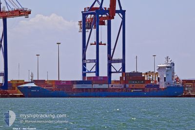
NINA A
Container Ship

Current Trip
| Time Travelled | 3 h, 4 mins |
|---|---|
| Remaining Time | --- |
| Distance Travelled | 4.63 nm |
| Remaining Distance | --- |
| AVG Speed | 7.6 Knots |
| MAX Speed | 10.7 Knots |
| AVG Wind | 4.1 knots |
| MAX Wind | 5 knots |
| MIN Temp | 8.8°C / 47.84°F |
| MAX Temp | 9.4°C / 48.92°F |
| Dybgang | 7.1 m |
| Position Modtaget | 1 m siden |
Current Position
| Longitude | --- |
|---|---|
| Latitude | --- |
| Status | At anchor |
| Fart | 0.1 Knots |
| Kurs | 30° |
| Område | Sea of Marmara |
| Station | T-AIS |
| Position Modtaget | 1 m siden |
Information
The current position of NINA A is in Sea of Marmara with coordinates 40.94708° / 28.60043° as reported on 2025-02-28 02:52 by AIS to our vessel tracker app. The vessel's current speed is 0.1 Knots
The vessel NINA A (IMO: 9440605, MMSI: 636021296) is a Container Ship that was built in 2008 ( 17 år gamle ). It's sailing under the flag of [LR] Liberia.
In this page you can find informations about the vessels current position, last detected port calls, and current voyage information. If the vessels is not in coverage by AIS you will find the latest position.
The current position of NINA A is detected by our AIS receivers and we are not responsible for the reliability of the data. The last position was recorded while the vessel was in Coverage by the Ais receivers of our vessel tracking app.
The current draught of NINA A as reported by AIS is 7.1 meters
Weather
| Temperature | 8.8°C / 47.84°F |
|---|---|
| Wind Speed | 5 knots |
| Direction | 44° NE |
| Pressure | 1019.4 hPa |
| Humidity | 79.9 % |
| Cloud Coverage | 100 % |


Featured Company
Last Port Calls
| Port | Arrival | Departure | Time In Port |
|---|---|---|---|
| 2025-02-27 10:26 | 2025-02-28 02:50 | 16 h | |
| 2025-02-25 17:01 | 2025-02-26 03:17 | 10 h | |
| 2025-02-22 23:29 | 2025-02-24 16:41 | 1 d | |
| 2025-02-20 01:44 | 2025-02-21 06:12 | 1 d | |
| 2025-02-18 01:57 | 2025-02-18 13:37 | 11 h | |
| 2025-02-17 05:33 | 2025-02-17 18:13 | 12 h | |
| 2025-02-14 16:41 | 2025-02-15 05:23 | 12 h | |
| 2025-02-12 18:35 | 2025-02-13 02:38 | 8 h | |
| 2025-02-11 02:16 | 2025-02-11 13:05 | 10 h | |
| 2025-02-10 09:48 | 2025-02-10 19:49 | 10 h |
Last Trips
| Origin | Departure | Destination | Arrival | Distance | |
|---|---|---|---|---|---|
| 2025-02-26 03:17 | 2025-02-27 10:26 | 176.54 nm | |||
| 2025-02-24 16:41 | 2025-02-25 17:01 | 73.35 nm | |||
| 2025-02-21 06:12 | 2025-02-22 23:29 | 196.75 nm | |||
| 2025-02-18 13:37 | 2025-02-20 01:44 | 188.47 nm | |||
| 2025-02-17 18:13 | 2025-02-18 01:57 | 69.89 nm | |||
| 2025-02-15 05:23 | 2025-02-17 05:33 | 165.72 nm | |||
| 2025-02-13 02:38 | 2025-02-14 16:41 | 10.68 nm | |||
| 2025-02-11 13:05 | 2025-02-12 18:35 | 174.62 nm | |||
| 2025-02-10 19:49 | 2025-02-11 02:16 | 71.74 nm | |||
| 2025-02-07 10:32 | 2025-02-10 09:48 | 175.52 nm |
Events
| Tid | Hændelsen | Detaljer | Position / Dest | Info |
|---|---|---|---|---|
| 2025-02-28 00:34 | Status er ændret | At anchor Under way using engine |
40.94835 / 28.60014
TRKMX
|
Fart: 0.8 kn Kurs: 99° |
| 2025-02-28 00:31 | STOP Sejllads | 3.4 nm, West of AMBARLI |
40.94835 / 28.60104
TRKMX
|
Fart: 0.3 kn Kurs: 72° |
| 2025-02-27 23:57 | Dybgangen er ændret | 7.1 7 |
40.94418 / 28.67786
TRKMX
|
Fart: 7.3 kn Kurs: 210.8° |
| 2025-02-27 23:50 | Afsejlet fra sidste havn |
|
40.95606 / 28.67951
TRKMX
|
Fart: 4.5 kn Kurs: 175° |
| 2025-02-27 23:44 | START Sejllads |
40.96314 / 28.67679
[TR] AMBARLI
|
Fart: 3.1 kn Kurs: 165° |
|
| 2025-02-27 23:39 | Status er ændret | Under way using engine Default |
40.96544 / 28.67623
[TR] AMBARLI
|
Fart: Kurs: 175° |
| 2025-02-27 23:24 | Indenfor Dækning |
40.96529 / 28.67629
Sea of Marmara
[TR] AMBARLI
|
Fart: 0.6 kn Kurs: 163.8° |
|
| 2025-02-27 22:20 | Status er ændret | Default Moored |
40.96540 / 28.67631
[TR] AMBARLI
|
Fart: Kurs: 176° |
| 2025-02-27 22:11 | Status er ændret | Moored Default |
40.96540 / 28.67629
[TR] AMBARLI
|
Fart: Kurs: 176° |
| 2025-02-27 22:11 | Udenfor Dækning |
40.96540 / 28.67629
Sea of Marmara
[TR] AMBARLI
|
Fart: Kurs: 322.9° |