
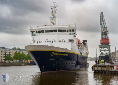
NG EXPLORER
Passengers Ship
Current Trip
CAPE TOWN
| Time Travelled | 7 days |
|---|---|
| Remaining Time | --- |
| Distance Travelled | 2678.41 nm |
| Remaining Distance | --- |
| AVG Speed | 14.3 Knots |
| MAX Speed | 16 Knots |
| AVG Wind | 12.8 knots |
| MAX Wind | 20 knots |
| MIN Temp | 14.6°C / 58.28°F |
| MAX Temp | 28.9°C / 84.02°F |
| Dybgang | 4.9 m |
| Position Modtaget | 7 d siden |
Current Position
| Longitude | 16.18777° |
|---|---|
| Latitude | -32.06625° |
| Status | Moored |
| Fart | 14.4 Knots |
| Kurs | 313.7° |
| Område | South Atlantic Ocean |
| Station | T-AIS |
| Position Modtaget | 7 d siden |
Info
Information
The current position of NG EXPLORER is in South Atlantic Ocean with coordinates -32.06625° / 16.18777° as reported on 2024-04-19 06:11 by AIS to our vessel tracker app. The vessel's current speed is 14.4 Knots
The vessel NG EXPLORER (IMO: 8019356, MMSI: 309336000) is a Passengers Ship that was built in 1982 ( 42 år gamle ). It's sailing under the flag of [BS] Bahamas.
In this page you can find informations about the vessels current position, last detected port calls, and current voyage information. If the vessels is not in coverage by AIS you will find the latest position.
The current position of NG EXPLORER is detected by our AIS receivers and we are not responsible for the reliability of the data. The last position was recorded while the vessel was in Coverage by the Ais receivers of our vessel tracking app.
The current draught of NG EXPLORER as reported by AIS is 4.9 meters
Weather
| Temperature | 28.4°C / 83.12°F |
|---|---|
| Wind Speed | 8 knots |
| Direction | 139° SE |
| Pressure | 1009.4 hPa |
| Humidity | 76.8 % |
| Cloud Coverage | 100 % |
Featured Company
Last Port Calls
| Port | Arrival | Departure | Time In Port |
|---|---|---|---|
| 2024-04-18 13:50 | 2024-04-18 19:15 | 5 h | |
| 2024-04-11 05:22 | 2024-04-11 13:47 | 8 h | |
| 2024-04-10 04:46 | 2024-04-10 19:39 | 14 h | |
| 2024-04-04 05:28 | 2024-04-04 14:04 | 8 h | |
| 2024-03-31 10:19 | 2024-04-01 17:08 | 1 d | |
| 2024-03-29 06:56 | 2024-03-29 17:12 | 10 h | |
| 2024-03-28 08:24 | 2024-03-28 14:47 | 6 h | |
| 2024-03-26 03:20 | 2024-03-27 11:52 | 1 d | |
| 2024-03-07 23:42 | 2024-03-08 21:17 | 21 h | |
| 2024-02-17 00:22 | 2024-02-17 21:51 | 21 h |
Most Visited Ports (Last year)
| Port | Arrivals | |
|---|---|---|
| 14 | ||
| 4 | ||
| 3 | ||
| 3 | ||
| 3 | ||
| 3 |
Last Trips
| Origin | Departure | Destination | Arrival | Distance | |
|---|---|---|---|---|---|
| 2024-04-11 16:47 | 2024-04-18 15:50 | 2401.08 nm | |||
| 2024-04-10 22:39 | 2024-04-11 08:22 | 50.09 nm | |||
| 2024-04-04 17:04 | 2024-04-10 07:46 | 1424.44 nm | |||
| 2024-04-01 19:08 | 2024-04-04 08:28 | 707.75 nm | |||
| 2024-03-29 19:12 | 2024-03-31 12:19 | 475.09 nm | |||
| 2024-03-28 16:47 | 2024-03-29 08:56 | 206.59 nm | |||
| 2024-03-27 13:52 | 2024-03-28 10:24 | 263.17 nm | |||
| 2024-03-08 18:17 | 2024-03-26 05:20 | 4514.90 nm | |||
| 2024-02-17 18:51 | 2024-03-07 20:42 | 3475.19 nm | |||
| 2024-02-07 19:09 | 2024-02-16 21:22 | 1858.34 nm |
Events
| Tid | Hændelsen | Detaljer | Position / Dest | Info |
|---|---|---|---|---|
| 2024-04-19 06:11 | Udenfor Dækning |
-32.06625 / 16.18777
South Atlantic Ocean
|
Fart: 14.4 kn Kurs: 313.7° |
|
| 2024-04-19 05:30 | Status er ændret | Moored Default |
-32.18285 / 16.32147
CAPE TOWN
|
Fart: 14.6 kn Kurs: 317° |
| 2024-04-19 05:30 | Indenfor Dækning |
-32.17938 / 16.31770
South Atlantic Ocean
|
Fart: 14.7 kn Kurs: 316.9° |
|
| 2024-04-19 04:13 | Status er ændret | Default Moored |
-32.40642 / 16.57147
CAPE TOWN
|
Fart: 14.5 kn Kurs: 313° |
| 2024-04-19 03:47 | Udenfor Dækning |
-32.47901 / 16.66682
South Atlantic Ocean
|
Fart: 14.5 kn Kurs: 313° |
|
| 2024-04-19 03:23 | Status er ændret | Moored Default |
-32.54355 / 16.74942
CAPE TOWN
|
Fart: 14.8 kn Kurs: 315° |
| 2024-04-19 03:21 | Indenfor Dækning |
-32.54355 / 16.74942
South Atlantic Ocean
|
Fart: 14.9 kn Kurs: 314.2° |
|
| 2024-04-19 02:54 | Status er ændret | Default Moored |
-32.62972 / 16.85034
CAPE TOWN
|
Fart: 14.7 kn Kurs: 312.2° |
| 2024-04-19 02:22 | Udenfor Dækning |
-32.72020 / 16.95830
South Atlantic Ocean
|
Fart: 14.7 kn Kurs: 312.2° |
|
| 2024-04-19 02:11 | Status er ændret | Moored Default |
-32.75142 / 16.99814
CAPE TOWN
|
Fart: 14.6 kn Kurs: 310° |