
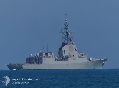
NATO WARSHIP F-102
Not available
Current Trip
FIRING EXERCISE
| Time Travelled | 5 days |
|---|---|
| Remaining Time | --- |
| Distance Travelled | 11.39 nm |
| Remaining Distance | --- |
| AVG Speed | 12.2 Knots |
| MAX Speed | 13.9 Knots |
| AVG Wind | 20.8 knots |
| MAX Wind | 21.9 knots |
| MIN Temp | 8.6°C / 47.48°F |
| MAX Temp | 9.6°C / 49.28°F |
| Dybgang | 0 m |
| Position Modtaget | 5 d siden |
Current Position
| Longitude | 5.44441° |
|---|---|
| Latitude | 59.10958° |
| Status | Under way using engine |
| Fart | 5.8 Knots |
| Kurs | 252.6° |
| Område | North Sea |
| Station | T-AIS |
| Position Modtaget | 5 d siden |
Info
Information
The current position of NATO WARSHIP F-102 is in North Sea with coordinates 59.10958° / 5.44441° as reported on 2024-04-29 11:23 by AIS to our vessel tracker app. The vessel's current speed is 5.8 Knots
The vessel NATO WARSHIP F-102 (MMSI: 224800000) is a Not available It's sailing under the flag of [ES] Spain.
In this page you can find informations about the vessels current position, last detected port calls, and current voyage information. If the vessels is not in coverage by AIS you will find the latest position.
The current position of NATO WARSHIP F-102 is detected by our AIS receivers and we are not responsible for the reliability of the data. The last position was recorded while the vessel was in Coverage by the Ais receivers of our vessel tracking app.
Weather
| Temperature | 8.7°C / 47.66°F |
|---|---|
| Wind Speed | 21 knots |
| Direction | 178° S |
| Pressure | 1014.7 hPa |
| Humidity | 78.6 % |
| Cloud Coverage | 94 % |
Featured Company
Last Port Calls
| Port | Arrival | Departure | Time In Port |
|---|---|---|---|
| 2024-04-25 07:42 | 2024-04-29 10:20 | 4 d | |
| 2024-04-12 05:09 | 2024-04-15 15:15 | 3 d | |
| 2024-03-25 08:03 | 2024-04-02 10:08 | 8 d | |
| 2024-03-19 09:09 |
Most Visited Ports (Last year)
| Port | Arrivals | |
|---|---|---|
| 1 | ||
| 1 | ||
| 1 | ||
| 1 | ||
| 1 |
Last Trips
| Origin | Departure | Destination | Arrival | Distance | |
|---|---|---|---|---|---|
| 2024-04-15 18:15 | 2024-04-25 09:42 | 1096.64 nm | |||
| 2024-04-02 12:08 | 2024-04-12 08:09 | 484.11 nm | |||
| 2024-02-24 09:07 | 2024-03-19 10:09 | 925.30 nm |
Events
| Tid | Hændelsen | Detaljer | Position / Dest | Info |
|---|---|---|---|---|
| 2024-04-29 11:23 | Udenfor Dækning |
59.10958 / 5.44441
North Sea
|
Fart: 5.8 kn Kurs: 252.6° |
|
| 2024-04-29 10:20 | Afsejlet fra sidste havn |
|
58.98931 / 5.70627
FIRING EXERCISE
|
Fart: 5.2 kn Kurs: 330.6° |
| 2024-04-29 10:07 | START Sejllads |
58.97608 / 5.72734
[NO] STAVANGER
|
Fart: 3.3 kn Kurs: 325° |
|
| 2024-04-29 10:03 | Status er ændret | Under way using engine Moored |
58.97438 / 5.72819
[NO] STAVANGER
|
Fart: 1.7 kn Kurs: 511° |
| 2024-04-29 09:12 | Indenfor Dækning |
58.97186 / 5.72967
North Sea
[NO] STAVANGER
|
Fart: Kurs: 511° |
|
| 2024-04-25 07:56 | Udenfor Dækning |
58.97188 / 5.72967
North Sea
[NO] STAVANGER
|
Fart: Kurs: 511° |
|
| 2024-04-25 07:43 | STOP Sejllads |
58.97225 / 5.72913
[NO] STAVANGER
|
Fart: 0.2 kn Kurs: 511° |
|
| 2024-04-25 07:42 | Skibe i havn |
|
58.97236 / 5.72908
[NO] STAVANGER
|
Fart: 0.6 kn Kurs: 511° |
| 2024-04-25 04:34 | Ændre havområde | Norwegian part of the North Sea Danish part of the Kattegat |
58.89538 / 5.21496
North Sea
|
Fart: 12.5 kn Kurs: 350.2° |
| 2024-04-25 04:33 | Indenfor Dækning |
58.89538 / 5.21496
North Sea
|
Fart: 12.5 kn Kurs: 350.2° |