
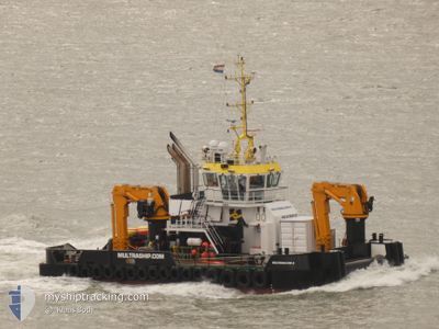
MULTRASALVOR 6
Tug
Current Trip
FEHMARN PROJECT
| Time Travelled | 65 days |
|---|---|
| Remaining Time | --- |
| Distance Travelled | 281.36 nm |
| Remaining Distance | --- |
| AVG Speed | 6.3 Knots |
| MAX Speed | 10.5 Knots |
| AVG Wind | 11 knots |
| MAX Wind | 24.8 knots |
| MIN Temp | 11°C / 51.8°F |
| MAX Temp | 25.9°C / 78.62°F |
| Dybgang | 3.8 m |
| Position Modtaget | 2 m siden |
Current Position
| Longitude | 11.37427° |
|---|---|
| Latitude | 54.63747° |
| Status | Under way using engine |
| Fart | |
| Kurs | 331° |
| Område | Baltic Sea |
| Station | T-AIS |
| Position Modtaget | 2 m siden |
Info
Information
The current position of MULTRASALVOR 6 is in Baltic Sea with coordinates 54.63747° / 11.37427° as reported on 2024-07-07 09:07 by AIS to our vessel tracker app. The vessel's current speed is 0 Knots
The vessel MULTRASALVOR 6 (IMO: 9766413, MMSI: 244475000) is a Tug It's sailing under the flag of [NL] Netherlands.
In this page you can find informations about the vessels current position, last detected port calls, and current voyage information. If the vessels is not in coverage by AIS you will find the latest position.
The current position of MULTRASALVOR 6 is detected by our AIS receivers and we are not responsible for the reliability of the data. The last position was recorded while the vessel was in Coverage by the Ais receivers of our vessel tracking app.
The current draught of MULTRASALVOR 6 as reported by AIS is 3.8 meters
Weather
| Temperature | 15.9°C / 60.62°F |
|---|---|
| Wind Speed | 19 knots |
| Direction | 239° WSW |
| Pressure | 1009.7 hPa |
| Humidity | 73.4 % |
| Cloud Coverage | 67 % |
Featured Company
Most Visited Ports (Last year)
| Port | Arrivals | |
|---|---|---|
| 350 | ||
| 26 | ||
| 7 | ||
| 2 | ||
| 2 | ||
| 2 |
Events
| Tid | Hændelsen | Detaljer | Position / Dest | Info |
|---|---|---|---|---|
| 2024-07-06 10:13 | STOP Sejllads | 1.28 nm, South East of RODBYHAVN |
54.63750 / 11.37429
FEHMARN PROJECT
|
Fart: 0.1 kn Kurs: 322° |
| 2024-07-06 09:53 | START Sejllads | 2.88 nm, South of RODBYHAVN |
54.60557 / 11.33437
FEHMARN PROJECT
|
Fart: 8.1 kn Kurs: 46.7° |
| 2024-07-06 09:44 | STOP Sejllads | 2.99 nm, South of RODBYHAVN |
54.60403 / 11.33217
FEHMARN PROJECT
|
Fart: 0.3 kn Kurs: 244° |
| 2024-07-06 09:42 | START Sejllads | 3.07 nm, South of RODBYHAVN |
54.60258 / 11.33297
FEHMARN PROJECT
|
Fart: 4.7 kn Kurs: 161° |
| 2024-07-06 09:39 | STOP Sejllads | 3.18 nm, South of RODBYHAVN |
54.60079 / 11.33197
FEHMARN PROJECT
|
Fart: 0.3 kn Kurs: 245° |
| 2024-07-06 09:36 | START Sejllads | 3.05 nm, South of RODBYHAVN |
54.60272 / 11.33481
FEHMARN PROJECT
|
Fart: 3.3 kn Kurs: 243° |
| 2024-07-06 09:27 | STOP Sejllads | 2.99 nm, South of RODBYHAVN |
54.60348 / 11.33781
FEHMARN PROJECT
|
Fart: 0.2 kn Kurs: 241° |
| 2024-07-06 09:24 | START Sejllads | 2.99 nm, South of RODBYHAVN |
54.60358 / 11.33726
FEHMARN PROJECT
|
Fart: 3.3 kn Kurs: 176° |
| 2024-07-06 09:15 | STOP Sejllads | 3.2 nm, South of RODBYHAVN |
54.60039 / 11.33291
FEHMARN PROJECT
|
Fart: 0.3 kn Kurs: 197° |
| 2024-07-06 09:14 | START Sejllads | 3.14 nm, South of RODBYHAVN |
54.60133 / 11.33342
FEHMARN PROJECT
|
Fart: 4.8 kn Kurs: 212° |