
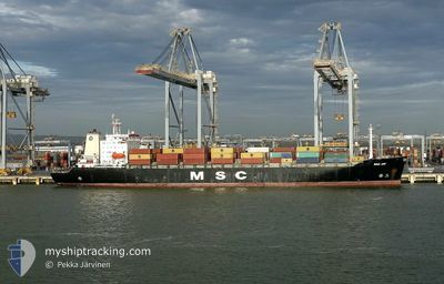
MSC JOY
Container Ship
Current Trip
| Trip Time | 2 days |
|---|---|
| Trip Distance | 708.93 nm |
| AVG Speed | 12.9 Knots |
| MAX Speed | 17.6 Knots |
| Dybgang | 9.3 m |
| AVG Wind | 12.3 knots |
| MAX Wind | 28.9 knots |
| MIN Temp | 4.9°C / 40.82°F |
| MAX Temp | 10.3°C / 50.54°F |
| Position Modtaget | 1 m siden |
Current Position
| Longitude | --- |
|---|---|
| Latitude | --- |
| Status | Moored |
| Fart | |
| Kurs | 313° |
| Område | Irish Sea and St. George's Channel |
| Station | T-AIS |
| Position Modtaget | 1 m siden |
Info
Information
The current position of MSC JOY is in Irish Sea and St. George's Channel with coordinates 53.45363° / -3.02572° as reported on 2025-02-27 18:19 by AIS to our vessel tracker app. The vessel's current speed is 0 Knots and is currently inside the port of LIVERPOOL.
The vessel MSC JOY (IMO: 9039250, MMSI: 356037000) is a Container Ship that was built in 1992 ( 33 år gamle ). It's sailing under the flag of [PA] Panama.
In this page you can find informations about the vessels current position, last detected port calls, and current voyage information. If the vessels is not in coverage by AIS you will find the latest position.
The current position of MSC JOY is detected by our AIS receivers and we are not responsible for the reliability of the data. The last position was recorded while the vessel was in Coverage by the Ais receivers of our vessel tracking app.
The current draught of MSC JOY as reported by AIS is 9.3 meters
Weather
| Temperature | 5.5°C / 41.9°F |
|---|---|
| Wind Speed | 7 knots |
| Direction | 314° NW |
| Pressure | 1025 hPa |
| Humidity | 87.2 % |
| Cloud Coverage | 9 % |
Featured Company
Last Port Calls
| Port | Arrival | Departure | Time In Port |
|---|---|---|---|
| 2025-02-27 10:38 | |||
| 2025-02-13 19:35 | 2025-02-25 06:06 | 11 d | |
| 2025-02-09 17:12 | 2025-02-11 15:44 | 1 d | |
| 2025-02-04 10:25 | 2025-02-07 18:27 | 3 d | |
| 2025-01-28 23:22 | 2025-01-31 06:59 | 2 d | |
| 2025-01-26 04:27 | 2025-01-26 12:10 | 7 h | |
| 2025-01-22 18:30 | 2025-01-24 11:36 | 1 d | |
| 2025-01-19 21:05 | 2025-01-20 16:57 | 19 h | |
| 2025-01-15 08:20 | 2025-01-16 14:14 | 1 d | |
| 2025-01-12 23:55 | 2025-01-14 09:53 | 1 d |
Last Trips
| Origin | Departure | Destination | Arrival | Distance | |
|---|---|---|---|---|---|
| 2025-02-25 07:06 | 2025-02-27 10:38 | 708.93 nm | |||
| 2025-02-11 16:44 | 2025-02-13 20:35 | 752.06 nm | |||
| 2025-02-07 19:27 | 2025-02-09 18:12 | 721.73 nm | |||
| 2025-01-31 07:59 | 2025-02-04 11:25 | 669.79 nm | |||
| 2025-01-26 13:10 | 2025-01-29 00:22 | 542.28 nm | |||
| 2025-01-24 12:36 | 2025-01-26 05:27 | 530.49 nm | |||
| 2025-01-20 16:57 | 2025-01-22 19:30 | 508.76 nm | |||
| 2025-01-16 14:14 | 2025-01-19 21:05 | 1160.66 nm | |||
| 2025-01-14 09:53 | 2025-01-15 08:20 | 208.46 nm | |||
| 2025-01-11 01:45 | 2025-01-12 23:55 | 531.07 nm |
Events
| Tid | Hændelsen | Detaljer | Position / Dest | Info |
|---|---|---|---|---|
| 2025-02-27 11:04 | Status er ændret | Moored Under way using engine |
53.45364 / -3.02576
[GB] LIVERPOOL
|
Fart: Kurs: 314° |
| 2025-02-27 10:44 | STOP Sejllads |
53.45308 / -3.02644
[GB] LIVERPOOL
|
Fart: 0.3 kn Kurs: 316° |
|
| 2025-02-27 10:38 | Skibe i havn |
|
53.45151 / -3.02706
[GB] LIVERPOOL
|
Fart: 1.9 kn Kurs: 344° |
| 2025-02-27 07:24 | Dybgangen er ændret | 9.3 8.9 |
53.50920 / -3.84195
BEANR>GBLIV
|
Fart: 10.2 kn Kurs: 90.6° |
| 2025-02-27 07:02 | Status er ændret | Under way using engine Default |
53.50616 / -3.95089
BEANR>GBLIV
|
Fart: 10.3 kn Kurs: 87° |
| 2025-02-27 06:55 | Indenfor Dækning |
53.50645 / -3.94124
Irish Sea and St. George's Channel
BEANR>GBLIV
|
Fart: 10.4 kn Kurs: 87.5° |
|
| 2025-02-27 05:40 | Status er ændret | Default Under way using engine |
53.49848 / -4.35374
BEANR>GBLIV
|
Fart: 11.1 kn Kurs: 88.1° |
| 2025-02-27 05:33 | Udenfor Dækning |
53.49780 / -4.38825
Irish Sea and St. George's Channel
BEANR>GBLIV
|
Fart: 11.1 kn Kurs: 88.1° |
|
| 2025-02-27 05:33 | Status er ændret | Under way using engine Default |
53.49778 / -4.38929
BEANR>GBLIV
|
Fart: 11.1 kn Kurs: 88° |
| 2025-02-27 05:32 | Status er ændret | Default Under way using engine |
53.49771 / -4.39528
BEANR>GBLIV
|
Fart: 11 kn Kurs: 88° |