
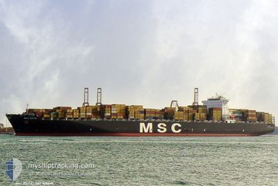
MSC ESTHI
Container Ship
Current Trip
| Time Travelled | 5 h, 28 mins |
|---|---|
| Remaining Time | 13 h, 4 mins |
| Distance Travelled | 72.42 nm |
| Remaining Distance | 201.27 nm |
| AVG Speed | 13.2 Knots |
| MAX Speed | 15.9 Knots |
| AVG Wind | 7.3 knots |
| MAX Wind | 13.8 knots |
| MIN Temp | 9°C / 48.2°F |
| MAX Temp | 16.2°C / 61.16°F |
| Dybgang | 12.2 m |
| Position Modtaget | 3 m siden |
Current Position
| Longitude | -6.77676° |
|---|---|
| Latitude | 36.11610° |
| Status | Under way using engine |
| Fart | 14.9 Knots |
| Kurs | 288° |
| Område | North Atlantic Ocean |
| Station | T-AIS |
| Position Modtaget | 3 m siden |
Info
Information
The current position of MSC ESTHI is in North Atlantic Ocean with coordinates 36.11610° / -6.77676° as reported on 2024-04-29 05:18 by AIS to our vessel tracker app. The vessel's current speed is 14.9 Knots and is heading at the port of SINES. The estimated time of arrival as calculated by MyShipTracking vessel tracking app is 2024-04-29 18:25 LT
The vessel MSC ESTHI (IMO: 9304411, MMSI: 354499000) is a Container Ship that was built in 2006 ( 18 år gamle ). It's sailing under the flag of [PA] Panama.
In this page you can find informations about the vessels current position, last detected port calls, and current voyage information. If the vessels is not in coverage by AIS you will find the latest position.
The current position of MSC ESTHI is detected by our AIS receivers and we are not responsible for the reliability of the data. The last position was recorded while the vessel was in Coverage by the Ais receivers of our vessel tracking app.
The current draught of MSC ESTHI as reported by AIS is 12.2 meters
Weather
| Temperature | 14.8°C / 58.64°F |
|---|---|
| Wind Speed | 13 knots |
| Direction | 325° NW |
| Pressure | 1015.5 hPa |
| Humidity | 69 % |
| Cloud Coverage | 100 % |
Featured Company
Last Port Calls
| Port | Arrival | Departure | Time In Port |
|---|---|---|---|
| 2024-04-28 10:58 | 2024-04-28 23:53 | 12 h | |
| 2024-04-25 12:41 | 2024-04-27 10:40 | 1 d | |
| 2024-04-21 03:27 | 2024-04-22 15:06 | 1 d | |
| 2024-04-08 07:27 | 2024-04-10 01:39 | 1 d | |
| 2024-04-02 18:44 | 2024-04-03 14:07 | 19 h | |
| 2024-04-01 01:59 | 2024-04-02 00:45 | 22 h | |
| 2024-03-28 00:08 | 2024-03-29 12:49 | 1 d | |
| 2024-02-24 23:15 | 2024-02-26 00:46 | 1 d | |
| 2024-02-21 17:31 | |||
| 2024-02-15 22:07 | 2024-02-16 13:27 | 15 h |
Most Visited Ports (Last year)
| Port | Arrivals | |
|---|---|---|
| 5 | ||
| 4 | ||
| 4 | ||
| 4 | ||
| 4 | ||
| 3 |
Last Trips
| Origin | Departure | Destination | Arrival | Distance | |
|---|---|---|---|---|---|
| 2024-04-27 12:40 | 2024-04-28 12:58 | 402.31 nm | |||
| 2024-04-22 17:06 | 2024-04-25 14:41 | 573.58 nm | |||
| 2024-04-09 21:39 | 2024-04-21 05:27 | 4858.07 nm | |||
| 2024-04-03 10:07 | 2024-04-08 03:27 | 575.73 nm | |||
| 2024-04-01 20:45 | 2024-04-02 14:44 | 131.94 nm | |||
| 2024-03-29 08:49 | 2024-03-31 21:59 | 758.73 nm | |||
| 2024-02-26 06:16 | 2024-03-27 20:08 | 11913.75 nm | |||
| 2024-02-21 23:01 | 2024-02-25 04:45 | 1190.81 nm | |||
| 2024-02-11 11:41 | 2024-02-16 03:37 | 1257.45 nm | |||
| 2024-01-29 10:13 | 2024-02-10 12:19 | 4937.33 nm |
Events
| Tid | Hændelsen | Detaljer | Position / Dest | Info |
|---|---|---|---|---|
| 2024-04-29 05:18 | Status er ændret | Under way using engine Default |
36.11610 / -6.77676
SINES
|
Fart: 14 kn Kurs: 287° |
| 2024-04-29 05:03 | Status er ændret | Default Under way using engine |
36.10166 / -6.72667
SINES
|
Fart: 14.9 kn Kurs: 288.1° |
| 2024-04-29 04:58 | Status er ændret | Under way using engine Default |
36.09543 / -6.69832
SINES
|
Fart: 14 kn Kurs: 287° |
| 2024-04-29 04:27 | Status er ændret | Default Under way using engine |
36.05777 / -6.55519
SINES
|
Fart: 14.9 kn Kurs: 288.4° |
| 2024-04-29 04:22 | Status er ændret | Under way using engine Default |
36.04886 / -6.52135
SINES
|
Fart: 15 kn Kurs: 288° |
| 2024-04-29 04:18 | Status er ændret | Default Under way using engine |
36.04500 / -6.50833
SINES
|
Fart: 15 kn Kurs: 288.4° |
| 2024-04-29 04:06 | Status er ændret | Under way using engine Default |
36.02834 / -6.44444
SINES
|
Fart: 15 kn Kurs: 287° |
| 2024-04-29 04:06 | Indenfor Dækning |
36.02834 / -6.44444
North Atlantic Ocean
SINES
|
Fart: 15 kn Kurs: 288.4° |
|
| 2024-04-29 03:04 | Status er ændret | Default Under way using engine |
35.96538 / -6.14440
SINES
|
Fart: 14.8 kn Kurs: 269.9° |
| 2024-04-29 03:01 | Udenfor Dækning |
35.96542 / -6.12869
North Atlantic Ocean
SINES
|
Fart: 14.8 kn Kurs: 269.9° |