
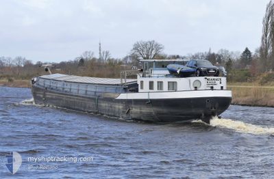
MIAMAUX
Cargo
Current Trip
MIAMAUX is out of coverage. Learn how you can join the community and extend the coverage to your area by clicking here!
AIRE SUR LA LYS
Unknown Port
ETA*
2024-05-08 16:00 UTC
| Time Travelled | 1 day |
|---|---|
| Remaining Time | --- |
| Distance Travelled | 70.49 nm |
| Remaining Distance | --- |
| AVG Speed | 5.4 Knots |
| MAX Speed | 6.2 Knots |
| AVG Wind | 4.6 knots |
| MAX Wind | 12.9 knots |
| MIN Temp | 8.1°C / 46.58°F |
| MAX Temp | 18.2°C / 64.76°F |
| Dybgang | 0 m |
| Position Modtaget | 6 h, 36 m siden |
Current Position
| Longitude | 2.42700° |
|---|---|
| Latitude | 50.63786° |
| Status | Under way using engine |
| Fart | 4.4 Knots |
| Kurs | 290.9° |
| Område | North Sea |
| Station | T-AIS |
| Position Modtaget | 6 h, 36 m siden |
Info
info
Information
The current position of MIAMAUX is in North Sea with coordinates 50.63786° / 2.42700° as reported on 2024-05-08 10:19 by AIS to our vessel tracker app. The vessel's current speed is 4.4 Knots
The vessel MIAMAUX (MMSI: 205539690) is a Cargo It's sailing under the flag of [BE] Belgium.
In this page you can find informations about the vessels current position, last detected port calls, and current voyage information. If the vessels is not in coverage by AIS you will find the latest position.
The current position of MIAMAUX is detected by our AIS receivers and we are not responsible for the reliability of the data. The last position was recorded while the vessel was in Coverage by the Ais receivers of our vessel tracking app.
Weather
| Temperature | 14.9°C / 58.82°F |
|---|---|
| Wind Speed | 10 knots |
| Direction | 9° N |
| Pressure | 1028.5 hPa |
| Humidity | 71.2 % |
| Cloud Coverage | 60 % |
Featured Company
Limited time offer - Install a base station receiver to your area and list your company on MyShipTracking Free forever!
Last Port Calls
| Port | Arrival | Departure | Time In Port |
|---|---|---|---|
| 2024-05-06 19:33 | 2024-05-07 04:43 | 9 h | |
| 2024-05-05 17:09 | 2024-05-06 14:33 | 21 h | |
| 2024-05-01 11:35 | 2024-05-05 17:04 | 4 d | |
| 2024-04-23 13:16 | 2024-04-25 19:40 | 2 d | |
| 2024-04-22 15:07 | 2024-04-22 15:41 | 33 m | |
| 2024-04-19 11:23 | 2024-04-22 10:50 | 2 d | |
| 2024-04-11 11:44 | 2024-04-11 12:10 | 25 m | |
| 2024-04-08 04:51 | 2024-04-08 07:12 | 2 h | |
| 2024-03-26 11:48 | 2024-03-26 14:13 | 2 h | |
| 2024-03-26 10:24 | 2024-03-26 10:48 | 24 m |
Last Trips
| Origin | Departure | Destination | Arrival | Distance | |
|---|---|---|---|---|---|
| 2024-05-06 16:33 | 2024-05-06 21:33 | 33.10 nm | |||
| 2024-05-05 19:04 | 2024-05-05 19:09 | 0.06 nm | |||
| 2024-04-25 21:40 | 2024-05-01 13:35 | 149.03 nm | |||
| 2024-04-22 17:41 | 2024-04-23 15:16 | 61.93 nm | |||
| 2024-04-22 12:50 | 2024-04-22 17:07 | 15.58 nm | |||
| 2024-04-11 14:10 | 2024-04-19 13:23 | 164.73 nm | |||
| 2024-04-08 09:12 | 2024-04-11 13:44 | 115.21 nm | |||
| 2024-03-26 15:13 | 2024-04-08 06:51 | 129.88 nm | |||
| 2024-03-26 11:48 | 2024-03-26 12:48 | 8.21 nm | |||
| 2024-03-26 08:15 | 2024-03-26 11:24 | 23.14 nm |
Events
| Tid | Hændelsen | Detaljer | Position / Dest | Info |
|---|---|---|---|---|
| 2024-05-08 10:21 | Status er ændret | Default Under way using engine |
50.63833 / 2.42333
AIRE SUR LA LYS
|
Fart: 4.4 kn Kurs: 290.9° |
| 2024-05-08 10:19 | Udenfor Dækning |
50.63786 / 2.42700
North Sea
AIRE SUR LA LYS
|
Fart: 4.4 kn Kurs: 290.9° |
|
| 2024-05-08 10:18 | Indenfor Dækning |
50.63786 / 2.42700
North Sea
AIRE SUR LA LYS
|
Fart: 4.4 kn Kurs: 290.9° |
|
| 2024-05-08 07:51 | START Sejllads | 14.71 nm, North West of AUBY |
50.52667 / 2.72667
AIRE SUR LA LYS
|
Fart: 5 kn Kurs: 294° |
| 2024-05-08 07:24 | STOP Sejllads | 13.56 nm, North West of AUBY |
50.52167 / 2.75667
AIRE SUR LA LYS
|
Fart: Kurs: -1° |
| 2024-05-08 05:57 | START Sejllads | 9.74 nm, North West of AUBY |
50.53333 / 2.89667
AIRE SUR LA LYS
|
Fart: 5 kn Kurs: 219° |
| 2024-05-07 17:54 | STOP Sejllads | 9.23 nm, South West of MARQUETTE-LEZ-LILLE |
50.54666 / 2.92167
AIRE SUR LA LYS
|
Fart: Kurs: -1° |
| 2024-05-07 16:36 | START Sejllads | 2.4 nm, South West of MARQUETTE-LEZ-LILLE |
50.63500 / 3.03667
AIRE SUR LA LYS
|
Fart: 5 kn Kurs: 191° |
| 2024-05-07 15:42 | STOP Sejllads | 1.49 nm, South of MARQUETTE-LEZ-LILLE |
50.64834 / 3.04833
AIRE SUR LA LYS
|
Fart: Kurs: -1° |
| 2024-05-07 14:42 | START Sejllads | 2.59 nm, North West of MARQUETTE-LEZ-LILLE |
50.70167 / 3.01500
AIRE SUR LA LYS
|
Fart: 4 kn Kurs: -1° |