
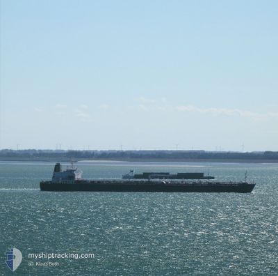
MEZAIRA'A
Oil Products Tanker
Current Trip
| Trip Time | 13 days |
|---|---|
| Trip Distance | 3580.21 nm |
| AVG Speed | 11.5 Knots |
| MAX Speed | 16.3 Knots |
| Dybgang | 8.5 m |
| AVG Wind | 5.8 knots |
| MAX Wind | 17.8 knots |
| MIN Temp | 24.7°C / 76.46°F |
| MAX Temp | 29.3°C / 84.74°F |
| Position Modtaget | 1 m siden |
Current Position
| Longitude | --- |
|---|---|
| Latitude | --- |
| Status | Moored |
| Fart | |
| Kurs | 338° |
| Område | Persian Gulf |
| Station | T-AIS |
| Position Modtaget | 1 m siden |
Info
Information
The current position of MEZAIRA'A is in Persian Gulf with coordinates 25.01434° / 55.04799° as reported on 2024-11-22 22:07 by AIS to our vessel tracker app. The vessel's current speed is 0 Knots and is currently inside the port of JEBEL ALI.
The vessel MEZAIRA'A (IMO: 9487275, MMSI: 636014947) is a Oil Products Tanker that was built in 2011 ( 13 år gamle ). It's sailing under the flag of [LR] Liberia.
In this page you can find informations about the vessels current position, last detected port calls, and current voyage information. If the vessels is not in coverage by AIS you will find the latest position.
The current position of MEZAIRA'A is detected by our AIS receivers and we are not responsible for the reliability of the data. The last position was recorded while the vessel was in Coverage by the Ais receivers of our vessel tracking app.
The current draught of MEZAIRA'A as reported by AIS is 8.5 meters
Weather
| Temperature | 26.7°C / 80.06°F |
|---|---|
| Wind Speed | 3 knots |
| Direction | 314° NW |
| Pressure | 1013.2 hPa |
| Humidity | 68.6 % |
| Cloud Coverage | 88 % |
Featured Company
Last Port Calls
| Port | Arrival | Departure | Time In Port |
|---|---|---|---|
| 2024-11-23 01:23 | |||
| 2024-11-06 16:37 | 2024-11-09 09:21 | 2 d | |
| 2024-09-26 01:58 | 2024-09-27 09:02 | 1 d |
Most Visited Ports (Last year)
| Port | Arrivals | |
|---|---|---|
| 3 | ||
| 2 | ||
| 2 | ||
| 2 | ||
| 1 | ||
| 1 |
Last Trips
| Origin | Departure | Destination | Arrival | Distance | |
|---|---|---|---|---|---|
| 2024-11-09 09:21 | 2024-11-23 01:23 | 3580.21 nm | |||
| 2024-09-27 09:02 | 2024-11-06 16:37 | 7561.08 nm | |||
| 2024-08-22 00:43 | 2024-09-26 01:58 | 7009.69 nm |
Events
| Tid | Hændelsen | Detaljer | Position / Dest | Info |
|---|---|---|---|---|
| 2024-11-22 21:49 | Status er ændret | Moored Under way using engine |
25.01426 / 55.04628
[AE] JEBEL ALI
|
Fart: 1.9 kn Kurs: 1° |
| 2024-11-22 21:37 | STOP Sejllads |
25.01617 / 55.04320
[AE] JEBEL ALI
|
Fart: 0.3 kn Kurs: 148° |
|
| 2024-11-22 21:23 | Skibe i havn |
|
25.02781 / 55.03687
[AE] JEBEL ALI
|
Fart: 6 kn Kurs: 149.5° |
| 2024-11-22 17:12 | START Sejllads |
25.52443 / 54.87508
AEJEA
|
Fart: 3.1 kn Kurs: 181° |
|
| 2024-11-22 16:52 | Status er ændret | Under way using engine At anchor |
25.52605 / 54.87403
AEJEA
|
Fart: 0.1 kn Kurs: 216° |
| 2024-11-22 12:49 | Status er ændret | At anchor Default |
25.52621 / 54.87134
AEJEA
|
Fart: 0.1 kn Kurs: 127° |
| 2024-11-22 12:34 | Status er ændret | Default At anchor |
25.52581 / 54.87104
AEJEA
|
Fart: 0.1 kn Kurs: 104° |
| 2024-11-22 12:16 | Status er ændret | At anchor Default |
25.52513 / 54.87076
AEJEA
|
Fart: 0.1 kn Kurs: 77° |
| 2024-11-22 12:07 | Indenfor Dækning |
25.52513 / 54.87076
Persian Gulf
|
Fart: 0.1 kn Kurs: 336.9° |
|
| 2024-11-22 11:01 | Udenfor Dækning |
25.52460 / 54.87083
Persian Gulf
|
Fart: Kurs: 26° |