
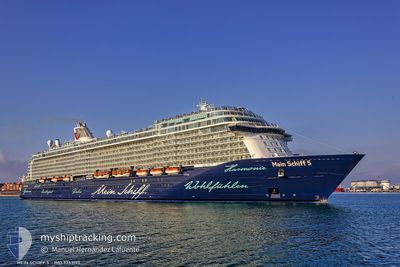
MEIN SCHIFF 5
Passenger
Current Trip
| Time Travelled | 22 h, 27 mins |
|---|---|
| Remaining Time | 9 h, 19 mins |
| Distance Travelled | 380.32 nm |
| Remaining Distance | 172.87 nm |
| AVG Speed | 17 Knots |
| MAX Speed | 18.1 Knots |
| AVG Wind | 8.7 knots |
| MAX Wind | 25 knots |
| MIN Temp | 17.8°C / 64.04°F |
| MAX Temp | 23.5°C / 74.3°F |
| Dybgang | 8.2 m |
| Position Modtaget | 1 m siden |
Current Position
| Longitude | --- |
|---|---|
| Latitude | --- |
| Status | Under way using engine |
| Fart | 16.8 Knots |
| Kurs | 275.2° |
| Område | Aegean Sea |
| Station | T-AIS |
| Position Modtaget | 1 m siden |
Info
Information
The current position of MEIN SCHIFF 5 is in Aegean Sea with coordinates 36.19034° / 25.87643° as reported on 2024-10-21 13:53 by AIS to our vessel tracker app. The vessel's current speed is 16.8 Knots and is heading at the port of PIRAEUS. The estimated time of arrival as calculated by MyShipTracking vessel tracking app is 2024-10-21 23:13 LT
The vessel MEIN SCHIFF 5 (IMO: 9753193, MMSI: 256235000) is a Passenger It's sailing under the flag of [MT] Malta.
In this page you can find informations about the vessels current position, last detected port calls, and current voyage information. If the vessels is not in coverage by AIS you will find the latest position.
The current position of MEIN SCHIFF 5 is detected by our AIS receivers and we are not responsible for the reliability of the data. The last position was recorded while the vessel was in Coverage by the Ais receivers of our vessel tracking app.
The current draught of MEIN SCHIFF 5 as reported by AIS is 8.2 meters
Weather
| Temperature | 19.9°C / 67.82°F |
|---|---|
| Wind Speed | 25 knots |
| Direction | 349° N |
| Pressure | 1025 hPa |
| Humidity | 59.2 % |
| Cloud Coverage | 5 % |
Featured Company
Last Port Calls
| Port | Arrival | Departure | Time In Port |
|---|---|---|---|
| 2024-10-20 03:28 | 2024-10-20 15:27 | 11 h | |
| 2024-10-17 23:58 | 2024-10-18 19:24 | 19 h | |
| 2024-10-16 04:12 | 2024-10-16 16:27 | 12 h | |
| 2024-10-13 01:44 | 2024-10-13 16:12 | 14 h | |
| 2024-10-12 02:56 | 2024-10-12 15:46 | 12 h | |
| 2024-10-11 00:01 | 2024-10-11 19:20 | 19 h | |
| 2024-10-09 03:11 | 2024-10-09 16:33 | 13 h | |
| 2024-10-07 01:11 | 2024-10-07 17:16 | 16 h | |
| 2024-10-06 04:15 | 2024-10-06 16:11 | 11 h | |
| 2024-10-05 05:41 | 2024-10-05 16:09 | 10 h |
Most Visited Ports (Last year)
| Port | Arrivals | |
|---|---|---|
| 21 | ||
| 12 | ||
| 9 | ||
| 8 | ||
| 8 | ||
| 8 |
Last Trips
| Origin | Departure | Destination | Arrival | Distance | |
|---|---|---|---|---|---|
| 2024-10-18 22:24 | 2024-10-20 06:28 | 411.00 nm | |||
| 2024-10-16 19:27 | 2024-10-18 02:58 | 453.98 nm | |||
| 2024-10-13 19:12 | 2024-10-16 07:12 | 550.00 nm | |||
| 2024-10-12 18:46 | 2024-10-13 04:44 | 158.87 nm | |||
| 2024-10-11 22:20 | 2024-10-12 05:56 | 66.32 nm | |||
| 2024-10-09 19:33 | 2024-10-11 03:01 | 439.26 nm | |||
| 2024-10-07 20:16 | 2024-10-09 06:11 | 557.55 nm | |||
| 2024-10-06 19:11 | 2024-10-07 04:11 | 101.01 nm | |||
| 2024-10-05 19:09 | 2024-10-06 07:15 | 186.09 nm | |||
| 2024-10-04 22:21 | 2024-10-05 08:41 | 167.77 nm |
Events
| Tid | Hændelsen | Detaljer | Position / Dest | Info |
|---|---|---|---|---|
| 2024-10-21 08:28 | Ændre havområde | Greek part of the Aegean Sea Greek part of the Mediterranean Sea - Eastern Basin |
35.83880 / 27.64071
Aegean Sea
GR PIR
|
Fart: 17.4 kn Kurs: 306.3° |
| 2024-10-21 05:03 | Ændre havområde | Greek part of the Mediterranean Sea - Eastern Basin Turkish part of the Mediterranean Sea - Eastern Basin |
35.51828 / 28.81111
Mediterranean Sea - Eastern Basin
GR PIR
|
Fart: 17.8 kn Kurs: 297° |
| 2024-10-21 04:50 | Ændre havområde | Turkish part of the Mediterranean Sea - Eastern Basin Cypriote part of the Mediterranean Sea - Eastern Basin |
35.48774 / 28.88431
Mediterranean Sea - Eastern Basin
GR PIR
|
Fart: 17.9 kn Kurs: 296.9° |
| 2024-10-21 04:48 | Status er ændret | Under way using engine Default |
35.48502 / 28.89083
GR PIR
|
Fart: 17.9 kn Kurs: 287° |
| 2024-10-21 04:48 | Indenfor Dækning |
35.48774 / 28.88431
Mediterranean Sea - Eastern Basin
GR PIR
|
Fart: 17.9 kn Kurs: 296.9° |
|
| 2024-10-20 18:20 | Status er ændret | Default Under way using engine |
34.58884 / 32.39998
GR PIR
|
Fart: 17.6 kn Kurs: 283.9° |
| 2024-10-20 18:16 | Udenfor Dækning |
34.58416 / 32.42041
Mediterranean Sea - Eastern Basin
GR PIR
|
Fart: 17.6 kn Kurs: 283.9° |
|
| 2024-10-20 15:27 | Afsejlet fra sidste havn |
|
34.65447 / 33.03828
GR PIR
|
Fart: 7.9 kn Kurs: 67° |
| 2024-10-20 15:20 | START Sejllads |
34.64960 / 33.02428
[CY] LIMASSOL
|
Fart: 3.1 kn Kurs: 88° |
|
| 2024-10-20 15:07 | Status er ændret | Under way using engine Moored |
34.65320 / 33.02211
[CY] LIMASSOL
|
Fart: 0.1 kn Kurs: 154° |