
MAYERA
Cargo
Current Trip
AALTER
| Time Travelled | 27 days |
|---|---|
| Remaining Time | --- |
| Distance Travelled | 224.99 nm |
| Remaining Distance | --- |
| AVG Speed | 6.2 Knots |
| MAX Speed | 6.2 Knots |
| AVG Wind | 12.3 knots |
| MAX Wind | 15 knots |
| MIN Temp | -0.6°C / 30.92°F |
| MAX Temp | 14.1°C / 57.38°F |
| Dybgang | 2.3 m |
| Position Modtaget | 7 h, 5 m siden |
Current Position
| Longitude | --- |
|---|---|
| Latitude | --- |
| Status | Under way using engine |
| Fart | 7.3 Knots |
| Kurs | 48.1° |
| Område | North Sea |
| Station | T-AIS |
| Position Modtaget | 7 h, 5 m siden |
Info
Information
The current position of MAYERA is in North Sea with coordinates 52.32010° / 10.48904° as reported on 2026-01-04 13:30 by AIS to our vessel tracker app. The vessel's current speed is 7.3 Knots
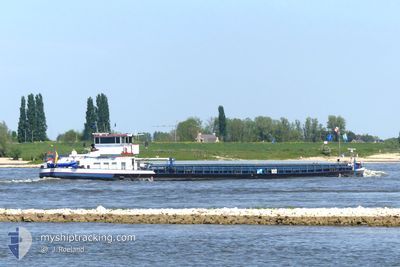
The vessel MAYERA (MMSI: 211147040) is a Cargo It's sailing under the flag of [DE] Germany.
In this page you can find informations about the vessels current position, last detected port calls, and current voyage information. If the vessels is not in coverage by AIS you will find the latest position.
The current position of MAYERA is detected by our AIS receivers and we are not responsible for the reliability of the data. The last position was recorded while the vessel was in Coverage by the Ais receivers of our vessel tracking app.
The current draught of MAYERA as reported by AIS is 2.3 meters
Weather
| Temperature | 0.6°C / 33.08°F |
|---|---|
| Wind Speed | 14 knots |
| Direction | 255° WSW |
| Pressure | 1005.7 hPa |
| Humidity | 91.4 % |
| Cloud Coverage | 100 % |
Featured Company
Last Port Calls
| Port | Arrival | Departure | Time In Port |
|---|---|---|---|
| 2025-12-08 10:45 | 2025-12-08 11:04 | 19 m | |
| 2025-12-05 16:25 | 2025-12-07 16:25 | 2 d | |
| 2025-11-30 18:17 | 2025-12-05 12:51 | 4 d | |
| 2025-11-29 16:00 | 2025-11-30 10:35 | 18 h | |
| 2025-11-28 08:02 | 2025-11-29 09:20 | 1 d | |
| 2025-11-27 15:20 | 2025-11-27 16:35 | 1 h | |
| 2025-11-27 13:23 | 2025-11-27 15:06 | 1 h | |
| 2025-11-16 08:25 | 2025-11-18 06:48 | 1 d | |
| 2025-11-15 22:07 | 2025-11-16 06:09 | 8 h | |
| 2025-11-14 13:11 | 2025-11-15 12:45 | 23 h |
Last Trips
| Origin | Departure | Destination | Arrival | Distance | |
|---|---|---|---|---|---|
| 2025-12-07 16:25 | 2025-12-08 10:45 | 58.77 nm | |||
| 2025-12-05 12:51 | 2025-12-05 16:25 | 8.52 nm | |||
| 2025-11-30 10:35 | 2025-11-30 18:17 | 65.10 nm | |||
| 2025-11-29 09:20 | 2025-11-29 16:00 | 64.89 nm | |||
| 2025-11-27 16:35 | 2025-11-28 08:02 | 8.31 nm | |||
| 2025-11-27 15:06 | 2025-11-27 15:20 | 0.17 nm | |||
| 2025-11-18 06:48 | 2025-11-27 13:23 | 192.94 nm | |||
| 2025-11-16 06:09 | 2025-11-16 08:25 | 12.97 nm | |||
| 2025-11-15 12:45 | 2025-11-15 22:07 | 93.52 nm | |||
| 2025-11-12 14:48 | 2025-11-14 13:11 | 41.04 nm |
Events
| Tid | Hændelsen | Detaljer | Position / Dest | Info |
|---|---|---|---|---|
| 2026-01-04 13:35 | Status er ændret | Default Under way using engine |
52.32719 / 10.50216
AALTER
|
Fart: 7.3 kn Kurs: 48.1° |
| 2026-01-04 13:30 | Udenfor Dækning |
52.32010 / 10.48904
North Sea
|
Fart: 7.3 kn Kurs: 48.1° |
|
| 2026-01-04 13:23 | Indenfor Dækning |
52.31317 / 10.47233
North Sea
|
Fart: 5.7 kn Kurs: 73.6° |
|
| 2026-01-04 08:42 | Udenfor Dækning |
52.40781 / 9.73929
North Sea
|
Fart: 6.9 kn Kurs: 118.9° |
|
| 2026-01-04 08:30 | Indenfor Dækning |
52.41823 / 9.70927
North Sea
|
Fart: 6.4 kn Kurs: 120.5° |
|
| 2026-01-03 17:46 | Udenfor Dækning |
52.40409 / 9.58335
North Sea
|
Fart: 5.1 kn Kurs: 53.7° |
|
| 2026-01-03 15:55 | Status er ændret | Under way using engine Default |
52.38104 / 9.24725
AALTER
|
Fart: 7.1 kn Kurs: 81° |
| 2026-01-03 15:52 | Status er ændret | Default Under way using engine |
52.37997 / 9.23681
AALTER
|
Fart: 6.9 kn Kurs: 81° |
| 2026-01-03 15:46 | Indenfor Dækning |
52.37800 / 9.21690
North Sea
|
Fart: 6.9 kn Kurs: 81° |