
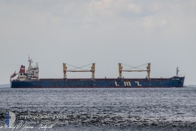
LMZ PHOEBE
Cargo
Current Trip
| Time Travelled | 22 days |
|---|---|
| Remaining Time | --- |
| Distance Travelled | 5620.19 nm |
| Remaining Distance | --- |
| AVG Speed | 10.4 Knots |
| MAX Speed | 13.2 Knots |
| AVG Wind | 13.2 knots |
| MAX Wind | 27.9 knots |
| MIN Temp | -0.7°C / 30.74°F |
| MAX Temp | 28.9°C / 84.02°F |
| Dybgang | 11.5 m |
| Position Modtaget | 8 d siden |
Current Position
| Longitude | -18.41229° |
|---|---|
| Latitude | 28.49265° |
| Status | Under way using engine |
| Fart | 11.9 Knots |
| Kurs | 211.1° |
| Område | North Atlantic Ocean |
| Station | T-AIS |
| Position Modtaget | 8 d siden |
Info
Information
The current position of LMZ PHOEBE is in North Atlantic Ocean with coordinates 28.49265° / -18.41229° as reported on 2024-05-01 17:27 by AIS to our vessel tracker app. The vessel's current speed is 11.9 Knots and is heading at the port of SAO FRANCISCO DO SUL. The estimated time of arrival as calculated by MyShipTracking vessel tracking app is 2024-05-14 10:00 LT
The vessel LMZ PHOEBE (IMO: 9599389, MMSI: 538005370) is a Cargo It's sailing under the flag of [MH] Marshall Is.
In this page you can find informations about the vessels current position, last detected port calls, and current voyage information. If the vessels is not in coverage by AIS you will find the latest position.
The current position of LMZ PHOEBE is detected by our AIS receivers and we are not responsible for the reliability of the data. The last position was recorded while the vessel was in Coverage by the Ais receivers of our vessel tracking app.
The current draught of LMZ PHOEBE as reported by AIS is 11.5 meters
Weather
| Temperature | 28.4°C / 83.12°F |
|---|---|
| Wind Speed | 13 knots |
| Direction | 101° E |
| Pressure | 1009.5 hPa |
| Humidity | 68.1 % |
| Cloud Coverage | 83 % |
Featured Company
Last Port Calls
| Port | Arrival | Departure | Time In Port |
|---|---|---|---|
| 2024-04-15 03:53 | 2024-04-18 09:49 | 3 d | |
| 2024-03-21 05:45 | 2024-03-28 21:54 | 7 d |
Most Visited Ports (Last year)
| Port | Arrivals | |
|---|---|---|
| 1 | ||
| 1 | ||
| 1 | ||
| 1 | ||
| 1 | ||
| 1 |
Last Trips
| Origin | Departure | Destination | Arrival | Distance | |
|---|---|---|---|---|---|
| 2024-03-28 22:54 | 2024-04-15 06:53 | 4422.96 nm | |||
| 2024-02-13 22:51 | 2024-03-21 06:45 | 7314.07 nm |
Events
| Tid | Hændelsen | Detaljer | Position / Dest | Info |
|---|---|---|---|---|
| 2024-05-01 17:30 | Status er ændret | Default Under way using engine |
28.48167 / -18.41833
BR SFS
|
Fart: 11.9 kn Kurs: 211.1° |
| 2024-05-01 17:27 | Udenfor Dækning |
28.49265 / -18.41229
North Atlantic Ocean
BR SFS
|
Fart: 11.9 kn Kurs: 211.1° |
|
| 2024-05-01 17:26 | Status er ændret | Under way using engine Default |
28.49705 / -18.40945
BR SFS
|
Fart: 11 kn Kurs: 210° |
| 2024-05-01 17:21 | Status er ændret | Default Under way using engine |
28.50833 / -18.40167
BR SFS
|
Fart: 12.1 kn Kurs: 206.7° |
| 2024-05-01 17:03 | Status er ændret | Under way using engine Default |
28.56643 / -18.37064
BR SFS
|
Fart: 12 kn Kurs: 201° |
| 2024-05-01 16:33 | Status er ændret | Default Under way using engine |
28.65833 / -18.32500
BR SFS
|
Fart: 12 kn Kurs: 205.7° |
| 2024-05-01 16:09 | Indenfor Dækning |
28.73347 / -18.28496
North Atlantic Ocean
BR SFS
|
Fart: 11.6 kn Kurs: 205.2° |
|
| 2024-05-01 16:08 | Status er ændret | Under way using engine Default |
28.73590 / -18.28367
BR SFS
|
Fart: 11 kn Kurs: 205° |
| 2024-05-01 15:12 | Status er ændret | Default Under way using engine |
28.90500 / -18.22833
BR SFS
|
Fart: 11.3 kn Kurs: 188.9° |
| 2024-05-01 15:08 | Udenfor Dækning |
28.92047 / -18.22612
North Atlantic Ocean
BR SFS
|
Fart: 11.3 kn Kurs: 188.9° |