
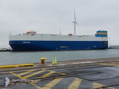
LAKE KIVU
Vehicles Carrier
Current Trip
| Time Travelled | 23 h, 23 mins |
|---|---|
| Remaining Time | 1 day |
| Distance Travelled | 400.32 nm |
| Remaining Distance | 469.19 nm |
| AVG Speed | 17.2 Knots |
| MAX Speed | 22.3 Knots |
| AVG Wind | 7.7 knots |
| MAX Wind | 12.2 knots |
| MIN Temp | 10.8°C / 51.44°F |
| MAX Temp | 13.9°C / 57.02°F |
| Dybgang | 8.7 m |
| Position Modtaget | 1 m siden |
Current Position
| Longitude | -5.91762° |
|---|---|
| Latitude | 48.73957° |
| Status | Under way using engine |
| Fart | 19.2 Knots |
| Kurs | 210° |
| Område | Celtic Sea |
| Station | T-AIS |
| Position Modtaget | 1 m siden |
Info
Information
The current position of LAKE KIVU is in Celtic Sea with coordinates 48.73957° / -5.91762° as reported on 2024-05-07 22:13 by AIS to our vessel tracker app. The vessel's current speed is 19.2 Knots and is heading at the port of VIGO. The estimated time of arrival as calculated by MyShipTracking vessel tracking app is 2024-05-08 22:32 LT
The vessel LAKE KIVU (IMO: 9308792, MMSI: 636015993) is a Vehicles Carrier that was built in 2006 ( 18 år gamle ). It's sailing under the flag of [LR] Liberia.
In this page you can find informations about the vessels current position, last detected port calls, and current voyage information. If the vessels is not in coverage by AIS you will find the latest position.
The current position of LAKE KIVU is detected by our AIS receivers and we are not responsible for the reliability of the data. The last position was recorded while the vessel was in Coverage by the Ais receivers of our vessel tracking app.
The current draught of LAKE KIVU as reported by AIS is 8.7 meters
Weather
| Temperature | 12.6°C / 54.68°F |
|---|---|
| Wind Speed | 6 knots |
| Direction | 20° NNE |
| Pressure | 1028 hPa |
| Humidity | 87 % |
| Cloud Coverage | 37 % |
Featured Company
Last Port Calls
| Port | Arrival | Departure | Time In Port |
|---|---|---|---|
| 2024-05-04 11:05 | 2024-05-06 22:52 | 2 d | |
| 2024-05-02 22:01 | 2024-05-03 15:00 | 16 h | |
| 2024-04-30 04:13 | 2024-04-30 15:02 | 10 h | |
| 2024-04-26 21:23 | 2024-04-28 08:41 | 1 d | |
| 2024-04-21 11:12 | 2024-04-22 21:59 | 1 d | |
| 2024-04-19 10:44 | 2024-04-20 14:37 | 1 d | |
| 2024-04-16 10:19 | 2024-04-16 18:15 | 7 h | |
| 2024-04-13 09:17 | 2024-04-14 20:42 | 1 d | |
| 2024-04-03 12:09 | 2024-04-04 21:46 | 1 d | |
| 2024-04-01 08:25 | 2024-04-02 13:23 | 1 d |
Most Visited Ports (Last year)
| Port | Arrivals | |
|---|---|---|
| 19 | ||
| 18 | ||
| 18 | ||
| 18 | ||
| 5 | ||
| 4 |
Last Trips
| Origin | Departure | Destination | Arrival | Distance | |
|---|---|---|---|---|---|
| 2024-05-03 17:00 | 2024-05-04 13:05 | 196.30 nm | |||
| 2024-04-30 17:02 | 2024-05-03 00:01 | 722.11 nm | |||
| 2024-04-28 09:41 | 2024-04-30 06:13 | 554.24 nm | |||
| 2024-04-22 23:59 | 2024-04-26 22:23 | 1376.89 nm | |||
| 2024-04-20 16:37 | 2024-04-21 13:12 | 201.38 nm | |||
| 2024-04-16 20:15 | 2024-04-19 12:44 | 717.92 nm | |||
| 2024-04-14 21:42 | 2024-04-16 12:19 | 538.25 nm | |||
| 2024-04-04 23:46 | 2024-04-13 09:17 | 2055.37 nm | |||
| 2024-04-02 15:23 | 2024-04-03 14:09 | 203.11 nm | |||
| 2024-03-28 03:38 | 2024-04-01 10:25 | 1242.73 nm |
Events
| Tid | Hændelsen | Detaljer | Position / Dest | Info |
|---|---|---|---|---|
| 2024-05-07 21:37 | Status er ændret | Under way using engine Default |
48.88388 / -5.72622
ES VGO
|
Fart: 19.2 kn Kurs: 237° |
| 2024-05-07 21:34 | Status er ændret | Default Under way using engine |
48.89117 / -5.70840
ES VGO
|
Fart: 19.4 kn Kurs: 239° |
| 2024-05-07 21:26 | Status er ændret | Under way using engine Default |
48.91668 / -5.64730
ES VGO
|
Fart: 19.5 kn Kurs: 236° |
| 2024-05-07 21:22 | Status er ændret | Default Under way using engine |
48.92578 / -5.62553
ES VGO
|
Fart: 19.5 kn Kurs: 238° |
| 2024-05-07 19:52 | Ændre havområde | French part of the Celtic Sea French part of the English Channel |
49.20635 / -5.03092
Celtic Sea
ES VGO
|
Fart: 18.6 kn Kurs: 233° |
| 2024-05-07 19:05 | Ændre havområde | French part of the English Channel United Kingdom part of the English Channel |
49.33572 / -4.72483
English Channel
ES VGO
|
Fart: 17.7 kn Kurs: 237° |
| 2024-05-07 17:50 | Ændre havområde | United Kingdom part of the English Channel French part of the English Channel |
49.50935 / -4.25695
English Channel
ES VGO
|
Fart: 16.2 kn Kurs: 245° |
| 2024-05-07 17:47 | Ændre havområde | French part of the English Channel United Kingdom part of the English Channel |
49.51490 / -4.23827
English Channel
ES VGO
|
Fart: 16.1 kn Kurs: 245° |
| 2024-05-07 17:16 | ETA er ændret | 2024/05/09 04:00 2024/05/09 06:00 |
49.58188 / -4.05962
ES VGO
|
Fart: 16 kn Kurs: 237° |
| 2024-05-07 14:29 | Ændre havområde | United Kingdom part of the English Channel Guernsey part of the English Channel |
49.97063 / -3.01277
English Channel
ES VGO
|
Fart: 19.4 kn Kurs: 240° |