

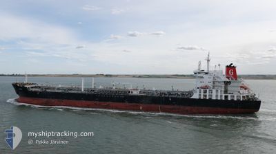
LADY MARIELLA
Oil/Chemical Tanker

Current Trip
| Time Travelled | 1 day |
|---|---|
| Remaining Time | --- |
| Distance Travelled | 247.81 nm |
| Remaining Distance | 3.32 nm |
| AVG Speed | 9.2 Knots |
| MAX Speed | 12.2 Knots |
| AVG Wind | 7.9 knots |
| MAX Wind | 19.2 knots |
| MIN Temp | 10.6°C / 51.08°F |
| MAX Temp | 14.6°C / 58.28°F |
| Dybgang | 6.5 m |
| Position Modtaget | 1 m siden |
Current Position
| Longitude | --- |
|---|---|
| Latitude | --- |
| Status | Under way using engine |
| Fart | |
| Kurs | 12° |
| Område | Tyrrhenian Sea |
| Station | T-AIS |
| Position Modtaget | 1 m siden |
Information
The current position of LADY MARIELLA is in Tyrrhenian Sea with coordinates 38.22431° / 15.32785° as reported on 2025-02-04 14:32 by AIS to our vessel tracker app. The vessel's current speed is 0 Knots and is heading at the port of MILAZZO. The estimated time of arrival as calculated by MyShipTracking vessel tracking app is 2025-02-04 07:00 LT
The vessel LADY MARIELLA (IMO: 9644433, MMSI: 247430200) is a Oil/Chemical Tanker that was built in 2013 ( 12 år gamle ). It's sailing under the flag of [IT] Italy.
In this page you can find informations about the vessels current position, last detected port calls, and current voyage information. If the vessels is not in coverage by AIS you will find the latest position.
The current position of LADY MARIELLA is detected by our AIS receivers and we are not responsible for the reliability of the data. The last position was recorded while the vessel was in Coverage by the Ais receivers of our vessel tracking app.
The current draught of LADY MARIELLA as reported by AIS is 6.5 meters
Weather
| Temperature | 13.3°C / 55.94°F |
|---|---|
| Wind Speed | 7 knots |
| Direction | 293° WNW |
| Pressure | 1023 hPa |
| Humidity | 77.8 % |
| Cloud Coverage | --- |


Featured Company
Last Port Calls
| Port | Arrival | Departure | Time In Port |
|---|---|---|---|
| 2025-01-31 13:30 | 2025-02-02 16:50 | 2 d | |
| 2025-01-28 06:48 | 2025-01-29 18:53 | 1 d | |
| 2025-01-24 09:01 | 2025-01-25 14:57 | 1 d | |
| 2025-01-09 10:45 | 2025-01-11 05:51 | 1 d | |
| 2025-01-05 08:13 | 2025-01-06 11:05 | 1 d | |
| 2025-01-01 07:27 | 2025-01-02 11:51 | 1 d | |
| 2024-12-19 09:37 | 2024-12-20 06:19 | 20 h | |
| 2024-12-13 07:02 | 2024-12-17 07:54 | 4 d | |
| 2024-12-09 10:29 | 2024-12-11 12:54 | 2 d | |
| 2024-12-02 07:24 | 2024-12-03 16:21 | 1 d |
Last Trips
| Origin | Departure | Destination | Arrival | Distance | |
|---|---|---|---|---|---|
| 2025-01-29 19:53 | 2025-01-31 14:30 | 208.53 nm | |||
| 2025-01-25 15:57 | 2025-01-28 07:48 | 647.46 nm | |||
| 2025-01-11 06:51 | 2025-01-24 10:01 | 851.26 nm | |||
| 2025-01-06 12:05 | 2025-01-09 11:45 | 647.34 nm | |||
| 2025-01-02 12:51 | 2025-01-05 09:13 | 649.10 nm | |||
| 2024-12-20 07:19 | 2025-01-01 08:27 | 242.06 nm | |||
| 2024-12-17 08:54 | 2024-12-19 10:37 | 436.10 nm | |||
| 2024-12-11 13:54 | 2024-12-13 08:02 | 434.60 nm | |||
| 2024-12-03 17:21 | 2024-12-09 11:29 | 658.56 nm | |||
| 2024-11-29 15:36 | 2024-12-02 08:24 | 646.73 nm |
Events
| Tid | Hændelsen | Detaljer | Position / Dest | Info |
|---|---|---|---|---|
| 2025-02-04 07:17 | STOP Sejllads | 3.68 nm, East of MILAZZO |
38.22688 / 15.32850
ITMLZ
|
Fart: 0.3 kn Kurs: 171° |
| 2025-02-04 02:49 | Status er ændret | Under way using engine Default |
38.94377 / 15.28573
ITMLZ
|
Fart: 10 kn Kurs: 147° |
| 2025-02-04 02:31 | Status er ændret | Default Under way using engine |
38.98544 / 15.25017
ITMLZ
|
Fart: 10.2 kn Kurs: 147.4° |
| 2025-02-04 02:26 | Status er ændret | Under way using engine Default |
38.99736 / 15.24010
ITMLZ
|
Fart: 10.1 kn Kurs: 148° |
| 2025-02-04 02:21 | Status er ændret | Default Under way using engine |
39.00934 / 15.23050
ITMLZ
|
Fart: 10.1 kn Kurs: 149.2° |
| 2025-02-04 02:16 | Status er ændret | Under way using engine Default |
39.02215 / 15.22027
ITMLZ
|
Fart: 10 kn Kurs: 148° |
| 2025-02-04 02:08 | Indenfor Dækning |
39.02215 / 15.22027
Tyrrhenian Sea
ITMLZ
|
Fart: 10.1 kn Kurs: 149.2° |
|
| 2025-02-03 17:03 | Status er ændret | Default Under way using engine |
40.16650 / 14.34563
ITMLZ
|
Fart: 6.1 kn Kurs: 149.2° |
| 2025-02-03 16:56 | Udenfor Dækning |
40.17750 / 14.33800
Tyrrhenian Sea
ITMLZ
|
Fart: 6.1 kn Kurs: 149.2° |
|
| 2025-02-03 16:11 | Status er ændret | Under way using engine Default |
40.24498 / 14.29332
ITMLZ
|
Fart: 6.2 kn Kurs: 150° |