
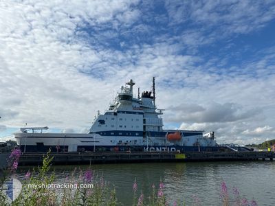
KONTIO
Icebreaker
Current Trip
BAY OF BOTHNIA
| Time Travelled | 7 days |
|---|---|
| Remaining Time | --- |
| Distance Travelled | 576.03 nm |
| Remaining Distance | --- |
| AVG Speed | 10 Knots |
| MAX Speed | 17.9 Knots |
| AVG Wind | 10.7 knots |
| MAX Wind | 21 knots |
| MIN Temp | -13°C / 8.6°F |
| MAX Temp | 3°C / 37.4°F |
| Dybgang | 7.4 m |
| Position Modtaget | 2024-12-21 10:54 |
Current Position
| Longitude | --- |
|---|---|
| Latitude | --- |
| Status | Under way using engine |
| Fart | 13.3 Knots |
| Kurs | 353.9° |
| Område | Gulf of Bothnia |
| Station | T-AIS |
| Position Modtaget | 2024-12-21 10:54 |
Information
The current position of KONTIO is in Gulf of Bothnia with coordinates 61.33429° / 20.63960° as reported on 2024-12-21 10:54 by AIS to our vessel tracker app. The vessel's current speed is 13.3 Knots
The vessel KONTIO (IMO: 8518120, MMSI: 230251000) is a Icebreaker that was built in 1987 ( 38 år gamle ). It's sailing under the flag of [FI] Finland.
In this page you can find informations about the vessels current position, last detected port calls, and current voyage information. If the vessels is not in coverage by AIS you will find the latest position.
The current position of KONTIO is detected by our AIS receivers and we are not responsible for the reliability of the data. The last position was recorded while the vessel was in Coverage by the Ais receivers of our vessel tracking app.
The current draught of KONTIO as reported by AIS is 7.4 meters
Weather
| Temperature | -9.3°C / 15.26°F |
|---|---|
| Wind Speed | 4 knots |
| Direction | 294° WNW |
| Pressure | 1007.1 hPa |
| Humidity | 92.8 % |
| Cloud Coverage | 36 % |
Featured Company
Last Port Calls
| Port | Arrival | Departure | Time In Port |
|---|---|---|---|
| 2025-03-18 12:30 | 2025-03-18 12:38 | 7 m | |
| 2025-03-17 22:38 | 2025-03-17 22:46 | 7 m | |
| 2025-03-16 04:58 | 2025-03-16 13:10 | 8 h | |
| 2025-03-12 00:34 | 2025-03-12 00:45 | 11 m | |
| 2025-03-10 04:06 | 2025-03-10 04:17 | 11 m | |
| 2025-03-09 12:18 | 2025-03-09 12:26 | 8 m | |
| 2025-03-06 04:46 | 2025-03-06 14:01 | 9 h | |
| 2025-02-25 05:16 | 2025-02-25 14:08 | 8 h | |
| 2025-02-19 22:54 | 2025-02-19 23:12 | 18 m | |
| 2025-02-15 04:53 | 2025-02-15 14:09 | 9 h |
Last Trips
| Origin | Departure | Destination | Arrival | Distance | |
|---|---|---|---|---|---|
| 2025-03-18 00:46 | 2025-03-18 14:30 | 33.15 nm | |||
| 2025-03-16 15:10 | 2025-03-18 00:38 | 205.80 nm | |||
| 2025-03-12 02:45 | 2025-03-16 06:58 | 263.99 nm | |||
| 2025-03-10 06:17 | 2025-03-12 02:34 | 100.35 nm | |||
| 2025-03-09 14:26 | 2025-03-10 06:06 | 73.40 nm | |||
| 2025-03-06 16:01 | 2025-03-09 14:18 | 186.86 nm | |||
| 2025-02-25 16:08 | 2025-03-06 06:46 | 717.70 nm | |||
| 2025-02-20 01:12 | 2025-02-25 07:16 | 813.51 nm | |||
| 2025-02-15 16:09 | 2025-02-20 00:54 | 708.18 nm | |||
| 2025-02-13 10:49 | 2025-02-15 06:53 | 133.76 nm |
Events
| Tid | Hændelsen | Detaljer | Position / Dest | Info |
|---|---|---|---|---|
| 2025-03-26 04:38 | START Sejllads | 2.76 nm, South of AJOS |
65.61612 / 24.48391
BAY OF BOTHNIA
|
Fart: 3.1 kn Kurs: 11° |
| 2025-03-26 02:46 | STOP Sejllads | 2.67 nm, South of AJOS |
65.61713 / 24.48913
BAY OF BOTHNIA
|
Fart: Kurs: 102° |
| 2025-03-26 01:58 | START Sejllads | 8.48 nm, South of AJOS |
65.52725 / 24.40140
BAY OF BOTHNIA
|
Fart: 6.6 kn Kurs: 39° |
| 2025-03-26 01:42 | STOP Sejllads | 8.74 nm, South of AJOS |
65.52359 / 24.39442
BAY OF BOTHNIA
|
Fart: Kurs: 41° |
| 2025-03-26 01:14 | START Sejllads | 6.98 nm, South of AJOS |
65.54912 / 24.43398
BAY OF BOTHNIA
|
Fart: 9.2 kn Kurs: 211° |
| 2025-03-25 23:02 | STOP Sejllads | 6.96 nm, South of AJOS |
65.54850 / 24.44223
BAY OF BOTHNIA
|
Fart: Kurs: 118° |
| 2025-03-25 21:50 | START Sejllads | 18.45 nm, South West of AJOS |
65.40642 / 24.09741
BAY OF BOTHNIA
|
Fart: 12.8 kn Kurs: 72° |
| 2025-03-25 21:34 | STOP Sejllads | 19.06 nm, South West of AJOS |
65.40273 / 24.06763
BAY OF BOTHNIA
|
Fart: Kurs: 76° |
| 2025-03-25 21:06 | START Sejllads |
65.38518 / 23.93630
BAY OF BOTHNIA
|
Fart: 3.1 kn Kurs: 80° |
|
| 2025-03-25 20:50 | STOP Sejllads |
65.38773 / 23.93924
BAY OF BOTHNIA
|
Fart: Kurs: 342° |