
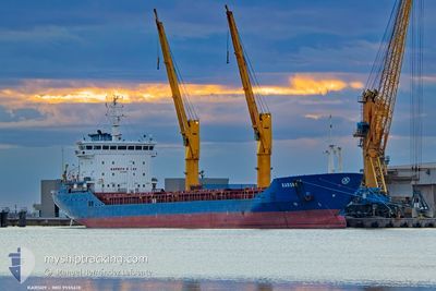
KARSOY
General Cargo
Current Trip
| Time Travelled | 6 days |
|---|---|
| Remaining Time | 9 h, 57 mins |
| Distance Travelled | 303.38 nm |
| Remaining Distance | 1084.00 nm |
| AVG Speed | 8.4 Knots |
| MAX Speed | 10.7 Knots |
| AVG Wind | 16.4 knots |
| MAX Wind | 21.5 knots |
| MIN Temp | 15°C / 59°F |
| MAX Temp | 17.1°C / 62.78°F |
| Dybgang | 8.3 m |
| Position Modtaget | 4 d siden |
Current Position
| Longitude | --- |
|---|---|
| Latitude | --- |
| Status | Under way using engine |
| Fart | 9 Knots |
| Kurs | 0.5° |
| Område | North Atlantic Ocean |
| Station | T-AIS |
| Position Modtaget | 4 d siden |
Info
Information
The current position of KARSOY is in North Atlantic Ocean with coordinates 39.10334° / -9.84049° as reported on 2025-12-06 23:19 by AIS to our vessel tracker app. The vessel's current speed is 9 Knots and is heading at the port of MOERDIJK. The estimated time of arrival as calculated by MyShipTracking vessel tracking app is 2025-12-11 19:13 LT
The vessel KARSOY (IMO: 9555618, MMSI: 636093349) is a General Cargo that was built in 2009 ( 16 år gamle ). It's sailing under the flag of [LR] Liberia.
In this page you can find informations about the vessels current position, last detected port calls, and current voyage information. If the vessels is not in coverage by AIS you will find the latest position.
The current position of KARSOY is detected by our AIS receivers and we are not responsible for the reliability of the data. The last position was recorded while the vessel was in Coverage by the Ais receivers of our vessel tracking app.
The current draught of KARSOY as reported by AIS is 8.3 meters
Weather
| Temperature | 17°C / 62.6°F |
|---|---|
| Wind Speed | 10 knots |
| Direction | 209° SSW |
| Pressure | 1023.5 hPa |
| Humidity | 75.6 % |
| Cloud Coverage | 100 % |
Featured Company
Last Port Calls
| Port | Arrival | Departure | Time In Port |
|---|---|---|---|
| 2025-12-04 16:33 | 2025-12-04 21:39 | 5 h | |
| 2025-11-30 11:04 | 2025-12-01 21:29 | 1 d | |
| 2025-11-24 06:56 | 2025-11-28 21:22 | 4 d | |
| 2025-11-19 09:52 | 2025-11-19 13:07 | 3 h | |
| 2025-11-16 21:17 | 2025-11-18 01:36 | 1 d | |
| 2025-11-07 01:26 | 2025-11-10 19:33 | 3 d | |
| 2025-10-19 19:23 | 2025-10-24 01:11 | 4 d | |
| 2025-10-13 19:24 | 2025-10-16 19:34 | 3 d | |
| 2025-10-13 17:09 | 2025-10-13 18:15 | 1 h |
Last Trips
| Origin | Departure | Destination | Arrival | Distance | |
|---|---|---|---|---|---|
| 2025-12-01 21:29 | 2025-12-04 16:33 | 518.92 nm | |||
| 2025-11-28 21:22 | 2025-11-30 11:04 | 387.08 nm | |||
| 2025-11-19 13:07 | 2025-11-24 06:56 | 861.66 nm | |||
| 2025-11-18 01:36 | 2025-11-19 09:52 | 284.23 nm | |||
| 2025-11-10 19:33 | 2025-11-16 21:17 | 694.00 nm | |||
| 2025-10-24 01:11 | 2025-11-07 01:26 | 2332.09 nm | |||
| 2025-10-16 19:34 | 2025-10-19 19:23 | 731.95 nm | |||
| 2025-10-13 18:15 | 2025-10-13 19:24 | 7.15 nm | |||
| 2025-08-23 09:16 | 2025-10-13 17:09 | 3229.49 nm |
Events
| Tid | Hændelsen | Detaljer | Position / Dest | Info |
|---|---|---|---|---|
| 2025-12-06 23:19 | Udenfor Dækning |
39.10334 / -9.84049
North Atlantic Ocean
NLMOE
|
Fart: 9 kn Kurs: 0.5° |
|
| 2025-12-06 21:52 | Destination er ændret | NLMOE MAPTM |
38.87365 / -9.84813
NLMOE
|
Fart: 10.1 kn Kurs: 337° |
| 2025-12-06 21:52 | ETA er ændret | 2025/12/11 06:00 2025/12/04 21:30 |
38.87365 / -9.84813
NLMOE
|
Fart: 10.1 kn Kurs: 337° |
| 2025-12-06 21:10 | Ændre havområde | Portuguese part of the North Atlantic Ocean Spanish part of the Strait of Gibraltar |
38.76595 / -9.84887
North Atlantic Ocean
|
Fart: 8.7 kn Kurs: 340.1° |
| 2025-12-06 21:09 | Indenfor Dækning |
38.76595 / -9.84887
North Atlantic Ocean
|
Fart: 8.7 kn Kurs: 340.1° |
|
| 2025-12-05 11:50 | Udenfor Dækning |
35.95177 / -5.62402
Strait of Gibraltar
|
Fart: 10 kn Kurs: 274.8° |
|
| 2025-12-05 11:36 | Ændre havområde | Spanish part of the Strait of Gibraltar Moroccan part of the Strait of Gibraltar |
35.95115 / -5.58056
Strait of Gibraltar
|
Fart: 8.7 kn Kurs: 273.2° |
| 2025-12-05 11:36 | Indenfor Dækning |
35.95115 / -5.58056
Strait of Gibraltar
|
Fart: 8.7 kn Kurs: 273.2° |
|
| 2025-12-04 22:41 | Udenfor Dækning |
35.95039 / -5.54258
Strait of Gibraltar
MAPTM
|
Fart: 8.9 kn Kurs: 203.8° |
|
| 2025-12-04 22:41 | Ændre havområde | Moroccan part of the Strait of Gibraltar Spanish part of the Strait of Gibraltar |
35.95039 / -5.54258
Strait of Gibraltar
MAPTM
|
Fart: 8.9 kn Kurs: 203.8° |