
KARLSKRONA
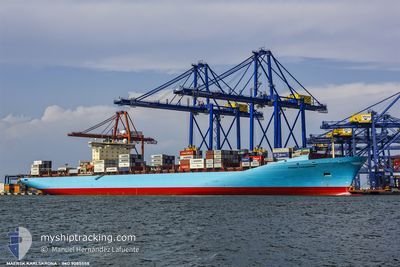
Container Ship
Current Trip
| Time Travelled | 1 day |
|---|---|
| Remaining Time | 3 h, 28 mins |
| Distance Travelled | 260.97 nm |
| Remaining Distance | 34.26 nm |
| AVG Speed | 11.4 Knots |
| MAX Speed | 18.7 Knots |
| AVG Wind | 8.9 knots |
| MAX Wind | 13.2 knots |
| MIN Temp | 21°C / 69.8°F |
| MAX Temp | 26.1°C / 78.98°F |
| Dybgang | 11.3 m |
| Position Modtaget | 1 h, 20 m siden |
Current Position
| Longitude | -88.02072° |
|---|---|
| Latitude | 30.06498° |
| Status | Under way using engine |
| Fart | 5.5 Knots |
| Kurs | 291.5° |
| Område | Gulf of Mexico |
| Station | T-AIS |
| Position Modtaget | 1 h, 20 m siden |
Info
Information
The current position of KARLSKRONA is in Gulf of Mexico with coordinates 30.06498° / -88.02072° as reported on 2024-05-03 08:31 by AIS to our vessel tracker app. The vessel's current speed is 5.5 Knots and is heading at the port of MOBILE. The estimated time of arrival as calculated by MyShipTracking vessel tracking app is 2024-05-03 13:20 LT
The vessel KARLSKRONA (IMO: 9085558, MMSI: 636018800) is a Container Ship that was built in 1996 ( 28 år gamle ). It's sailing under the flag of [LR] Liberia.
In this page you can find informations about the vessels current position, last detected port calls, and current voyage information. If the vessels is not in coverage by AIS you will find the latest position.
The current position of KARLSKRONA is detected by our AIS receivers and we are not responsible for the reliability of the data. The last position was recorded while the vessel was in Coverage by the Ais receivers of our vessel tracking app.
The current draught of KARLSKRONA as reported by AIS is 11.3 meters
Weather
| Temperature | 24.2°C / 75.56°F |
|---|---|
| Wind Speed | 8 knots |
| Direction | 163° SSE |
| Pressure | 1012.4 hPa |
| Humidity | 83.7 % |
| Cloud Coverage | 100 % |
Featured Company
Last Port Calls
| Port | Arrival | Departure | Time In Port |
|---|---|---|---|
| 2024-05-01 04:43 | 2024-05-02 09:50 | 1 d | |
| 2024-04-28 03:47 | 2024-04-28 18:16 | 14 h | |
| 2024-04-21 20:04 | 2024-04-22 17:25 | 21 h | |
| 2024-04-18 19:19 | 2024-04-20 00:28 | 1 d | |
| 2024-04-07 02:27 | 2024-04-07 23:47 | 21 h | |
| 2024-04-06 03:05 | 2024-04-06 17:22 | 14 h | |
| 2024-04-04 12:35 | 2024-04-05 02:37 | 14 h | |
| 2024-04-02 01:34 | 2024-04-02 22:05 | 20 h | |
| 2024-03-23 20:52 | 2024-03-24 03:22 | 6 h | |
| 2024-03-22 02:30 | 2024-03-23 02:08 | 23 h |
Most Visited Ports (Last year)
| Port | Arrivals | |
|---|---|---|
| 5 | ||
| 3 | ||
| 3 | ||
| 3 | ||
| 3 | ||
| 2 |
Last Trips
| Origin | Departure | Destination | Arrival | Distance | |
|---|---|---|---|---|---|
| 2024-04-28 13:16 | 2024-04-30 23:43 | 689.96 nm | |||
| 2024-04-22 13:25 | 2024-04-27 22:47 | 1536.50 nm | |||
| 2024-04-19 20:28 | 2024-04-21 16:04 | 646.72 nm | |||
| 2024-04-08 01:47 | 2024-04-18 15:19 | 3667.41 nm | |||
| 2024-04-06 19:22 | 2024-04-07 04:27 | 116.68 nm | |||
| 2024-04-05 04:37 | 2024-04-06 05:05 | 324.59 nm | |||
| 2024-04-03 00:05 | 2024-04-04 14:35 | 124.72 nm | |||
| 2024-03-24 03:22 | 2024-04-02 03:34 | 912.83 nm | |||
| 2024-03-23 03:08 | 2024-03-23 20:52 | 199.66 nm | |||
| 2024-03-21 16:45 | 2024-03-22 03:30 | 127.17 nm |
Events
| Tid | Hændelsen | Detaljer | Position / Dest | Info |
|---|---|---|---|---|
| 2024-05-03 08:58 | STOP Sejllads | 10.99 nm, South of DAUPHIN ISLAND |
30.07117 / -88.04352
USMSY>USMOB
|
Fart: 0.2 kn Kurs: 281° |
| 2024-05-03 08:38 | Status er ændret | Default Under way using engine |
30.06802 / -88.02969
USMSY>USMOB
|
Fart: 5.5 kn Kurs: 291.5° |
| 2024-05-03 08:31 | Udenfor Dækning |
30.06498 / -88.02072
Gulf of Mexico
USMSY>USMOB
|
Fart: 5.5 kn Kurs: 291.5° |
|
| 2024-05-03 07:03 | Status er ændret | Under way using engine Default |
29.92620 / -87.87142
USMSY>USMOB
|
Fart: 10.3 kn Kurs: 323° |
| 2024-05-03 06:50 | Status er ændret | Default Under way using engine |
29.89690 / -87.84623
USMSY>USMOB
|
Fart: 10.4 kn Kurs: 322.5° |
| 2024-05-03 06:43 | Status er ændret | Under way using engine Default |
29.87987 / -87.83148
USMSY>USMOB
|
Fart: 10.4 kn Kurs: 323° |
| 2024-05-03 06:42 | Status er ændret | Default Under way using engine |
29.87788 / -87.82975
USMSY>USMOB
|
Fart: 10.5 kn Kurs: 322.7° |
| 2024-05-03 06:35 | Status er ændret | Under way using engine Default |
29.86114 / -87.81525
USMSY>USMOB
|
Fart: 10.6 kn Kurs: 323° |
| 2024-05-03 06:30 | Status er ændret | Default Under way using engine |
29.85005 / -87.80563
USMSY>USMOB
|
Fart: 10.6 kn Kurs: 322.9° |
| 2024-05-03 06:00 | Status er ændret | Under way using engine Default |
29.77697 / -87.74388
USMSY>USMOB
|
Fart: 10.5 kn Kurs: 324° |